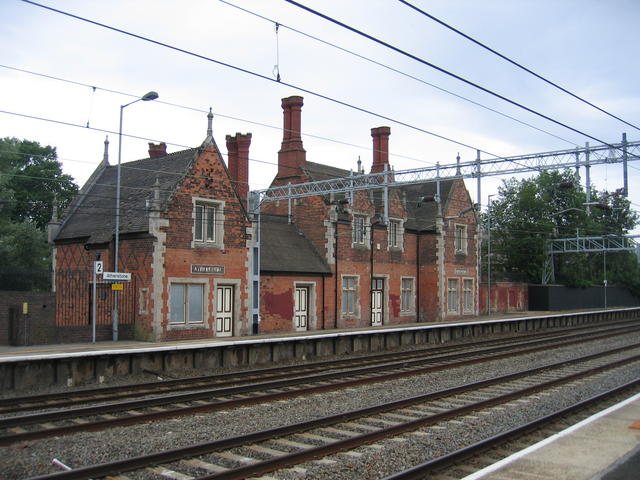
Atherstone railway station
- Atherstone railway station
UK stations
name=Atherstone
locale=Atherstone
borough=North Warwickshire
manager=London Midland
lowusage0405 = 1,658
lowusage0506 = 1,425
lowusage0607 = 3,162
platforms=2Atherstone railway station serves the town of Atherstone in Warwickshire.
It is located on the Trent Valley section of the West Coast Main Line, exactly 102 miles from London Euston station, as a placard on an adjacent building announces. A rail replacement bus currently substitutes most of the trains. The station is conveniently located near the A5.
The Station is set to receive an Hourly Train service from December 2008.
External links
* [
http://www.atherstone.org.uk/travel/train/atherstone-railway-station/ Atherstone railway station at Atherstone Organised]
* [
http://www.warwickshirerailways.com/lms/atherstone.htm Historical photographs at www.warwickshirerailways.com]
###@@@KEYEND@@@###
Wikimedia Foundation.
2010.
Look at other dictionaries:
Nuneaton railway station — Nuneaton Location … Wikipedia
Stafford railway station — Infobox UK station name = Stafford manager = Virgin Trains locale = Stafford borough = Stafford latitude = 52.80359 longitude = 2.12307 code = STA start = July 1837 Rebuilt 1844 Rebuilt 1862 Current building opened 1962 platforms = 5 usage0405 =… … Wikipedia
Atherstone — Infobox UK place country = England official name= Atherstone latitude= 52.5787 longitude= 1.5462 civil parish= population = 8,293 (2001) shire district= North Warwickshire shire county= Warwickshire region= West Midlands constituency westminster … Wikipedia
ATH — may mean*The IATA airport code for Athens International Airport in Athens, Greece. *The National Rail code for Atherstone railway station, United Kingdom. External links: Sildb prim|ATH|station information; Mmukpcloc|CV9|1BH; Brldb prim|ATH|live… … Wikipedia
Nuneaton — Coordinates: 52°31′23″N 1°28′06″W / 52.523°N 1.4683°W / 52.523; 1.4683 … Wikipedia
List of bus routes in the West Midlands county — A map which shows the area these routes operate in. This is a list of all the Network West Midlands bus routes in the West Midlands, England. Contents 1 … Wikipedia
Merevale — Coordinates: 52°34′36″N 1°34′22″W / 52.57656°N 1.57282°W / 52.57656; 1.57282 … Wikipedia
Hurley, Warwickshire — Coordinates: 52°33′32″N 1°38′46″W / 52.559°N 1.646°W / 52.559; 1.646 … Wikipedia
Stratford-upon-Avon — This article is about the town in south Warwickshire. For other uses, see Stratford. Coordinates: 52°11′24″N 1°42′36″W / 52.19°N 1.710°W / 52 … Wikipedia
Southam — For other uses, see Southam (disambiguation). Coordinates: 52°15′07″N 1°23′24″W / 52.252°N 1.39°W / 52.252; 1.39 … Wikipedia