Nicoya Peninsula — seen from space (false color) The Nicoya Peninsula (Spanish: Península de Nicoya) is a peninsula on the Pacific coast of Costa Rica and lies in the Guanacaste Province in the north, and the Puntarenas Province in the south. It is located at … Wikipedia
Nicoya Peninsula — /ni koy euh/; Sp. /nee kaw yah/ a peninsula in NW Costa Rica, on the Pacific Ocean. * * * Peninsula, western Costa Rica. It is bounded to the west and south by the Pacific Ocean, to the northeast by the Cordillera de Guanacaste, and to the… … Universalium
Nicoya Canton — Coordinates: 10°08′40″N 85°27′22″W / 10.14444°N 85.45611°W / 10.14444; 85.45611 ( … Wikipedia
Nicoya, Gulf of — Inlet of the Pacific Ocean, northwestern coast of Costa Rica. It is formed by the protrusion of the Nicoya Peninsula from the mainland and extends north and northwest for about 50 mi (80 km). The Tempisque, Abangares, and Tárcoles rivers empty… … Universalium
gulf — gulflike, adj. gulfy, adj. /gulf/, n. 1. a portion of an ocean or sea partly enclosed by land. 2. a deep hollow; chasm or abyss. 3. any wide separation, as in position, status, or education. 4. something that engulfs or swallows up. v.t. 5. to… … Universalium
Nicoya,Gulf of — Ni·co·ya (nĭ kōʹyə, nē kōʹyä), Gulf of An inlet of the Pacific Ocean between Nicoya Peninsula and the northwest mainland of Costa Rica. * * * … Universalium
Partido de Nicoya — The Partido de Nicoya was a major part of what is now the Guanacaste province in Costa Rica. Originally the territory was bounded on the northeast by the La Flor river and Lake Cocibolca, or Lake Nicaragua, on the south by Costa Rica (Gulf of… … Wikipedia
Golfe de Nicoya — Image satellite du golfe de Nicoya Le golfe de Nicoya (Golfo de Nicoya en espagnol) est une crique de l océan Pacifique, séparant la péninsule de Nicoya du Costa Rica continental. Lien externe http … Wikipédia en Français
Chira Island — is a 3.000 hectare Costa Rican Pacific island located at the upper end of the Gulf of Nicoya, an extensive inlet of sea water that is the result of a geological fault that has caused the land to submerge, leaving exposed only the tops of what… … Wikipedia
Geography of Mesoamerica — Location of Mesoamerica in the Americas: this prototypic culture area is situated on the Middle American isthmus, or land bridge, adjoining southern North America with South America. The geography of Mesoamerica entails the physical and human… … Wikipedia
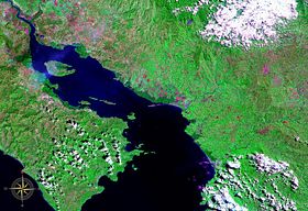 Gulf of Nicoya seen from space (false color)
