Oostknollendam

Oostknollendam
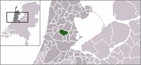
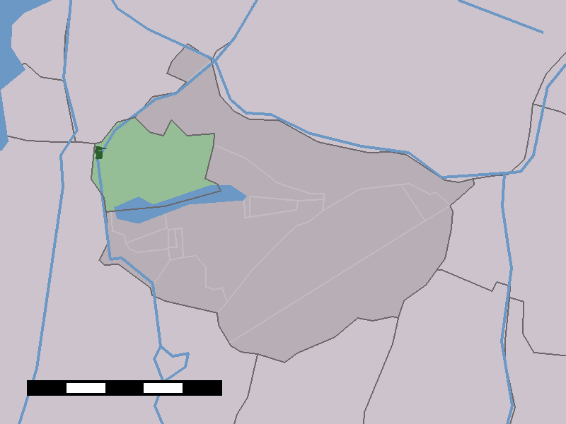
Oostknollendam
—  Town  —
The town centre (dark green) and the statistical district (light green) of Oostknollendam in the municipality of Wormerland.
Coordinates: 52°31′2″N 4°47′25″E / 52.51722°N 4.79028°E / 52.51722; 4.79028Coordinates: 52°31′2″N 4°47′25″E / 52.51722°N 4.79028°E / 52.51722; 4.79028
Country Netherlands
Province North Holland
Municipality Wormerland
Population (2006)
 - Total 492
Time zone CET (UTC+1)
 - Summer (DST) CEST (UTC+2)
Postal code

Oostknollendam is a town in the Dutch province of North Holland. It is a part of the municipality of Wormerland, and lies about 10 km east of IJmond.

In 2001, the town of Oostknollendam had 308 inhabitants. The built-up area of the town was 5 km², and contained 116 residences.[1] The statistical area "Oostknollendam", which also can include the surrounding countryside, has a population of around 570.[2]

References

  1. ^ Statistics Netherlands (CBS), Bevolkingskernen in Nederland 2001 [1]. (Statistics are for the continuous built-up area).
  2. ^ Statistics Netherlands (CBS), Gemeente Op Maat 2004: Wormerland [2].


Wikimedia Foundation. 2010.

Игры ⚽ Нужно решить контрольную?

Look at other dictionaries:

  • Oostknollendam — 52° 31′ 02″ N 4° 47′ 25″ E / 52.51722222, 4.79027778 …   Wikipédia en Français

  • Wormerland — Infobox Settlement official name = Wormerland mapsize = 280px flag size = 150x75px image shield = Wormerland wapen.png shield size = 150x75px subdivision type = Country subdivision name = Netherlands subdivision type1 = Province subdivision name1 …   Wikipedia

  • Wormerland — Womerland Héraldique …   Wikipédia en Français

  • List of places in the Netherlands — This is an alphabetical list of places (cities, towns, villages) in the Netherlands. Lists per province can be found at:* List of towns in Groningen * List of towns in Friesland * List of towns in Drente * List of towns in Overijssel * List of… …   Wikipedia

  • West-Knollendam — Dutch town locator maps mun town caption = The town centre (dark green) and the statistical district (light green) of West Knollendam in the municipality of Zaanstad.West Knollendam (coord|52|31|N|4|47|E|type:city(468)) is a town in the Dutch… …   Wikipedia

  • Wormer — is a town in the Dutch province of North Holland. It is a part of the municipality of Wormerland, and lies about 13 km northwest of Amsterdam.In 2006, the town of Wormer had 12566 inhabitants. The built up area of the town is 16.88 km² (of which… …   Wikipedia

  • Wormer — Gemeinde Wormerland Flagge Wappen Provinz Nordholland …   Deutsch Wikipedia

  • Wormerland — Gemeinde Wormerland Flagge Wappen Provinz Nordholland Bürgermeister …   Deutsch Wikipedia

  • Jisp — 52°30′22″N 4°51′14″E / 52.50611, 4.85389 …   Wikipédia en Français

  • Jisp (Hollande septentrionale) — Jisp 52°30′22″N 4°51′14″E / 52.50611, 4.85389 …   Wikipédia en Français

Share the article and excerpts

Direct link
Do a right-click on the link above
and select “Copy Link”