- Maków Podhalański
-
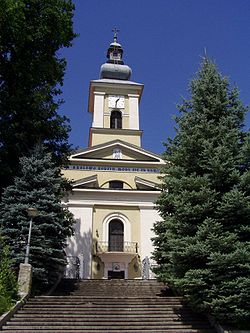
Maków Podhalański Church 
Flag
Coat of armsCoordinates: 49°43′50″N 19°40′51″E / 49.73056°N 19.68083°E Country  Poland
Voivodeship Lesser Poland County Sucha Gmina Maków Podhalański Government – Mayor Stanisław Pawlik Area – Total 20.04 km2 (7.7 sq mi) Elevation 455 m (1,493 ft) Population (2006) – Total 5,738 – Density 286.3/km2 (741.6/sq mi) Time zone CET (UTC+1) – Summer (DST) CEST (UTC+2) Postal code 34-220 Car plates KSU Website http://www.makow-podhalanski.um.pl/ Maków Podhalański [ˈmakuf pɔtxaˈlaɲski] (known as Maków until 1930) is a town in southern Poland. Population: 5,738 (2006).
Since 1999 situated in Sucha County, Lesser Poland Voivodeship. Previously (1975-1998) in Bielsko-Biala Voivodeship.
External links
Coordinates: 49°44′N 19°41′E / 49.733°N 19.683°E
Town and seat Maków Podhalański
Villages Białka • Grzechynia • Juszczyn • Kojszówka • Wieprzec • ŻarnówkaCategories:- Cities and towns in Lesser Poland Voivodeship
- Sucha County
- Lesser Poland geography stubs
Wikimedia Foundation. 2010.


