- Shinnecock Canal
Geobox | Water
name = Shinnecock
other_name =
category =Canal
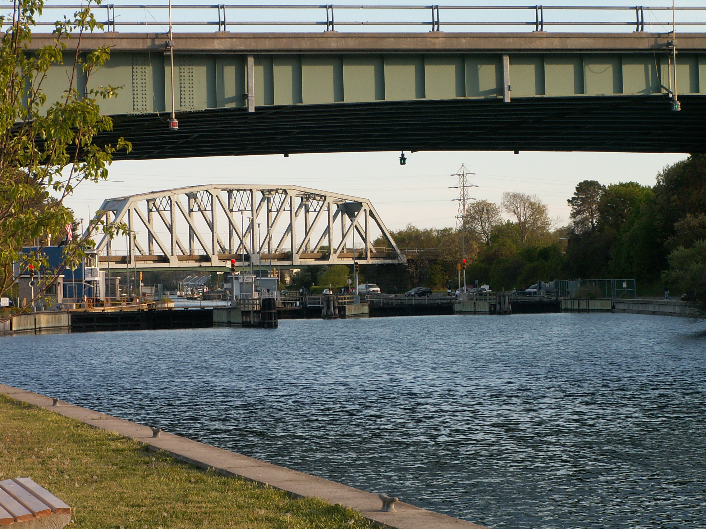
image_caption = Looking south toward the locks and Shinnecock Bay
etymology =
official_name =
nickname =
country = United States
state = New York
region = Suffolk County
district = Southampton
commune =
municipality =
parent =
city =
landmark =
river_type = Connecting
river = Peconic Bay
river1 = Shinnecock Bay
location =
elevation =
lat_d = 40
lat_m = 53
lat_s = 15
lat_NS = N
long_d = 72
long_m = 30
long_s = 5
long_EW = W
length = 1.4
length_round = 1
width_unit = ft
width = 180
width_type = Width min.
width1 = 250
width1_type = Width max
height = 250
height_type = Lock length
height1 = 41
height1_type = Lock width
number =
area =
author =
style =
material =
established = 1892
management =
management_lat_d =
management_long_d =
owner =
public =
visitation = 26000
visitation_type = Passages
visitation_date = 2006
access =
code =
free =
free_type =

map_caption =
map_locator = New York
commons =
statistics =
website =
footnotes =The Shinnecock Canal (also known as the Shinnecock and Peconic Canal) is a
canal that cuts across the South Fork of Long Island atHampton Bays, New York . At 4,700 feet long, it connectsGreat Peconic Bay and the north fork of Long Island withShinnecock Bay and theAtlantic Ocean . The canal opened to traffic in 1892.Although "the Hamptons" officially begins about 10 miles west at
Westhampton, New York , the Shinnecock Canal in popular imagination marks the beginning of theHamptons since traffic is funneled across two highway bridges (Sunrise Highway andMontauk Highway ) or theLong Island Rail Road bridge.Talk of building a canal on Shinnecock Creek had gone on for years and a popular myth says the
Shinnecock Indian Nation andMontaukett Native Americans built the original canal in the 1600s. The canal’s location is specifically calledCanoe Place because of this.A
Canal lock system had to be built in 1919 to alleviate dramatic differences in height between the two bays. The Peconic Bay to the north can be three feet higher than Shinnecock Bay. Further, the two bays have opposite tide cycles.The lock system now is the only navigation lock operating on Long Island.The lock increased the salinity levels in Shinnecock Bay which had nearly assumed fresh water proportions and was resulting in a dying off of its shell fish population even though it was separated from the Atlantic by a narrow
barrier island .Shinnecock Bay’s salinity levels were solidified during
Great Hurricane of 1938 which broke through the barrier island to formShinnecock Inlet almost due south of the canal. The new inlet has created a short cut to the Atlantic that is now used by 27,000 boats a year.The canal itself varies in width from 100 to 180 feet. The lock is 41 feet wide and 250 feet long.
External links
* [http://www.newsday.com/community/guide/lihistory/ny-past1026,0,6426268.story?coll=ny-lihistory-navigation Newsday profile]
* [http://www.history.rochester.edu/canal/bib/whitford/old1906/chapter12.htm Rochester history of New York canals]
Wikimedia Foundation. 2010.