Bartonsville Covered Bridge
- Bartonsville Covered Bridge
Infobox_nrhp | name =Bartonsville Covered Bridge
nrhp_type =
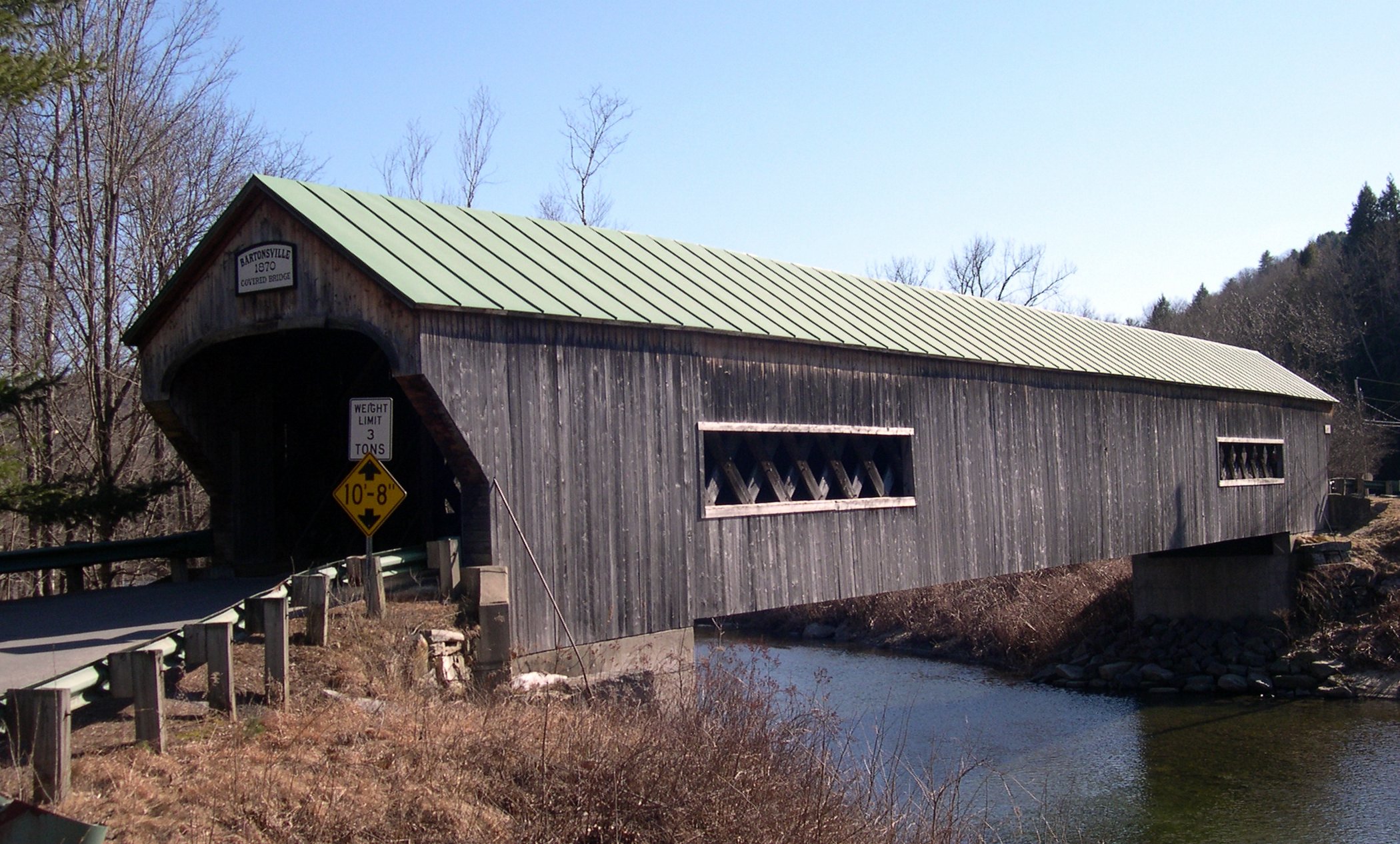
caption =The Northeast approach to the Bartonsville bridge
location= Bartonsville, Vermont
lat_degrees = 43 | lat_minutes = 13 | lat_seconds = 27.23 | lat_direction = N
long_degrees = 72 | long_minutes = 32 | long_seconds = 12.45 | long_direction = W
area =
built =1871
architect= Granger,Sanford
added = July 02, 1973
governing_body = Local
refnum=73000201 [cite web|url=http://www.nr.nps.gov/|title=National Register Information System|date=2007-01-23|work=National Register of Historic Places|publisher=National Park Service] ]The Bartonsville Covered Bridge is a covered bridge in the village of Bartonsville, in Rockingham, Vermont, United States. Built in 1870 by Sanford Granger, the bridge is a lattice truss style with a 151 foot span across the Williams River. The bridge is listed on the National Register of Historic Places.It is located on Lower Bartonsville Road, a paved road a short distance north from Vermont Route 103. Nearby, to the east, is the Worrall Covered Bridge, also built by Granger.
References
External links
Wikimedia Foundation.
2010.
Look at other dictionaries:
Worrall Covered Bridge — Infobox nrhp | name =Worrall Covered Bridge nrhp type = caption =The Southeast approach to the Worrall bridge. Note the rare wooden ramp on the opposite end. nearest city= Rockingham, Vermont lat degrees = 43 | lat minutes = 12 | lat seconds = 41 … Wikipedia
Lattice truss bridge — A lattice bridge is a form of truss bridge that uses a large number of small and closely spaced diagonal elements that form a lattice. It was patented by architect Ithiel Town in 1820 and 1835 as Town s lattice truss.Originally a design to allow… … Wikipedia
National Register of Historic Places listings in Windham County, Vermont — Location of Windham County in Vermont This is a list of the National Register of Historic Places listings in Windham County, Vermont. This is intended to be a complete list of the properties and districts on the National Register of Historic… … Wikipedia
Vermont Route 103 — Infobox road state=VT type=VT route=103 length mi=42.036 length ref=cite web |url=http://www.aot.state.vt.us/Planning/Documents/TrafResearch/Publications/2006%20Route%20Log%20AADTs%20State%20Highways Final.pdf |title=2006 (Route Log) AADTs State… … Wikipedia
Rockingham, Vermont — Infobox Settlement official name = Rockingham, Vermont settlement type = Town nickname = motto = imagesize = 250px image caption = Pleasant Valley Grange Hall, next to the Rockingham Meeting House image mapsize = 250px map caption = Rockingham,… … Wikipedia
Hurrikan Irene (2011) — Hurrikan Irene Kategorie 3 Hurrikan (SSHS) Hurrikan Irene am 24. August als ein Hurrikan der Kategorie 3 … Deutsch Wikipedia
National Register of Historic Places listings in Frederick County, Maryland — Location of Frederick County in Maryland This is a list of the National Register of Historic Places listings in Frederick County, Maryland. This is intended to be a complete list of the properties and districts on the National Register of… … Wikipedia
Stephens City, Virginia — Infobox Settlement official name = Stephens City, Virginia settlement type = Town nickname = motto = imagesize = 200px image caption = Town Seal image mapsize = 250x200px map caption = Location in Frederick County mapsize1 = map caption1 =… … Wikipedia