Malubiting

Malubiting
Malubiting
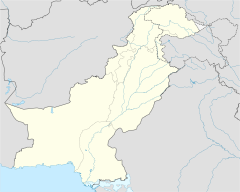
Malubiting is located in Pakistan
Malubiting
Location in Pakistan
Elevation 7,458 m (24,469 ft) 
Ranked 58th
Prominence 2,193 m (7,195 ft)
Listing Ultra
Location
Location Northern Areas, Pakistan
Range Rakaposhi-Haramosh Mountains, Karakoram
Coordinates 36°02′20″N 74°54′03″E / 36.03889°N 74.90083°E / 36.03889; 74.90083Coordinates: 36°02′20″N 74°54′03″E / 36.03889°N 74.90083°E / 36.03889; 74.90083
Climbing
First ascent 1971 by K. Pirker, H. Schell, H. Schindlbacher, H. Sturm
Easiest route glacier/snow/ice climb

Malubiting (also known as Malubiting West) is the second highest peak in the Rakaposhi-Haramosh Mountains, a subrange of the Karakoram range of Pakistan.

Location

Malubiting lies in the heart of the Rakaposhi-Haramosh Mountains, which rise above the north bank of the Indus River between its tributaries the Hunza River and the Shigar River. Malubiting lies about 40 km east-southeast of Rakaposhi, and about 50 km east of Gilgit, the most important town in the region. Malubiting rises steeply over the Phuparash River to the southwest, while on the east the large Chogo Lungma Glacier starts on its slopes.

Climbing History

Malubiting was unsuccessfully attempted in 1955, 1959, 1968, 1969 and 1970 and 1971 before the first ascent in 1971. In that year an Austrian team led by Horst Schindlbacher reached the summit via the Northeast Ridge, ascending the North Peak and skirting the Central Peak on the way.

According to the Himalayan Index, there has been only one additional ascent, in 1997 , via the original route. (There may however have been other ascents that did not make it into the Index.)

Sources

  • High Asia: An Illustrated History of the 7000 Metre Peaks by Jill Neate, ISBN 0-89886-238-8
  • Orographical Sketch Map of the Karakoram by Jerzy Wala, 1990. Published by the Swiss Foundation for Alpine Research.
  • Himalayan Index


Wikimedia Foundation. 2010.

Игры ⚽ Поможем решить контрольную работу

Look at other dictionaries:

  • Malubiting — pd1pd5 Malubiting Höhe 7.458  …   Deutsch Wikipedia

  • Список высочайших вершин мира — Высочайшая гора мира Эверест с юга, вид из самолёта. Слева, в виде гребня  Нупцзе, ещё левее  …   Википедия

  • Rakaposhi-Haramosh-Berge — p1p5 Rakaposhi Haramosh Berge Nordwestteil des Gebirges mit Rakaposhi (rechts) und Diran (links) Höchster Gipfel …   Deutsch Wikipedia

  • Haramosh — BW f1pd1pd5 Haramosh Höhe 7.406 m Lage Pakistan …   Deutsch Wikipedia

  • Liste der Berge in Asien — Die höchsten Berge in Asien Dieser Artikel oder Abschnitt bedarf einer Überarbeitung. Näheres ist auf der Diskussionsseite angegeben. Hilf mit, ihn zu verbessern, und entferne anschließend diese Markierung. Dies ist eine Liste der höchsten Berge… …   Deutsch Wikipedia

  • Spantik — pd5 Spantik Der Südostgrat (links) ist der Normalweg Höhe …   Deutsch Wikipedia

  • Montañas más altas — Anexo:Montañas más altas Saltar a navegación, búsqueda Monte Everest, la montaña más alta del mundo La siguiente es una lista de las ”100 montañas más altas del mundo” por altura sobre el nivel del mar; todas ellas se encuentran en Asia. Sólo se… …   Wikipedia Español

  • Anexo:Montañas más altas — Monte Everest, la montaña más alta del mundo. La siguiente es una lista de las 100 montañas más altas del mundo por altura sobre el nivel del mar; todas ellas se encuentran en Asia. Sólo se incluyen aquellas que, por una clasificación objetiva,… …   Wikipedia Español

  • Laila Peak (Rakaposhi-Haramosh-Berge) — pd5 Laila Peak Die Nordwestwand des Laila Peak Höhe …   Deutsch Wikipedia

  • Liste von Bergen in Asien — Höchster Berg Asiens, zugleich der höchste Berg der Erde: Der Mount Everest In dieser Liste werden die höchsten Berge Asiens geführt. Enthalten sind alle Erhebungen mit einer sogenannten Schartenhöhe von mindestens 500 Metern. Die Liste ist… …   Deutsch Wikipedia

Share the article and excerpts

Direct link
Do a right-click on the link above
and select “Copy Link”