- Los Robles La Paz
Infobox City
official_name = Los Robles La Paz
nickname =
motto =
imagesize =
image_caption =
image_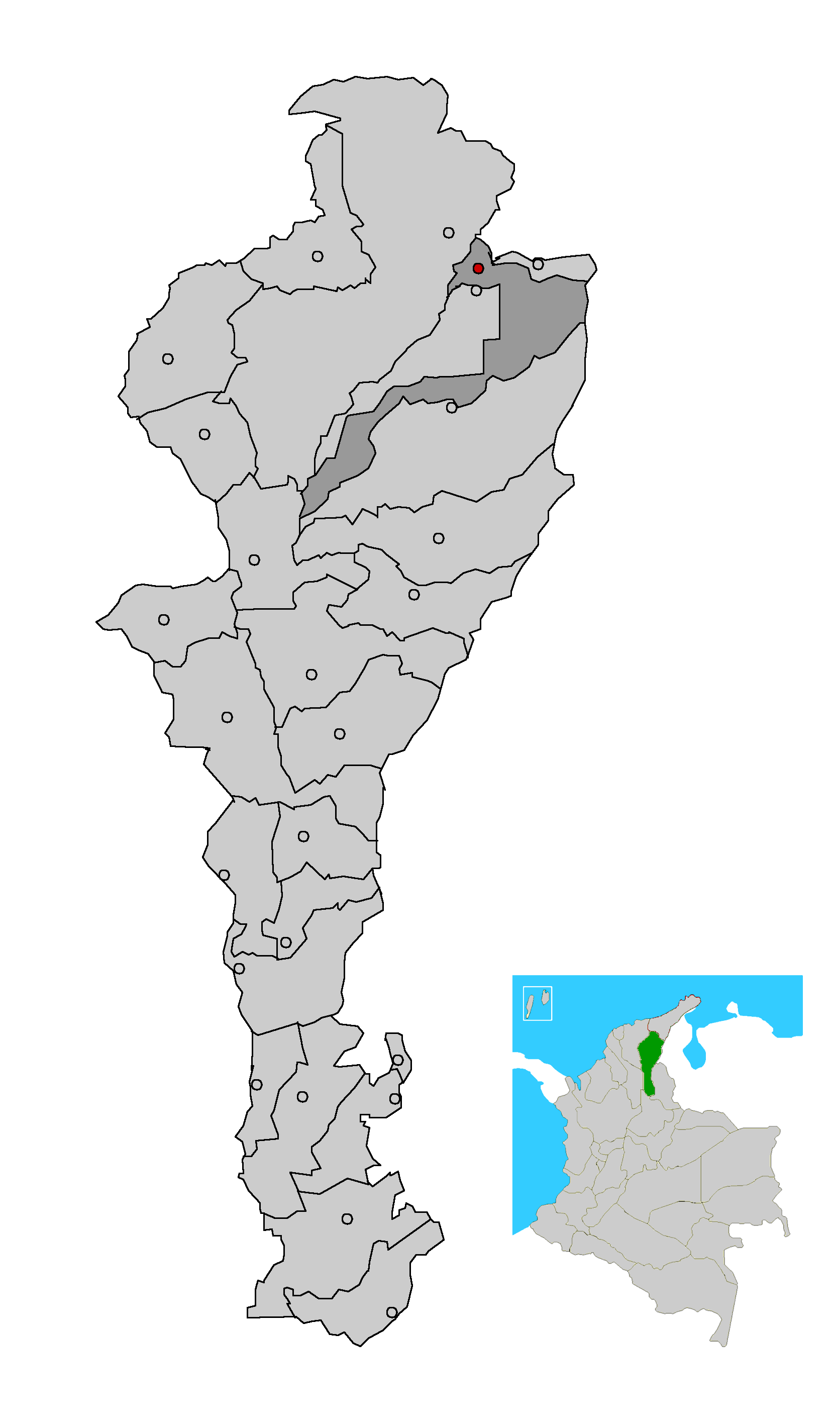
mapsize = 200px
map_caption = Location of the municipality and town of La Paz in the Department of Cesar.
subdivision_type =Country
subdivision_type1 = Region
subdivision_type2 = Department
subdivision_name =Colombia
subdivision_name1 = Caribbean
subdivision_name2 = Cesar
leader_title =Mayor
leader_name =Gerardo Alfonso Gutiérrez
(Alas Equipo Colombia) [ [http://www.interpolitico.com/noticias//noticia.php?cid=1&nid=344 es icon Interpolitico.com: Mayors of Cesar - 2008-2011] ]
established_title = Foundation
established_date =1700
area_magnitude =
area_total_sq_mi =
area_total_km2 =
area_land_sq_mi =
area_land_km2 =
area_water_sq_mi =
area_water_km2 =
area_water_percent =
area_urban_sq_mi =
area_urban_km2 =
area_metro_sq_mi =
area_metro_km2 =
population_as_of =2005
population_note = [ [http://www.colombiassh.org/site/IMG/png/demografia.pngColombiassh.org: Census 2005: Robles La Paz] ]
population_total = 21289
population_metro =
population_urban =
population_density_km2 =
population_density_sq_mi =
timezone =
utc_offset = -5
timezone_DST =
utc_offset_DST =
latd= |latm= |lats= |latNS=
longd= |longm= |longs= |longEW=
elevation_m =
elevation_ft =
website =
[http://www.lapazrobles-cesar.gov.co/ www.lapazrobles-cesar.gov.co]
footnotes =Los Robles La Paz or simply La Paz is a municipality and a town in the
Department of Cesar ,Colombia . The town is close to the Capital city of theDepartment of Cesar ;Valledupar . The municipality of La Paz borders to the north withLa Guajira Department , to the northeast with the municipality of Manaure. To the east with theBolivarian Republic of Venezuela sharing theSerrania del Perija mountain range. To the south with the municipalilty ofCodazzi , southwest with the municipality ofEl Paso, Cesar (sharing theMagdalena River as border). To the west with the municipality of San Diego and to the northwest with the municipality ofValledupar .The eaastern part of the territory, near the Serrania del Perija is inhabited by the
Yukpa indigenous people.History
The first inhabitants of what is present-day the municipality of Los Robles La Paz were the indigenous peoples known as
Chimilas which populated the plains of the valley of the Cesar River. On theSerrania del Perija mountains theYukpas were also part of the Chimila confederation of tribes. [Harvnb|Gutierrez Hinojosa|2000|p=106]The Spanish arrived in the area in
1531 but the region of Los Robles La Paz remained dominated by the Chimilas. In1700 Spanish CaptainSalvador Felix de Arias was sent to "pacify" the indigenous tribes. Arias founded Los Robles La Paz this same year. [Harvnb|Gutierrez Hinojosa|2000|p=27]Notes
References
*citation|last=Gutierrez Hinojosa|first= Tomas Dario|last2=|first2=|authorlink=|title=Valledupar Musica de una Historia|location=Bogota|publisher=Editorial Grijalbo LTDA|year=2000|isbn=958-639175-2
External links
*es icon [http://www.lapazrobles-cesar.gov.co/ Robles La Paaz official website]
Wikimedia Foundation. 2010.