- Dunbar Castle
-
Dunbar Castle Dunbar, East Lothian, Scotland 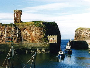
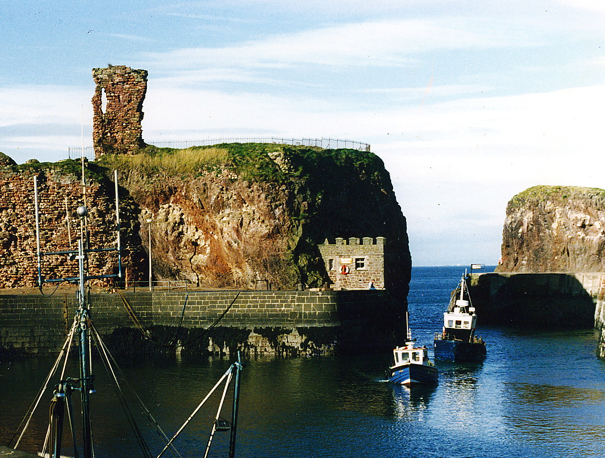
Dunbar harbour and castle ruins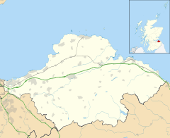
 Shown within Scotland East Lothian
Type Castle of enceinte Coordinates grid reference NT67827930 Built first stone castle c.1070 Built by Gospatric, Earl of Northumbria In use Until 1567 Current
conditionRuined Open to
the publicNo Dunbar Castle is the remnants of one of the most mighty fortresses in Scotland, situated over the harbour of the town of Dunbar, in East Lothian.
Contents
Early history
The Votadini or Gododdin, are thought to have been the first to defend this site, the Brythonic name Dyn Barr, (the fort of the point) is still in use. By the 7thc. Dunbar Castle was a central defensive position of the Kings of Bernicia, an Anglian kingdom that took over from the British Kingdom of Bryneich.
Northumbria
During the Early Middle Ages, Dunbar Castle was held by an Ealdorman owing homage to either the Kings at Bamburgh Castle, or latterly the Kings of York. In 678 Saint Wilfrid was imprisoned at Dunbar, following his expulsion from his see of York by Ecgfrith of Northumbria.
Later, Dunbar was said to have been burnt by Kenneth MacAlpin, King of the Scots. Certainly he is on record in possession of the castle.[1]
Kingdom of the Scots
In the 10th and early 11th century the Norsemen made increasing inroads in Scotland, and in 1005 there is record of a Patrick de Dunbar, under Malcolm II, engaged against the Norse invaders in the north, at Murthlake, a town of Marr, where, alongside Kenneth, Thane of the Isles, and Grim, Thane of Strathearn, he was slain.[1]
The first stone castle is thought to have been built by Gospatric, Earl of Northumbria, after his exile from England, following the Harrowing of the North, by William the Conqueror after Gospatric took refuge at the court of Malcolm II of Scotland. Gospatric was a powerful landowner in both kingdoms and could summon many men, which encouraged Malcolm to give him more lands in the Merse and Lauderdale, in return for those lost further south in return for loyalty. Sir Walter Scott argued that Cospatric or Gospatrick was a contraction of Comes Patricius. In any case, King Malcolm III is recorded as bestowing the manor of Dunbar &c., on "the expatriated Earl of Northumberland".[1]
Structure
The body of buildings measured in excess of one hundred and sixty five feet from east to west, and in some places up to two hundred and ten feet from north to south. The South Battery, which Grose supposes to have been the citadel or keep, is situated on a detached perpendicular rock, only accessible on one side, seventy two feet high, and is connected to the main part of the castle by a passage of masonry measuring sixty nine feet. The interior of the citadel measures fifty four feet by sixty within the walls. Its shape is octagonal. Five of the gun-ports remain, which are called the 'arrow-holes'. They measure four feet at the mouth and only sixteen inches at the other end. The buildings are arched and extend eight feet from the outer walls, and look into an open court, whence they derive their light.[2]
 19th-century engraving of the castle
About the middle of the fortress, part of a wall remains, through which there is a gateway, surmounted with armorial bearings. ths gate seems to have led to the principal apartments. In the centre, are the arms of George, 10th Earl of Dunbar, who succeeded his father in 1369, and who besides the earldom of Dunbar and March, inherited the Lordship of Annandale and the Isle of Man from his heroic aunt, Black Agnes of Dunbar They must have been placed there after his succession, as he was the first who assumed those sculptured Arms: viz, a large triangular shield, and thereon a lion rampant, within a bordure charged with eight roses. The shield is adorned with a helmet, carrying a crest: a horse's head bridled. On the right are the Arms of the Bruces, and on the left those of the Isle of Man.[2]
The castle towers had communication with the sea, and dip low in many places. North-east from the front of the castle is a large natural cavern, chiefly of black stone, which looks like the mouth of the Acheron - a place that leads to melancholy streams. This spot is supposed to have formed part of the dungeon where prisoners were confined, such as Gavin Douglas, Bishop of Dunkeld, who was a prisoner here in 1515. There is, however, also a dark postern which gives access to a rocky inlet from the sea, and it seems probable that it was through this that Sir Alexander Ramsay and his followers entered with a supply of provisions to the besieged in 1338.[2]
It was long said the castle was invulnerable, possibly because of the many sieges it sustained. The castle was built with a red stone similar to that found in the quarries near Garvald. Large masses of walls, which have fallen beneath the weight of time, appear to be vitrified or run together. In the north-west part of the ruins is an apartment about twelve feet square, and nearly inaccessible, which tradition states was the apartment of Mary, Queen of Scots.[2]
Later history
The Castle remained the stronghold of the Earls of Dunbar until the forfeiture of George, Earl of March, in 1457, when the Castle was dismantled to prevent its occupation by the English. It was restored by James IV later in the century. The castle came under the control of the Duke of Albany and it was during this period that the bulwark to the west was built. It may have been designed by Antoine d'Arces, Sieur de la Bastie who was placed in charge of the castle in December 1514.[3] Albany organised further repairs and amendments in July 1527.[4] It was burnt by the Earl of Shrewsbury on a punitive raid during the Rough wooing in 1548.[5] Further re-fortifications in 1548 were directed by Piero Strozzi and Migiliorino Ubaldini.[6]
Dunbar Castle was finally slighted by order of the Parliament of Scotland, following the debacle at Carberry Hill.
See also
References
- ^ a b c Miller, James, The History of Dunbar, Dunbar, 1830:8
- ^ a b c d Miller, James, The History of Dunbar, Dunbar, 1830, pps 2 - 6
- ^ Tabraham, Chris (1997) Scotland's Castles. Batsford. ISBN 0-7134-8147-1 p.100
- ^ State Papers Henry VIII, vol. 1, (1830), 211, Knighte to Wolsey, 10 July 1527.
- ^ Coventry, Martin (2001) The Castles of Scotland. Goblinshead. ISBN 1899874 26 7 p.188
- ^ Merriman, Marcus, The Rough Wooings, Tuckwell (2000), 327-330.
External links
Categories:- Castles in East Lothian
- History of East Lothian


Wikimedia Foundation. 2010.