- Kilmarnock railway station
Infobox UK station
name = Kilmarnock
other_name =
code = KMK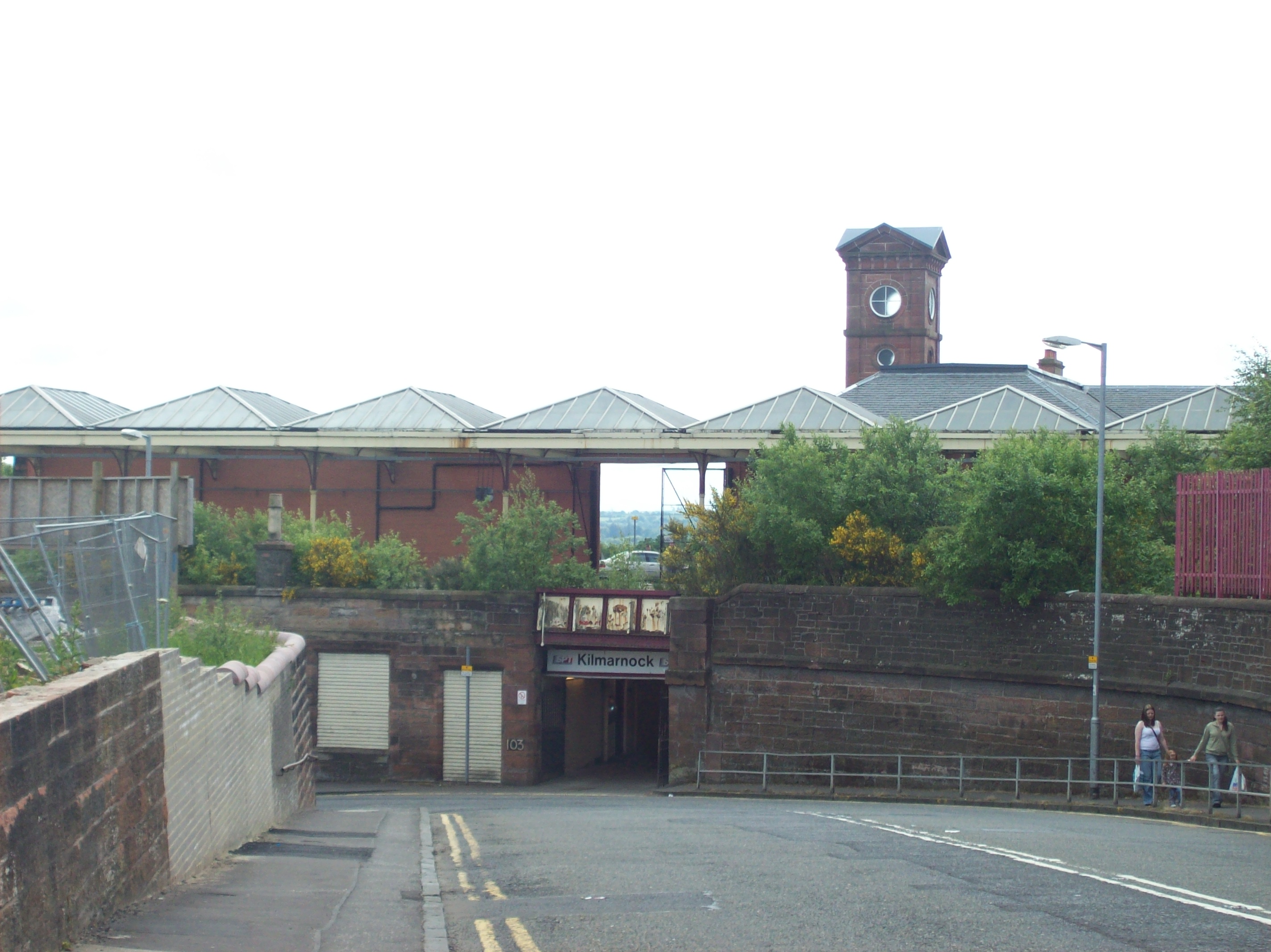
caption = A view of the station from the former Kilmarnock Infirmary Site
manager =First ScotRail
locale =Kilmarnock
borough =East Ayrshire
pte = SPT
original =Glasgow, Paisley, Kilmarnock and Ayr Railway
pregroup =Glasgow and South Western Railway
years =20 July 1846
events = Opened
years1 =
events1 =
platforms = 4
usage0203 = 0.398
usage0405 = 0.462
usage0506 = 0.455
usage0607 = 0.438Kilmarnock railway station is a railway station in
Kilmarnock ,East Ayrshire ,Scotland . The station is managed byFirst ScotRail and is served by trains on theGlasgow South Western Line .History
The station was opened on
20 July 1846 by theGlasgow, Paisley, Kilmarnock and Ayr Railway . [Butt (1995)] This was the third Kilmarnock railway station to be built: the first and second stations were solely termini for theKilmarnock and Troon Railway .Current operations and station description
The station is built well above street level and is accessed via either a subway and stairs or a more circuitous but step-free route along a narrow access road.
The station has a total of 4 platforms; two north-facing bays for both terminating Glasgow services and trains on the Glasgow to Stranraer via Kilmarnock route, on which trains reverse out of the station towards the junction with the Troon line. Two through platforms serve Glasgow to Carlisle trains, as well as Stranraer to Newcastle services. The bay platforms (1 and 2) as well as platform 3 are covered by a partly glazed roof and directly accessible from the ticket office. Platform 4 is used infrequently, accessed via a subway and stairs, and afforded only a bus stop style shelter.
The train service to Glasgow is limited by the fact that the line is single track northwards as far as
Barrhead with only a staticpassing loop atLugton . This limits the route's potential as a commuter service, and a dynamic passing loop is being considered to help rectify this. [ [http://www.railscot.co.uk/Glasgow_and_Kilmarnock_Joint_Railway/frame.htm RAILSCOT on Glasgow and Kilmarnock Joint Railway (retrieved 19 December 2006)] ] As of 2007, it takes some 40 minutes to reach Glasgow from Kilmarnock over First ScotRail.The present Kilmarnock
signal box is located north of the station, in the vee of the junction. Opened on12 April 1976 , it is a plain brick building containing an NX (entrance-exit) panel on the upper storey. It replaced four mechanical signal boxes in a scheme that saw the track layout greatly simplified. Originally, the box worked Track Circuit Block to Hurlford signal box andScottish Region Tokenless Block over the single lines to Barassie Junction and Lugton signal boxes. Kilmarnock signal box was severely damaged in a suspectedarson attack on25 December 2006 .2007 & 2008 gallery
References
Notes
Sources
*
*rail line three to one
previous1 = Troon
previous2 = Auchinleck
previous3 = "Terminus"
next = Kilmaurs
route1 =First ScotRail "'
Glasgow South Western Line
route2 =First ScotRail "'
Glasgow South Western Line
route3 =First Scotrail "'
Glasgow South Western Line
col = FF80C0rail line
previous = "Connection with
GPK&AR
next = Kilmaurs
"Line and station open
route = Caledonian and Glasgow & South Western Railways"'
Glasgow, Barrhead and Kilmarnock Joint Railway
col = 517a6arail line
previous = Hurlford
"Line open; station closed
next = Crosshouse
"Line and station closed
route =Glasgow and South Western Railway "'
Glasgow, Paisley, Kilmarnock and Ayr Railway
col = G&SW colourrail line
previous = Gatehead
"Line open; station closed
next = "Connection with
GPK&AR
route =Glasgow and South Western Railway "'
Kilmarnock and Troon Railway
col = G&SW colour
###@@@KEYEND@@@###
Wikimedia Foundation. 2010.