- Maxdorf
-
Maxdorf 
Coordinates 49°28′55″N 8°17′24″E / 49.48194°N 8.29°ECoordinates: 49°28′55″N 8°17′24″E / 49.48194°N 8.29°E Administration Country Germany State Rhineland-Palatinate District Rhein-Pfalz-Kreis Municipal assoc. Maxdorf Mayor Werner Baumann (CDU) Basic statistics Area 7 km2 (2.7 sq mi) Elevation 95 m (312 ft) Population 7,009 (31 December 2010)[1] - Density 1,001 /km2 (2,593 /sq mi) Other information Time zone CET/CEST (UTC+1/+2) Licence plate RP Postal code 67133 Area code 06237 Maxdorf is a municipality in the Rhein-Pfalz-Kreis, in Rhineland-Palatinate, Germany.
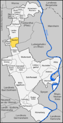
It is situated approx. 11 km west of Ludwigshafen.
Maxdorf is also the seat of the Verbandsgemeinde ("collective municipality") Maxdorf.
Towns and municipalities in Rhein-Pfalz-Kreis Altrip · Beindersheim · Birkenheide · Bobenheim-Roxheim · Böhl-Iggelheim · Dannstadt-Schauernheim · Dudenhofen · Fußgönheim · Großniedesheim · Hanhofen · Harthausen · Heßheim · Heuchelheim bei Frankenthal · Hochdorf-Assenheim · Kleinniedesheim · Lambsheim · Limburgerhof · Maxdorf · Mutterstadt · Neuhofen · Otterstadt · Rödersheim-Gronau · Römerberg · Schifferstadt · WaldseeReferences
- ^ "Bevölkerung der Gemeinden am 31.12.2010" (in German). Statistisches Landesamt Rheinland-Pfalz. 31 December 2010. http://www.statistik.rlp.de/fileadmin/dokumente/berichte/A1033_201022_hj_G.pdf.
Categories:- Municipalities in Rhineland-Palatinate
- Rheinhessen-Pfalz geography stubs
Wikimedia Foundation. 2010.


