- Coma Pedrosa
-
Coma Pedrosa 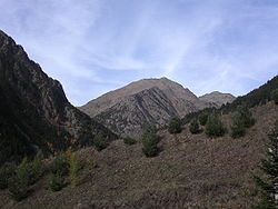
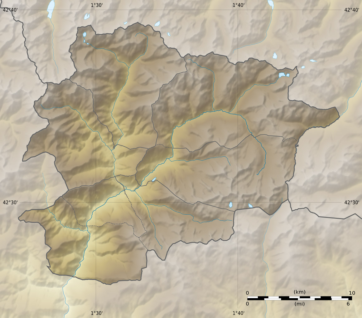
Elevation 2,943 m (9,656 ft) [1] Prominence 434 m (1,424 ft) [1] Listing Country high point Location Location of Coma Pedrosa in Andorra (near the French border)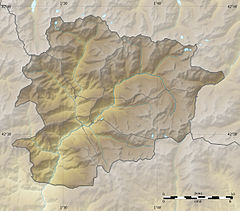
 Coma Pedrosa
Location  Andorra, parish of La Massana
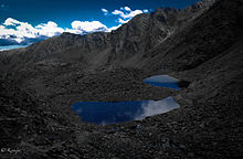
Range Pyrenees Coordinates 42°35′26″N 1°26′41.21″E / 42.59056°N 1.4447806°ECoordinates: 42°35′26″N 1°26′41.21″E / 42.59056°N 1.4447806°E Coma Pedrosa (Catalan pronunciation: [ˈkomə pəˈðɾozə], locally: [ˈkoma peˈðɾoza]) (2,943 m/9,656 ft) is the highest mountain in the principality of Andorra.[2] It is popular with mountain climbers, its ascent being technically straightforward, although strenuous. Several mountain lakes and tarns are found on the slopes, notably Estanys de Baiau, which lies on the western slopes, across the Spanish border.
The nearest town is Arinsal, La Massana. Historically, the mountain provided ample security from invasions into Andorra.[3]
Contents
Geography
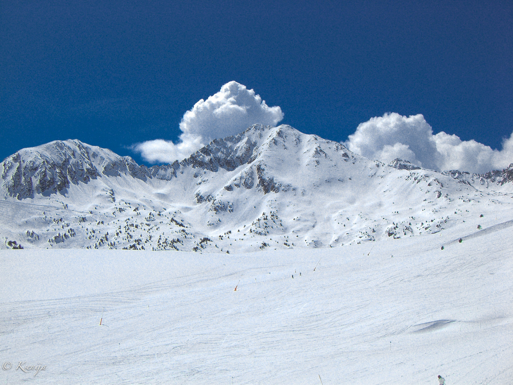
 Snow covered Andorra mountains
Coma Pedrosa, shaped like a pyramid,[4] is situated at the northwestern border with France and Spain. It has in the past acted as a barrier between Andorra and France. The mountainous terrain of Andorra, a landlocked country, contains 65 peaks that rise to an elevation of greater than 2,000 m (6,562 ft), and of the 65 peaks, Coma Pedrosa has the highest one at 2,943 m (9,656 ft).[5]
Its recent exposure to tourism has attracted millions to enjoy the unique scenic beauty of its hills and valleys.[5] The higher reaches of the mountain are covered with forests while the lower reaches have some arable lands. The mountain gets fully covered with snow during the winter months which provides opportunities for skiing and mountaineering, ice climbing and scrambling. During the summer season, the mountain provides many easy routes for trekking through the Arinsal valley covering neighbouring areas of Vall Ferrera in Spain after crossing Baiau, the mountain pass.[6][7]
The town of Arinsal is in the narrow valley below the mountain. The Coma Pedrosa's Estany Negre, the Torta Coma, Coma's Gaspedrosa, the Puestode las Erolas, Cape dels Croes, and Puig dels Emborts in the Sierra del Aguiro surround the parish of La Massana.[8]
Vegetation
The forest vegetation in the mountain and its valleys are of pines, birch and firs. There are many glacier lakes formed within the valley created by the mountains and also vast meadows. Consequent to the popularity of skiing in and around this mountain valley near Arinsal and close to the Andorra la Vella and other valleys in Andorra, the pristine ambiance of the valley has been inundated with tourist resorts, hotels, restaurants and business establishments catering to tourists. This has created an awareness to preserve virgin mountains and forests, and put restrictions on further proliferation of ski resorts and urban activities by introducing a national network of parks as preserves.[7]
Tourism
 Way to the of top of Andorra
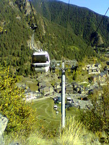 Cable car station at Arinsal
The trek or the mountain climb starts from Arinsal, which is considered an easy route, from the picnic area at the base of the Ribal Warefall at 1,580 metres (5,180 ft). It takes about 4 to 4 1/2 hours to reach the highest point of Pic de Coma Pedrosa. The first part of the climb, taking just under half an hour, is along a wide, 800 metres (2,600 ft) long foot track through a sign post to Aigues Juntes, which is the confluence of the Coma Pedrosa River and Pla de l'Estany River rising from the mountains and arriving at Grau. The ascent continues along a steep hill slope of the Coma Pedrosa River valley and arrives at the Coma Pedrosa refuge or camping site at an elevation 2,272 metres (7,454 ft), which is located near the l'Estany de les Truites (Trout Lake). A further hour's walk leads to the Estany Negre (Black Lake), named on account of its colour. The last stretch is for about one hour from Estany Negre to the highest peak in Andorra at 2,943 metres (9,656 ft) elevation, and this trek, passing through rocky terrain, is difficult. The return trek follows the same route. A diversion through Malhiverns pass instead of Estany Negre is more enjoyable.[9][10][11]
In the Arinsal valley below the Coma Pedrosa, winter season offers skiing and snowboarding. The first ski lifts were installed in Arinsal in 1973. It is 10 kilometres (6.2 mi) northwest of Andorra la Vella and 5 kilometres (3.1 mi) northwest of Massana, providing a pleasant après-ski sight.[12][13][14] At an altitude of 2,260 metres (7,410 ft) lies Refugi de Coma Pedrosa, a mountain hut.[15] It was inaugurated in 1992.[16]
References
- ^ a b http://www.peakbagger.com/peak.aspx?pid=9815
- ^ Simonis, Damien (October 2003). Catalunya & the Costa Brava. Lonely Planet. pp. 247–. ISBN 9781740593816. http://books.google.com/books?id=IpnA4A1qc4MC&pg=PA247. Retrieved 23 December 2010.
- ^ Augustin, Byron (January 2009). Andorra. Marshall Cavendish. pp. 8–. ISBN 9780761431220. http://books.google.com/books?id=O4MNjT4QS0EC&pg=PA8. Retrieved 22 December 2010.
- ^ Balari Y Jovany, Jose (in Catalan). Origenes Historicos de CataluÑa. Editorial MAXTOR. p. 60. ISBN 9788497616775. http://books.google.com/books?id=sBu7_DFvmpgC&pg=PA60. Retrieved 22 December 2010.
- ^ a b Augustin, Byron. Andorra. p. 8. http://books.google.co.in/books?id=O4MNjT4QS0EC&pg=PA8&dq=Coma+Pedrosa&hl=en&ei=6dsETeTbGY_prQf1lNGRDw&sa=X&oi=book_result&ct=result&resnum=9&ved=0CE8Q6AEwCDgK#v=onepage&q=Coma%20Pedrosa&f=false. Retrieved December 22, 2010.
- ^ Eur (13 December 2002). Western Europe 2003. Europa. p. 41. ISBN 9781857431520. http://books.google.com/books?id=M9QYndAPmuQC&pg=PA41. Retrieved 22 March 2010.
- ^ a b "Coma Pedrosa". Summitpost.org. http://www.summitpost.org/coma-pedrosa/195485. Retrieved December 22, 2010.
- ^ Bladé, Jean-François (1875) (in French). Études géographiques sur la vallée d'Andorre. J. Baer et cie. pp. 37–. http://books.google.com/books?id=vaoFAAAAQAAJ&pg=PA37. Retrieved 22 December 2010.
- ^ Alf Robertson; Jane Meadowcroft (November 2005). The Mountains Of Andorra: Walks, Scrambles, Via Ferratas, Treks. Cicerone Press Limited. p. 46. ISBN 9781852844240. http://books.google.com/books?id=tJMAXkr_ogMC&pg=PA46. Retrieved 22 December 2010.
- ^ Kev Reynolds (October 2007). Walks and Climbs in the Pyrenees. Cicerone Press Limited. pp. 398–400. ISBN 9781852844707. http://books.google.com/books?id=e123YCdPgOkC&pg=PA398. Retrieved 22 December 2010.
- ^ "The "Coma Pedrosa" 2942 m:Tackle the highest mountain in Andorra". Hola-andorra.com. http://www.hola-andorra.com/arinsal/english/comapedrosagb.html. Retrieved December 22, 2010.
- ^ Damien Simonis (15 March 2007). Spain. Lonely Planet. pp. 404–. ISBN 9781741045543. http://books.google.com/books?id=WttmSt7kPmMC&pg=PA404. Retrieved 22 December 2010.
- ^ Loretta Chilcoat; Reuben Acciano (15 February 2005). Western Europe. Lonely Planet. p. 30. ISBN 9781740599276. http://books.google.com/books?id=Enrkj9PsKGwC&pg=PA30. Retrieved 22 December 2010.
- ^ "Arinsal Andorra". Arinsal.co.uk!. http://webcache.googleusercontent.com/search?q=cache:PnA_7BqYzLMJ:www.arinsal.co.uk/+first+ski+lifts+were+installed+in+Arinsal+in+1973.&cd=3&hl=en&ct=clnk&gl=in&client=firefox-a. Retrieved December 22, 2010.
- ^ Dubin, Marc (28 June 2004). The rough guide to the Pyrenees. Rough Guides. pp. 218–. ISBN 9781843531968. http://books.google.com/books?id=SSynY9B7XrIC&pg=PA218. Retrieved 22 December 2010.
- ^ "Refugios". Andorra.com. http://www.andorra.com/es/activita/refugi.asp. Retrieved December 22, 2010.
External links
Categories:- Mountains of Andorra
- Mountains of the Pyrenees


Wikimedia Foundation. 2010.