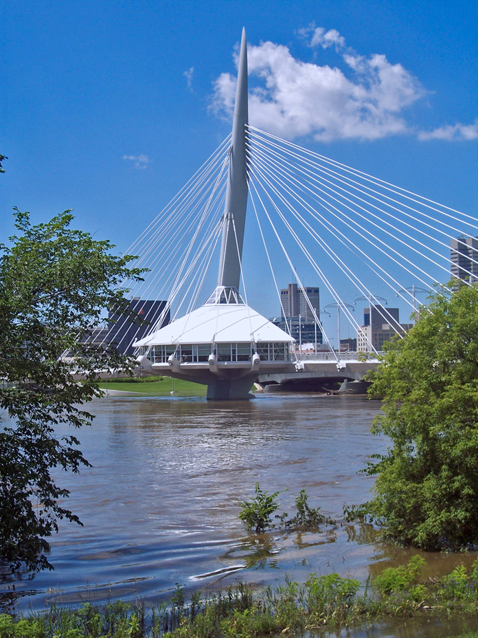
- Esplanade Riel
Infobox Bridge
bridge_name = Esplanade Riel
caption = Esplanade Riel pedestrian bridge
official_name = Esplanade Riel
carries =
crosses = Red River
locale =Winnipeg ,Manitoba ,Canada
maint = City of Winnipeg
id =
designer = Étienne Gaboury
design =Side-spar cable-stayed bridge
material =
spans = 2
pierswater =
mainspan =
length = 197 m
width = 7 m
height =
load =
clearance =
below =
traffic =
begin = 2003
complete = 2004
open =
closed =
toll =
map_cue =
map_
map_text =
map_width =
coordinates =
lat =
long = The Esplanade Riel is a pedestrian bridge located inWinnipeg, Manitoba designed by Étienne Gaboury of Wardrop Engineering and completed in 2003 [http://www.ciaowinnipeg.com/images/WEG_Riel.pdf] [Structurae|id=s0006036|title=Esplanade Riel Pedestrian Bridge] . It spans the Red River connectingdowntown Winnipeg with St. Boniface. It is paired with a vehicular bridge, Provencher Bridge. The bridge is only one of a few in the world in that it has a restaurant (Salisbury House) on it, giving patrons an excellent view of the river and in its rarely seen structure. The Esplanade Riel has become a landmark and is used in many promotional materials. The bridge itself is aside-spar cable-stayed bridge . The original drawing, stamped by Étienne Gaboury, rests in the Engineering building of the University of Manitoba in Winnipeg.References
Wikimedia Foundation. 2010.
