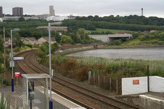
Invergowrie railway station
- Invergowrie railway station
Infobox UK station
name=Invergowrie
manager=First ScotRail
code =ING
locale=Invergowrie
borough= Perth and Kinross
lowusage0405 = 1,365
lowusage0506 = 1,740
lowusage0607 = 1,644
platforms= 2
Invergowrie railway station is an unstaffed halt which serves the village of Invergowrie near the city of Dundee, Scotland on the Banks of the Firth of Tay.
ee also
* Invergowrie rail crash on 22 October 1979 after a stop signal is ignored: Five killed and 52 hurt.
External links
Wikimedia Foundation.
2010.
Look at other dictionaries:
Dundee railway station — Dundee External view of Dundee station Location … Wikipedia
Invergowrie — is a village on the north bank of the River Tay to the west of Dundee. Although formally incorporated as part of Dundee, it is located in Perth and Kinross Fact|date=June 2007. The village is served by Invergowrie railway station.A village… … Wikipedia
Dundee and Perth Railway — [v · d · … Wikipedia
Dundee — For other uses, see Dundee (disambiguation). Coordinates: 56°27′50″N 2°58′12″W / 56.464°N 2.970°W / 56.464; 2.970 … Wikipedia
British Rail Class 47 — Brush Type 4 British Rail Class 47 Two Class 47s, Nos. 47424 and 47607, at Bangor station with a passenger train in 1987 Power type Diesel electric Builder Brush Traction … Wikipedia
List of rail accidents (1950–1999) — List of rail accidents from 1950 to 1999.For historic accidents before 1950, see List of pre 1950 rail accidents .For accidents from 2000 to the present, see List of rail accidents . notoc 1950s 1950* February 17 1950 ndash; Rockville Centre, New … Wikipedia
List of rail accidents in the United Kingdom — This list is of railway accidents in Britain sorted chronologically. For a list sorted by death toll see List of British rail accidents by death toll. It does not include incidents that did not involve rolling stock, such as the King s Cross fire … Wikipedia
Hume Highway — Hume Freeway Proposed … Wikipedia
Cambuslang — infobox UK place country = Scotland official name= Cambuslang gaelic name= Camas Long scots name= Cambuslang population= 24,500 os grid reference= NS642605 latitude=55.81 longitude= 4.16 unitary scotland= South Lanarkshire lieutenancy scotland=… … Wikipedia
Perth, Scotland — Coordinates: 56°23′49″N 3°26′14″W / 56.396911°N 3.437262°W / 56.396911; 3.437262 … Wikipedia