- Muir of Ord railway station
-
Muir of Ord 
Location Place Muir of Ord Local authority Highland Coordinates 57°31′05″N 4°27′40″W / 57.518°N 4.461°WCoordinates: 57°31′05″N 4°27′40″W / 57.518°N 4.461°W Operations Station code MOO Managed by First ScotRail Number of platforms 2 Live arrivals/departures and station information
from National Rail EnquiriesAnnual rail passenger usage 2004/05 * 24,365 2005/06 *  24,783
2006/07 * 32,5732007/08 * 39,2002008/09 * 51,1042009/10 * 57,396History Original company Inverness and Ross-shire Railway Pre-grouping Highland Railway Post-grouping LMS 11 June 1862 Opened[1] 13 June 1960 Closed 4 October 1976 Reopened National Rail - UK railway stations A B C D E F G H I J K L M N O P Q R S T U V W X Y Z * Annual passenger usage based on sales of tickets in stated financial year(s) which end or originate at Muir of Ord from Office of Rail Regulation statistics. Please note: methodology may vary year on year. Muir of Ord railway station is a railway station on the Kyle of Lochalsh Line and the Far North Line, serving the village of Muir of Ord in the Highland council area of Scotland. It is the location of the sole remaining crossing loop on the single line between Dingwall and Inverness. To the north is the site of the proposed station of Conon Bridge.
Contents
History
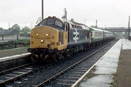
 Muir of Ord railway station in 2009
Muir of Ord railway station was once the junction of a branch railway to Fortrose. Passenger services on the branch ceased on 1 October 1951, but the branch remained open until 13 June 1960.
After the railway bridge across the River Ness washed away in February 1989, isolating the entire network north of Inverness, Muir of Ord was chosen as the location for a temporary depot, from which the stranded rolling stock could operate the service to the highland communities which depended on the line.
Increased services have increased usage dramatically (see right).
Preceding station  National Rail
Following station Beauly First ScotRail
Far North Line
Kyle of Lochalsh LineDingwall Historical railways Beauly Inverness and Ross-shire Railway
Highland RailwayConon Terminus Fortrose Branch
Highland RailwayRedcastle References
Notes
- ^ Butt (1995)
Sources
- Butt, R. V. J. (1995). The Directory of Railway Stations: details every public and private passenger station, halt, platform and stopping place, past and present (1st ed.). Sparkford: Patrick Stephens Ltd. ISBN 1-8526-0508-1. OCLC 60251199.
- Jowett, Alan (March 1989). Jowett's Railway Atlas of Great Britain and Ireland: From Pre-Grouping to the Present Day (1st ed.). Sparkford: Patrick Stephens Ltd. ISBN 1-8526-0086-1. OCLC 22311137.
- Jowett, Alan (2000). Jowett's Nationalised Railway Atlas (1st ed.). Penryn, Cornwall: Atlantic Transport Publishers. ISBN 0-9068-9999-0. OCLC 228266687.
Categories:- Railway stations in Highland (council area)
- Former Highland Railway stations
- Railway stations opened in 1862
- Railway stations closed in 1960
- Railway stations opened in 1976
- Railway stations served by First ScotRail
- Scotland railway station stubs


Wikimedia Foundation. 2010.