Ohlone Park

Ohlone Park
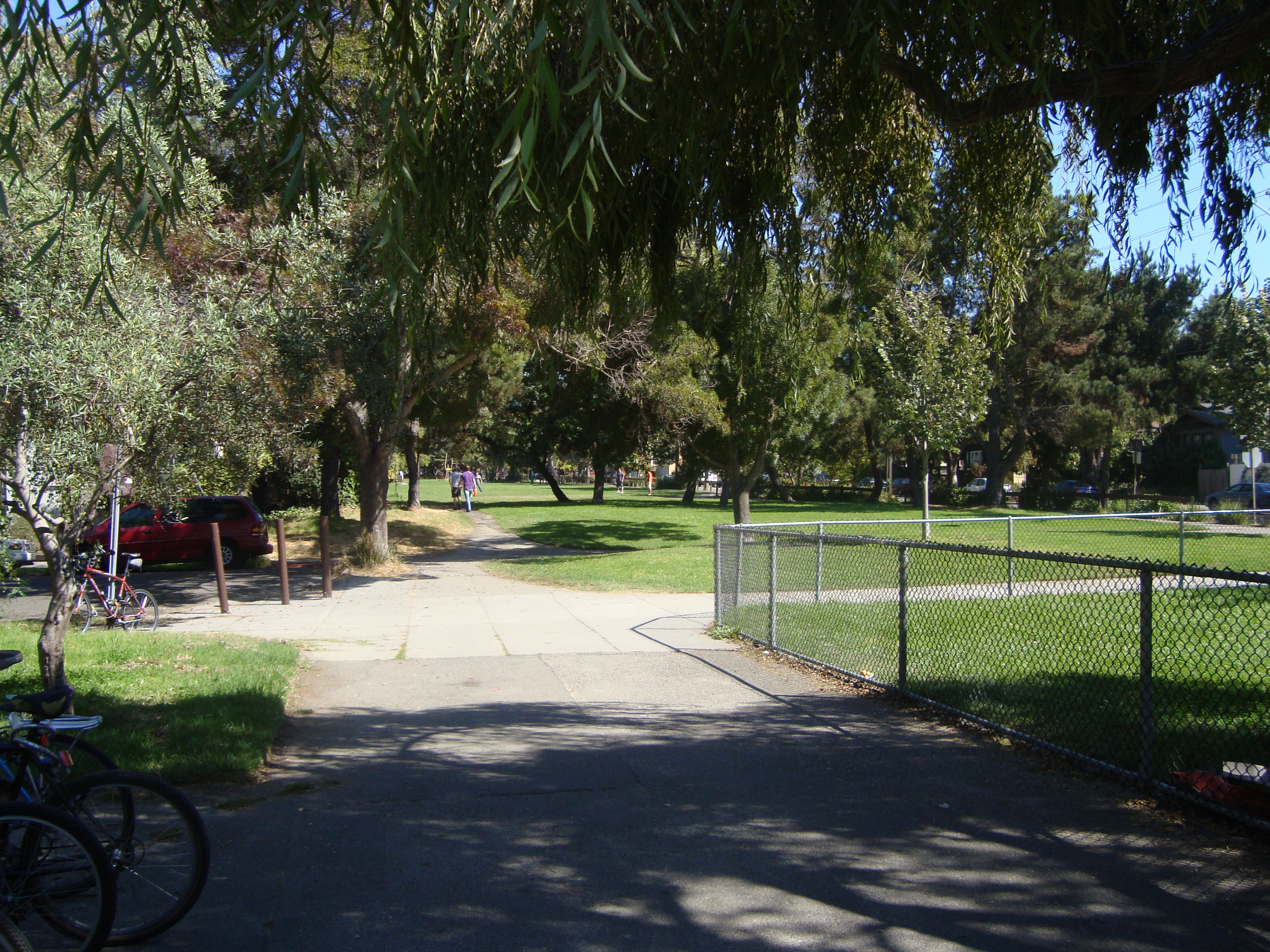
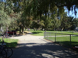
Ohlone Park in September 2010.

Ohlone Park is a public park in the city of Berkeley, California, United States, situated on a strip of land along the north side of Hearst Avenue between Martin Luther King Jr. Way and Sacramento Street. Directly underground is the subway used by the Bay Area Rapid Transit system's Richmond-Fremont and Richmond-Daly City lines.

The park is mostly grass with a scattering of trees, and includes pedestrian and bicycle paths, a dog park, a basketball court, and a small ballfield.

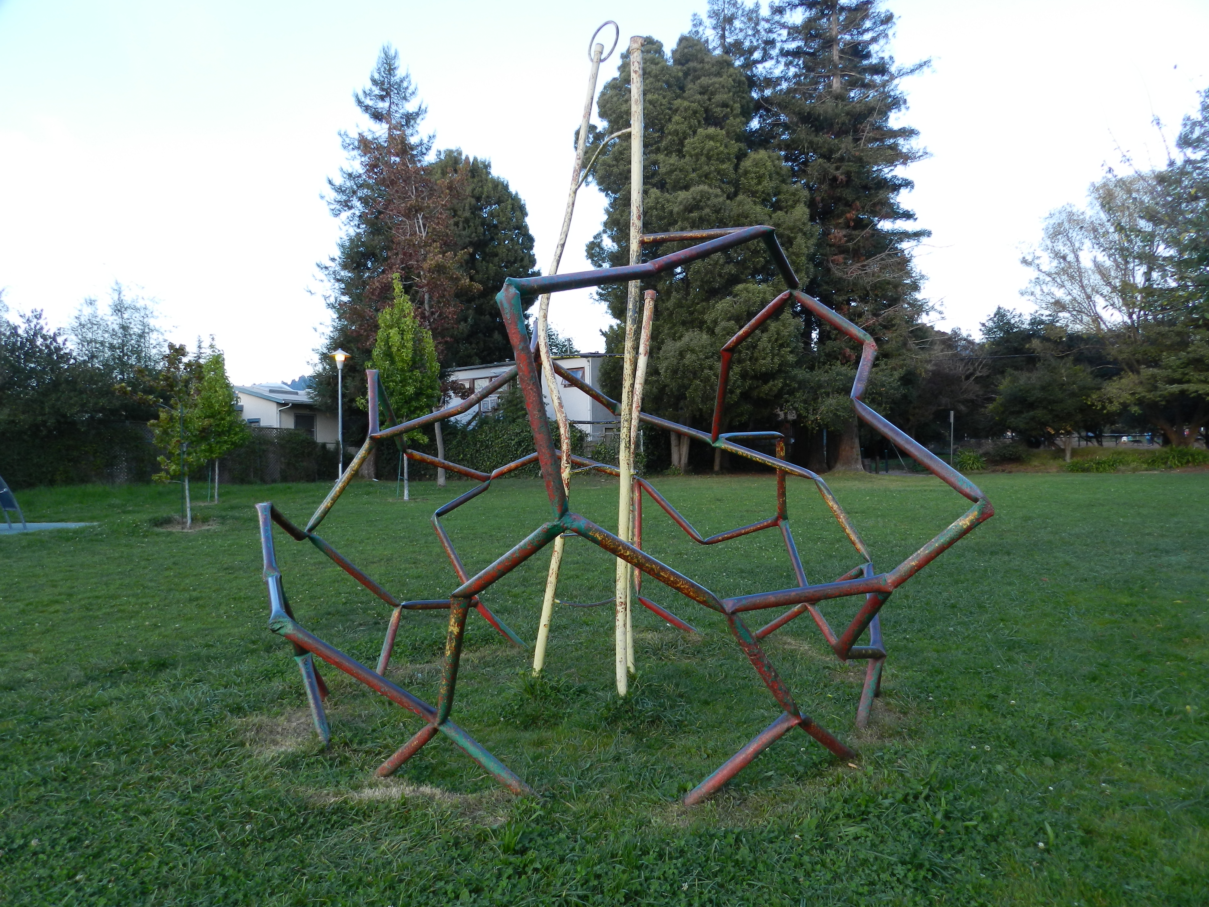
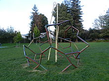
Jungle gym sculpture dating from the People's Park Annex (2011)

The park was created ad hoc by Berkeley citizens in connection with the People's Park controversy of the late 1960s. The land was originally occupied by residences which were acquired, then razed by BART in the construction of its subway through Berkeley. After the trench for the subway was filled in, BART planned to construct apartment complexes on the strip. But before their plans were complete, Berkeley citizens began planting sod and planting trees, and dubbed the strip "People's Park Annex".

After much haggling and public discussion, BART agreed to turn the Hearst strip over to the City of Berkeley. The park was formally named "Ohlone Park" after the name of the local indigenous people.

See also


Coordinates: 37°52′22″N 122°16′40″W / 37.872745°N 122.277832°W / 37.872745; -122.277832


Wikimedia Foundation. 2010.

Игры ⚽ Поможем написать реферат

Look at other dictionaries:

  • Ohlone Greenway — Public art along the Ohlone Greenway: sculpture by the path in Berkeley. The Ohlone Greenway is a pedestrian and bicycle path in the East Bay region of the San Francisco Bay Area. The path is named for the Ohlone Indians who originally lived in… …   Wikipedia

  • Ohlone languages — Ohlone Costanoan Pronunciation /oʊˈloʊniː/ Spoken in California Ethnicity Ohlone people …   Wikipedia

  • Ohlone/Chynoweth (VTA) — Ohlone/Chynoweth VTA light rail station Station statistics Address San Teresa Boulevard at Highway 87 San Jose, California Coordinates …   Wikipedia

  • Ohlone/Chynoweth–Almaden (VTA) — Ohlone/Chynoweth–Almaden Overview Type light rail System Santa Clara VTA Light Rail Status Cu …   Wikipedia

  • Ohlone traditional narratives — include myths, legends, tales, and oral histories preserved by the Ohlone (Costanoan) people of the central California coast. Ohlone oral literature formed part of the general cultural pattern of central California. See also: Traditional… …   Wikipedia

  • Ohlone-Chynoweth (VTA) — Ohlone/Chynoweth is a light rail station operated by Santa Clara Valley Transportation Authority (VTA). This station is served by VTA s Alum Rock Santa Teresa and serves as the terminus of the little used, stub Ohlone/Chynoweth Almaden line,… …   Wikipedia

  • Ohlone — infobox ethnic group caption = Map of the Costanoan languages and major villages. group = Ohlone (Costanoan) People poptime = 1770: 10,000 20,000 1800: 3000 • 1852: 864 1000 • 2000: 1500 2000+ popplace = California: San Francisco Peninsula, Santa …   Wikipedia

  • Ohlone people — For the college of the same name, see Ohlone College. For Tiger Beetle of the same name, see Ohlone tiger beetle. Ohlone (Costanoan) People Map of the Costanoan languages and major villages Total population 1770: 10,000 20,000 180 …   Wikipedia

  • Ohlone Wilderness — Coordinates: 37°30′32.56″N 121°52′2.6″W / 37.5090444°N 121.867389°W / 37.5090444; 121.867389 Ohlone Wilderness is a large …   Wikipedia

  • Ohlone mythology — The mythology of the Ohlone (Costanoan) Native American people of Northern California include creation myths as well as other ancient narratives that contain elements of their spiritual and philosophical belief systems, and their conception of… …   Wikipedia

Share the article and excerpts

Direct link
Do a right-click on the link above
and select “Copy Link”