- Ulukışla
Infobox Settlement
settlement_type = Town
subdivision_type = Country
subdivision_name = TUR
timezone= EET
utc_offset=+2
map_caption =Location of PAGENAME within Turkey.
timezone_DST=EEST
utc_offset_DST=+3
official_name = Ulukışla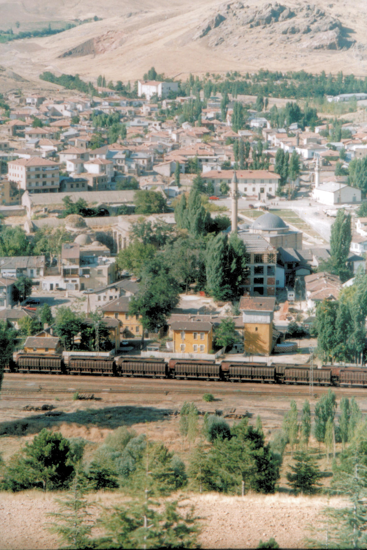
image_caption = General view of Ulukışla
image_blank_emblem =
blank_emblem_type =
map cTurkey
subdivision_type2=Province
subdivision_name2 = Niğde
population_total =
population_as_of = 2005
population_footnotes = []
population_density_km2 =
area_total_km2 =
latd = 37
latm = 32
latNS = N
longd = 34
longm = 29
longEW = E
elevation_m =
postal_code_type=Postal code
postal_code = 51xxx
area_code = 0
blank_info = 51|blank_name=Licence plate
leader_title=
leader_name =
website = [http://www.ulukisla.gov.tr www.ulukisla.gov.tr]Ulukışla is a town and district of
Niğde Province in the Central Anatolia region ofTurkey . It covers an area of 1,502 km², and the altitude is 1,427 m. Population is 32,928 of which 6,386 live in the town of Ulukışla.The town of Ulukışla lies in a valley between the Medetsiz and Bolkar ranges of the
Taurus Mountains , throughout history an important crossing from theMediterranean to the plains ofKonya and other parts of central Anatolia. This is a mountainous district and minerals including gold, silver, lead, coal and limestone have been mined here over the centuries. The climate is dry and the vegetation typical of the dry steppes of central Anatolia, summers are hot and dry, winters are cold and it snows. Wheat is grown in the valley.History
There are burial mounds
höyük and other signs of occupation going back to theHittites and even earlier. The area was later occupied byPhrygians , and Romans. the tomb of Faustina, wife of Emperor Marcus Aurelius was found in the village of Başmakçı, and the baths of Çiftehan claim among their patronsCleopatra (in the time when she was living in Tarsus). TheByzantines had armies based here, and then Ulukışla remained an important town in the time of theOttoman Empire .Ulukışla today
Ulukışla is a small market town in a rural area. The railway and the E5 highway from
Adana and the south-east of Turkey toAnkara and the west pass through here. There is a technical college of Niğde University here.Places of interest
*The therapeutic mineral baths of Çiftehan.
*The 17th centurycaravanserai of Öküz Mehmet Paşa, a classical example of the roadside havens built for journeys on theSilk Road toIran and points east. The inspiration for "Han Duvarları" a famous poem byFaruk Nafiz Çamlıbel .
*Medetsiz mountain and other peaks in the Bolkar range are popular with climbers, and there are also caves and canyons for adventure sports.References
External links
* [http://www.ulukisla.gov.tr District governor's official website] tr icon
* [http://www.ulukisla.bel.tr District municipality's official website] tr icon
* [http://www.nigdeli.net A web portal of Niğde] tr icon
* [http://www.yesilbor.com Yesilbor.com] tr icon

Wikimedia Foundation. 2010.