- Seferihisar
Infobox Settlement
settlement_type = Town
subdivision_type = Country
subdivision_name = TUR
timezone=EET
utc_offset=+2
map_caption =Location of PAGENAME within Turkey.
timezone_DST=EEST
utc_offset_DST=+3
official_name = Seferihisar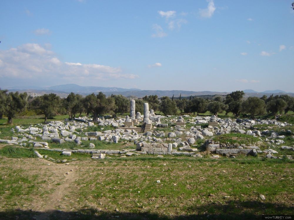
image_caption = Ruins of the ancient city ofTeos near Seferihisar
image_blank_emblem =
blank_emblem_type =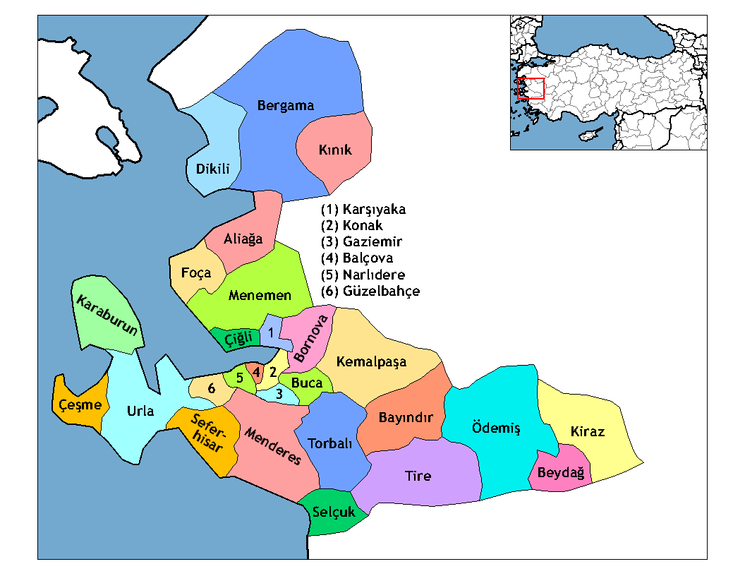
subdivision_type1=Region
subdivision_name1 = Aegean
subdivision_type2=Province
subdivision_name2 = Izmir
population_total = 43.361
population_urban =
population_as_of = 2006
population_footnotes = [http://www.izto.org.tr/NR/rdonlyres/898956C7-DD92-46C6-92D1-F06317523AE9/9357/27_SEFERİHİSAR.pdf]
population_density_km2 = 112
area_total_km2 = 386
elevation_m = 28
latd = 38
latm = 12
latNS = N
longd = 26
longm = 50
longEW = E
postal_code_type=Postal code
postal_code = 35xxx
blank_info = 35|blank_name=Licence plate
area_code = 0232
leader_title =
leader_name =
website = http://www.seferihisar.bel.tr
leader_name1 =
gwebsite = http://www.seferihisar.gov.trSeferihisar is a coastal town and the center of the district of the same name in
İzmir Province , inTurkey . Seferihisar district area borders on otherİzmir districts of Urla to the west and Menderes (Cumaovası ) to the east, and touches İzmir's western-most metropolitan district ofGüzelbahçe in the north. Seferihisar town center is situated slightly inland at an altitude of 28 m and the urban tissue extends towards the sea as composed of seven quarters, among which the part called Sığacık stands somewhat separately from the rest at a distance of 5 km, has its own port and made a name by its own right. The wide area of the district center partly accounts for its high population and an urbanization rate of 51 %, while the general impression received is rather rural in some of its sections. Both the center town and the district as a whole preserves an overall outlook of a pleasant resort area bearing typical Aegean characteristics. The district's economy is largely based on agriculture, with the production oftangerine s andsatsuma s standing out, and increasingly on tourism, with the presence of severalhousing projects or vacation villages, pensioners opting to settle in the region due to its quiet charm and a university campus in phase of being built. At a distance of convert|45|km|mi|0|abbr=on from İzmir center, (Konak), the connections with the metropolis are made easily, especially once reached the six-lanehighway in Urla. Seferihisar is where the ancient city ofTeos is located and its highly interesting await further research and discoveries. The district's literacy level is 99 %.ights of interest
Sights of interest include the ancient city of
Teos near Sığacık locality, the ruins locally called as Karaköse inDoğanbey -Gerenalanı region, the depending locality of Sığacık itself where an inner castle was constructed within a larger one by the Ottomans and near which a French vacation village is also situated. Seferihisar also has beautiful beaches and bays along its 27 km. coastal strait.Resources
*
Wikimedia Foundation. 2010.