- Hanak
Infobox Settlement
settlement_type = District
subdivision_type = Country
subdivision_name = TUR
timezone=EET
utc_offset=+2
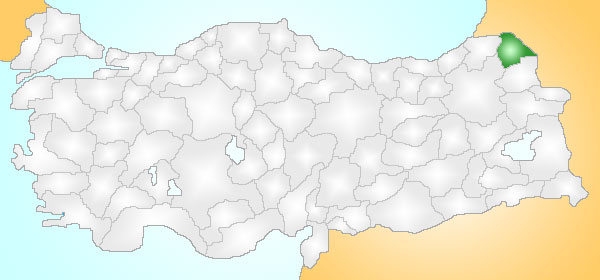
map_caption =Location of PAGENAME within Turkey.
timezone_DST=EEST
utc_offset_DST=+3official_name = Hanak
image_caption =
image_blank_emblem =
blank_emblem_type =
subdivision_type1=Region
subdivision_name1 = Mediterranean
subdivision_type2=Province
subdivision_name2 = Ardahan| population_total = 5000
population_as_of =
population_density_km2 =
area_total_km2 =
elevation_m = 1800|latd =
latm =
latNS = N
longd =
longm =
longEW = E
postal_code_type=Postal code
postal_code = 75xxx
area_code = (0090)+ 478
leader_name =
blank_info = 75|blank_name=Licence plate
website =Hanak is a district of
Ardahan Province ofTurkey on the road fromArdahan toPosof .Hanak sits in the valley of the Hanak River with high mountains on all sides, Ilgar to the north being the highest at 2915m. The weather, like all districts of Ardahan, is very, very cold and dry especially on the mountainsides where the cold weather begins in September, the snow will not melt until May, avalanches are common and the road to Posof is frequently closed. In summers it rains.
Until the 18th century these mountains were covered in forest, but now they are bare hillsides apart from one or two patches of pine forest. The local economy depends on grazing cattle.
History
See
Ardahan Province for the history of this area, including Hanak, long settled by theKipchak branch of theOghuz Turks, apart from brief periods of occupation byRussia in the late 19th and early 20th century.
Wikimedia Foundation. 2010.
