- Gülnar
Infobox Settlement
settlement_type = District
subdivision_type = Country
subdivision_name = TUR
timezone=EET
utc_offset=+2
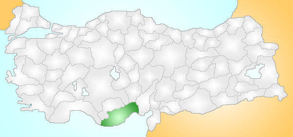
map_caption =Location of Gülnar within Turkey.
timezone_DST=EEST
utc_offset_DST=+3
subdivision_type1=Region
subdivision_name1 = Mediterranean
subdivision_type2=Province
subdivision_name2 = Mersin| population_total = 33714|population_footnotes=
population_as_of =| 1990
population_density_km2 =
area_total_km2 = 16690|elevation_m = 950|latd =
latm =
latNS = N
longd =
longm =
longEW = E
postal_code_type=Postal code
postal_code = 33xxx
area_code = (0090)+ 324
leader_name =
blank_info = 33|blank_name=Licence plate
website =Gülnar is a district of
Mersin Province ofTurkey , convert|150|km|mi|0|abbr=on south-west of the city ofMersin .Geography
The town of Gülnar is convert|32|km|mi|0|abbr=on inland on a plain high in the
Taurus Mountains , attractive countryside known for its vineyards and its green meadows used for summer grazing. Gülnar is a small town providing high schools and other basic amenities to the surrounding villages. The road from centralAnatolia toAnamur on theMediterranean coast passes through here, one of the windiest roads imaginable, making Gulnar a remote district indeed.The land area of Gülnar is convert|1669|km2|sqmi|0|abbr=on of which convert|351.1|km2|sqmi|0|abbr=on is cultivated, convert|848.09|km2|sqmi|0|abbr=on is forested hillside, convert|1.3|km2|sqmi|0|abbr=on is high meadow, and convert|468.51|km2|sqmi|0|abbr=on is rocky mountains. Much of the cultivated area is vineyards, other important crops are grains and chick peas. The high meadows are used for summer grazing.
History
The area has been occupied since the time of the
Hittites , and was later settled by theAssyrians ,Persians ,Egyptians and later theAncient Romans . The people of Gülnar today are descendents of theTurkmen tribes that came here fromCentral Asia in the 13th century.
Wikimedia Foundation. 2010.

