Big Sandy River (Ohio River)
- Big Sandy River (Ohio River)
Infobox River
river_name = Big Sandy River
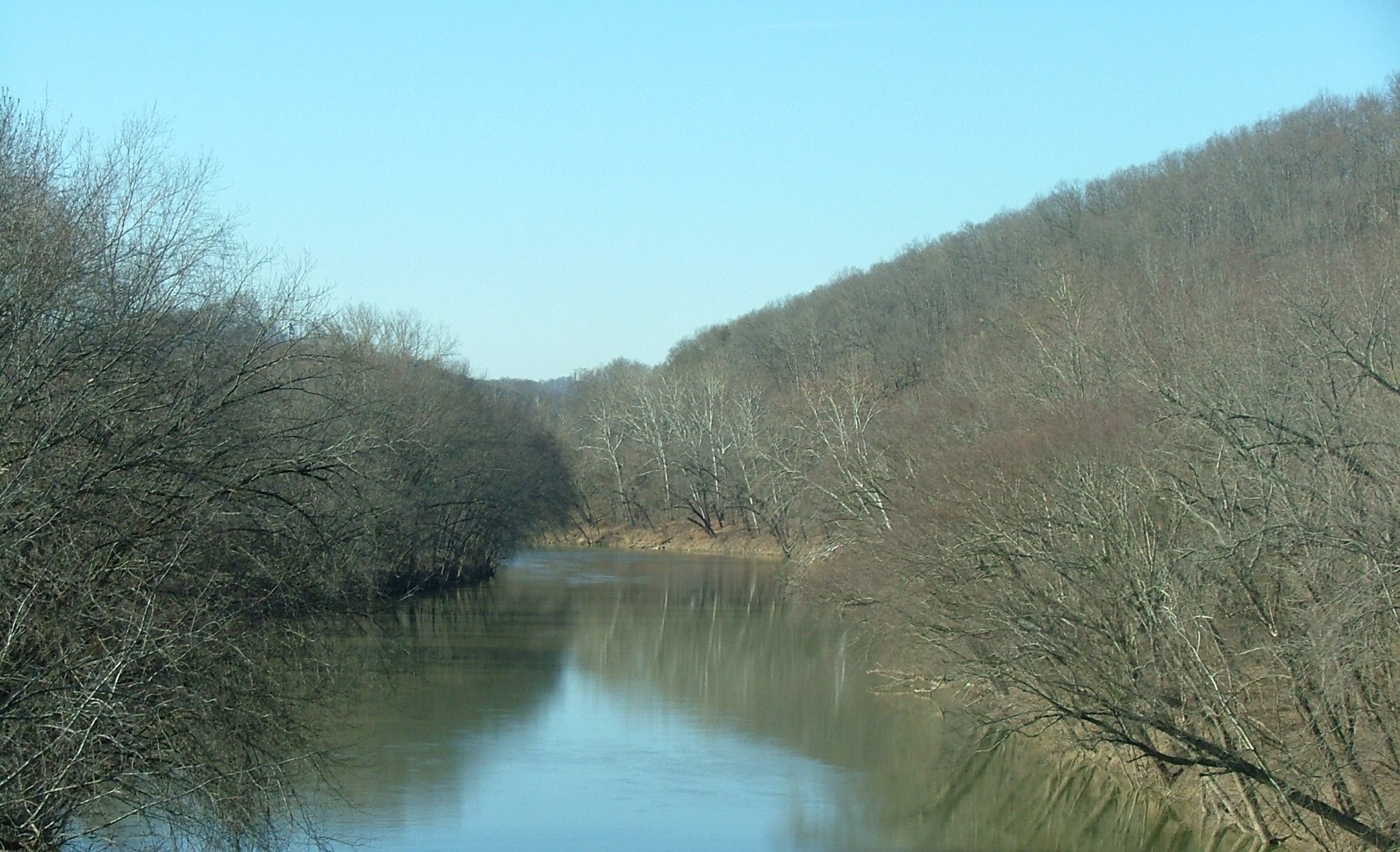
caption = View of Confluence, with the Levisa Fork on the left
origin = Confluence of Tug Fork and Levisa Fork at Louisa, Kentucky
mouth = Ohio River near Catlettsburg, Kentucky and Kenova, West Virginia
basin_countries = USA
length =
elevation = 545ft (166 m) [Gnis|1475920|Tug Fork] ]
mouth_elevation = 515ft (157 m) [U.S. Geological Survey. Catlettsburg quadrangle, Kentucky. 1:24,000. 7.5 Minute Series. Washington D.C.: USGS, 1985.] ]
discharge =
watershed = The Big Sandy River is a tributary of the Ohio River, approximately 28.79 mi (43 km) long, in western West Virginia and northeastern Kentucky in the United States. The river forms part of the boundary between the two states along its entire course. Via the Ohio River, it is part of the Mississippi River watershed.
It is formed between Louisa, Kentucky and Fort Gay, West Virginia by the confluence of the Tug Fork and Levisa Fork. It flows generally northwardly in a highly meandering course, between Lawrence and Boyd Counties in Kentucky and Wayne County in West Virginia. It joins the Ohio between Catlettsburg, Kentucky and Kenova, West Virginia, 8 mi (13 km) west of Huntington, West Virginia, at the common boundary between West Virginia, Kentucky, and Ohio.
The river is navigable and carries commercial shipping, primarily coal mined in the immediate region.
The name of the river comes from the presence of extensive sand bars. The Native American names for the river included "Tatteroa", "Chatteroi", and "Chatterwha" which had similar meaning to the English name.Fact|date=February 2007 It was known to the Lenape as "Sikeacepe",Fact|date=February 2007 meaning "Salt River", from the presence of salt licks on the river ("see": Licking River).
Two well-known fiddle-tunes take their name from the Big Sandy River: "Sandy River Belle" and the "Big Sandy River".
ee also
*List of Kentucky rivers
*List of West Virginia rivers
*Little Sandy River
References
External links
* [http://pride.uky.edu/basinassessments/bigsandyhuc.cfm University of Kentucky: Big Sandy Basin assessment]
Wikimedia Foundation.
2010.
Look at other dictionaries:
Big Sandy River (Ohio River) — Big Sandy River Einzugsgebiet des Big Sandy Rivers Daten Gewässerkennzahl … Deutsch Wikipedia
Big Sandy River (Tennessee) — Big Sandy River Gewässerkennzahl US: 1277382 Lage Tennessee, USA Flusssystem … Deutsch Wikipedia
Big Sandy River — The Big Sandy River may refer to one of the following rivers in the United States:*The Big Sandy River (Ohio River), on the border between Kentucky and West Virginia *The Big Sandy River (Tennessee), a tributary of the Tennessee River *The Big… … Wikipedia
Big Sandy River — Der Big Sandy River ist ein Fluss in Arizona; siehe Big Sandy River (Arizona) ein Fluss in Wyoming; siehe Big Sandy River (Wyoming) ein Fluss in Tennessee; siehe Big Sandy River (Tennessee) ein Fluss in Kentucky und West Virginia; siehe Big Sandy … Deutsch Wikipedia
Big Sandy River — Big Sandy Cette page d’homonymie répertorie les différents sujets et articles partageant un même nom. Big Sandy peut désigner : Toponyme Villes Big Sandy (Montana) Big Sandy (Nebraska) Big Sandy (Tennessee) Big Sandy (Texas) Big Sandy… … Wikipédia en Français
Big Sandy River — ▪ river, United States river formed by the confluence of Levisa and Tug forks at Louisa, Lawrence county, eastern Kentucky, U.S. The river, made navigable by a series of locks and dams, flows generally north for 27 miles (43 km) along the… … Universalium
Sandy Creek (Ohio) — Sandy Creek Der Sandy Creek nahe seiner Mündung.Vorlage:Infobox Fluss/KARTE fehlt Daten … Deutsch Wikipedia
Big Sandy, West Virginia — Big Sandy is an unincorporated community located in McDowell County, West Virginia, USA. The town s name comes from the Big Sandy River, a major tributary of the Ohio River which forms the boundary between West Virginia and Kentucky. External… … Wikipedia
Big Sandy (affluent de l'Ohio) — 38° 24′ 58″ N 82° 35′ 45″ W / 38.4161, 82.5958 … Wikipédia en Français
Sandy Creek (Ohio) — Geobox River name = Sandy Creek native name = other name = other name1 = image size = 290 image caption = Sandy Creek near its mouth, downstream of Bolivar Dam in 2006 image first = country = United States state = Ohio region = region1 = city =… … Wikipedia