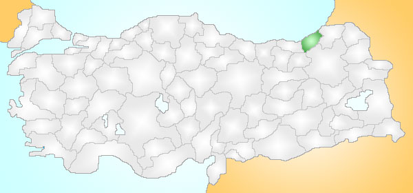
- İyidere
Infobox Settlement
official_name = PAGENAME
settlement_type = Town
subdivision_type = Country
subdivision_name = TUR
timezone=EET
utc_offset=+2
map_caption =Location of PAGENAME within Turkey.
timezone_DST=EEST
utc_offset_DST=+3official_name =
image_caption =
image_blank_emblem =
blank_emblem_type =
subdivision_type1=Region
subdivision_name1 = Black Sea
subdivision_type2=Province
subdivision_name2 = Rize| population_total = 10074|population_footnotes=
population_as_of =| 2000
population_density_km2 =
area_total_km2 = 25|elevation_m =
latd = 40
latm = 99
latNS = N
longd = 40
longm = 33
longEW = E
postal_code_type=Postal code
postal_code = 53
area_code = (0090)+ 464
leader_title=Mayor
leader_name = Ahmet Mete
blank_info = 53|blank_name=Licence plate
website = http://www.iyidere.gov.tr/İyidere is a town and district of
Rize Province on theBlack Sea coast of north-easternTurkey , 14 km from the city ofRize .Formerly known as "Aspet", İyidere is a green rural district. The local economy depends on growing and processing tea, plus some other farming and fishing.
History
See
Rize Province for the history of the area, once part of the trading network of theAncient Greeks based inMiletos , who founded the port of İyidere, then part of theRoman Empire , theByzantine Empire and theEmpire of Trebizond until it was brought into theOttoman Empire byMehmet II in1461 .External links
* [http://www.iyidere.bel.tr/ District municipality's official website]
** [http://www.iyidere.bel.tr/galeri.php and photo gallery]
* [http://www.iyidere.gov.tr/ District governor's official website]
Wikimedia Foundation. 2010.
