Ohoopee River

Ohoopee River
Ohoopeerivermap.png

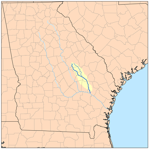
The Ohoopee River is a 119-mile-long (192 km)[1] river in east-central Georgia in the United States. It is a tributary of the Altamaha River, which flows to the Atlantic Ocean.

Course

The Ohoopee River rises in Washington County, about 2 miles (3 km) south of Tennille, and flows generally southeastwardly, through or along the boundaries of Johnson, Emanuel, Treutlen, Candler, Toombs and Tattnall Counties. It joins the Altamaha River 13 miles (21 km) south of Reidsville.

In Emanuel County, it collects the Little Ohoopee River, about 54 miles (87 km) long,[1] which rises in Washington County and flows generally southeastwardly through Johnson and Emanuel Counties, past Kite.

See also

  • List of Georgia rivers

References

  1. ^ a b U.S. Geological Survey. National Hydrography Dataset high-resolution flowline data. The National Map, accessed April 21, 2011


Wikimedia Foundation. 2010.

Игры ⚽ Нужна курсовая?

Look at other dictionaries:

  • Ohoopee River — Ohoopee Ohoopee Caractéristiques Longueur 160 km Bassin  ? Bassin collecteur …   Wikipédia en Français

  • Ohoopee — Le bassin versant de la rivière Ohoopee. Caractéristiques Longueur 160 km Bassin  ? Bassin collecteur …   Wikipédia en Français

  • Altamaha River — Geobox River name = Altamaha River native name = other name = other name1 = image size = image caption = country = United States country1 = state = Georgia state1 = region = region1 = district = district1 = city = city1 = length imperial = 137… …   Wikipedia

  • Altamaha River — Einzugsgebiet des Altamaha Rivers mit den beiden Hauptzuflüssen Ocmulgee River und Oconee River …   Deutsch Wikipedia

  • Altamaha River — Altamaha Altamaha Le bassin versant du fleuve Altamaha Caractéristiques Longueur …   Wikipédia en Français

  • List of rivers of Georgia (U.S. state) — List of rivers in Georgia (U.S. state).By Drainage BasinThis list is arranged by drainage basin, with respective tributaries indented under each larger stream s name. Atlantic Ocean *Savannah River **Brier Creek **Little River ***Kettle Creek… …   Wikipedia

  • Altamaha — Vorlage:Infobox Fluss/BILD fehltVorlage:Infobox Fluss/DGWK fehlt Altamaha River Lage Georgia, Vereinigte Staaten Länge 220 kmdep1 Ursprung Zusammenfluss von Oconee River …   Deutsch Wikipedia

  • Altamaha (Fluss) — Vorlage:Infobox Fluss/BILD fehltVorlage:Infobox Fluss/DGWK fehlt Altamaha River Lage Georgia, Vereinigte Staaten Länge 220 kmdep1 Ursprung Zusammenfluss von Oconee River …   Deutsch Wikipedia

  • Smith Creek — ist der Name von Orten: Smith Creek (Florida) Smith Creek (Kentucky) Smith Creek (North Carolina) Smith Creek ist außerdem der Name zahlreicher Bäche in den Vereinigten Staaten: Alabama: Smith Creek (Reeves Creek) Smith Creek (Bassett Creek)… …   Deutsch Wikipedia

  • Heartworn Highways — is documentary film by James Szalapski whose vision captured some of the founders of the Outlaw Country movement in Texas and Tennessee in the last weeks of 1975 and the first weeks of 1976. The film was not released theatrically until 1981. The… …   Wikipedia

Share the article and excerpts

Direct link
Do a right-click on the link above
and select “Copy Link”