- Gonten
Infobox Swiss town
subject_name = Gonten
municipality_name = Gonten
municipality_type = municipality
imagepath_coa = Gonten-Wappen.png|pixel_coa=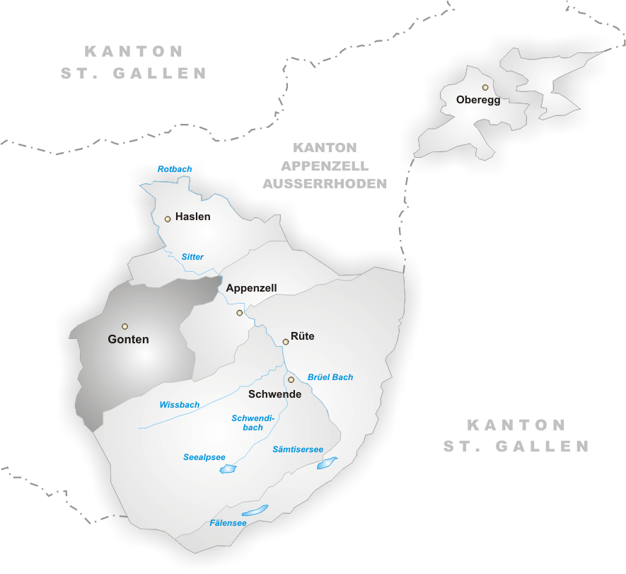
languages = German
canton = Appenzell Innerrhoden
iso-code-region = CH-AI
district = n.a.
lat_d=47|lat_m=19|lat_NS=N|long_d=9|long_m=20|long_EW=E
postal_code = 9108
municipality_code = 3102
area = 24.7
elevation = 902|elevation_description=
population = 1386|populationof = December 2002 | popofyear = 2002
website = www.gonten.ch
mayor = |mayor_asof=|mayor_party=
mayor_title = |list_of_mayors =
places =
demonym =
neighboring_municipalities=Appenzell ,Hundwil (AR),Schlatt-Haslen ,Schwende
twintowns = |Gonten is a district of the canton of
Appenzell Innerrhoden inSwitzerland . It has a population of 1,400 (2000 , estimate). The area of Gonten is 24.73 km².Coat of arms
The bottom of the coat of arms is green. The background of the coat of arms is divided into red and gold. There are two pilgrim staffs, one each on the red and golden area respectively. A red staff is placed on the golden background, a golden one on the red background. The pilgirm staffs symbolize the apostle Jacob the elder. There is a chapel on the Kronberg mountain dedicated to Jacob the elder.
Name
Around
1200 "Gumbton" was used. This refers to a pool of water, which points at the nearby peat-bog.Formation
The municipality was formally established in
1872 when "Gonten" was joined with the rhodes "Stechlenegg" and "Rinkenbach"External links
* [http://www.appenzell.ch/e/news/index.php Appenzell Tourism]
*
Wikimedia Foundation. 2010.