Mount Kliment Ohridski

Mount Kliment Ohridski
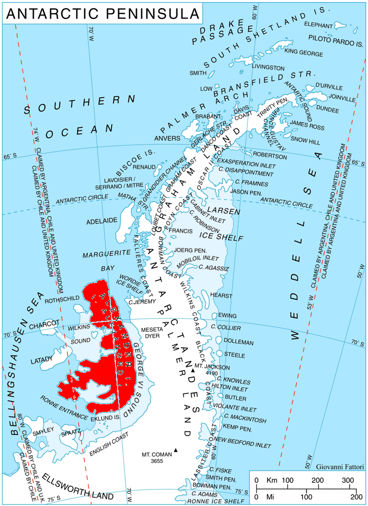
Location of Alexander Island in the Antarctic Peninsula region.
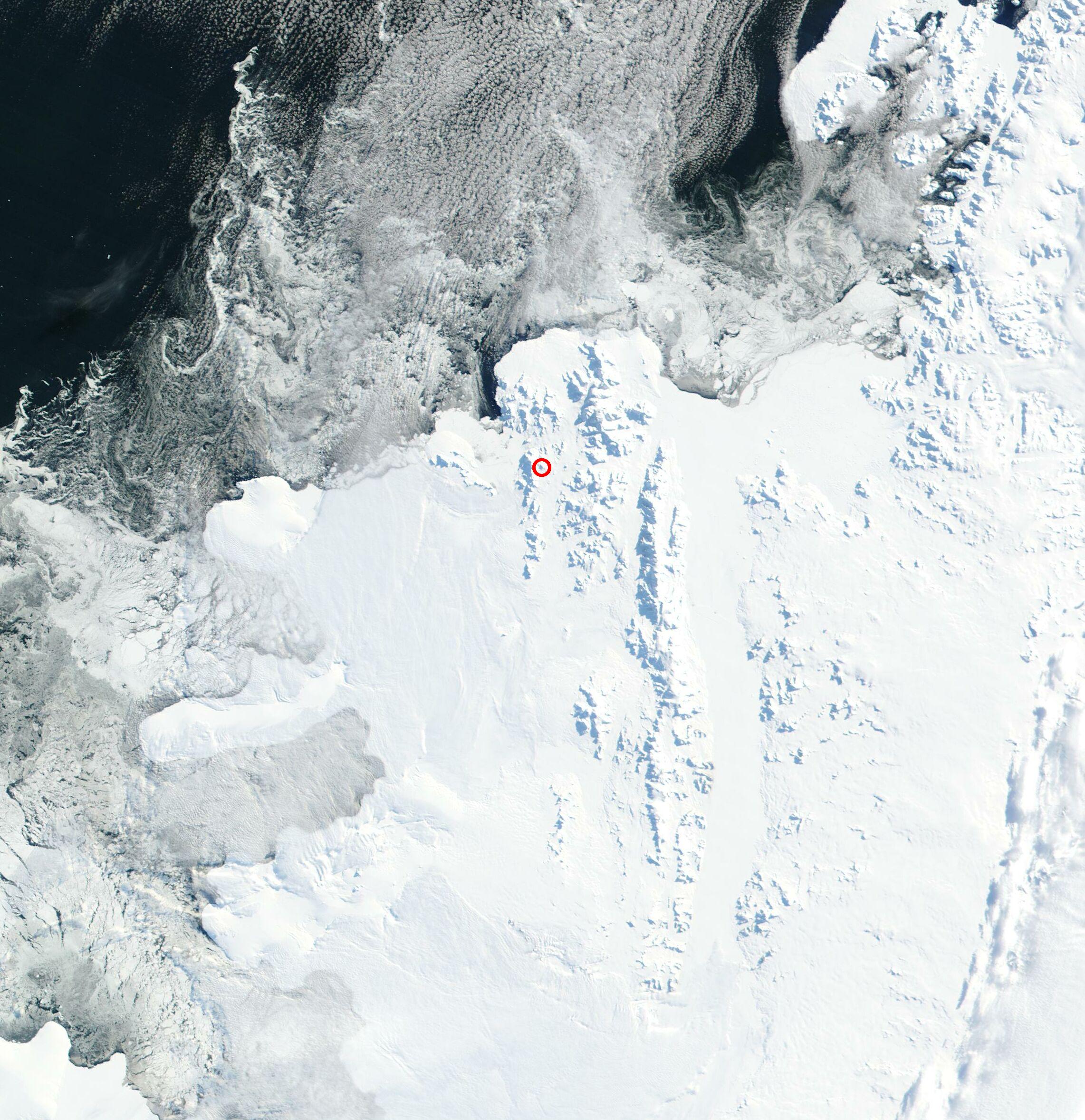
NASA satellite image of Alexander Island

Mount Kliment Ohridski (Vrah Kliment Ohridski \'vr&h 'kli-ment 'o-hrid-ski\) is the highest ridge (1500m) in the Sofia University Mountains on Alexander Island, Antarctica. The feature extends 7 km in the northwest-southeast direction with partly ice-free southern slopes. Shaw Nunatak is located in Nichols Snowfield 4 km off the southeast extremity of Mount Kliment Ohridski.

Following field work in northern Alexander Island by a joint British-Bulgarian party during the summer of 1987-88, the peak was named for Clement of Ohrid in association with the St. Kliment Ohridski University of Sofia.

Location

The cliff is located at 69°31′04″S 71°23′30″W / 69.51778°S 71.39167°W / -69.51778; -71.39167 which is 7.15 km east-соутхеаст of Mount Wilbye аnd 9.12 km south of the summit of Balan Ridge (British mapping of the area from air photos taken by the 1947-48 US Expedition under Ronne).

Maps

  • British Antarctic Territory. Scale 1:200000 topographic map No. 3127. DOS 610 - W 69 70. Tolworth, UK, 1971.
  • Antarctic Digital Database (ADD). Scale 1:250000 topographic map. Scientific Committee on Antarctic Research (SCAR), 1993-2006.

References

This article includes information from the Antarctic Place-names Commission of Bulgaria which is used with permission.


Wikimedia Foundation. 2010.

Игры ⚽ Нужно решить контрольную?

Look at other dictionaries:

  • Mount Friesland — Elevation 1,700 m (5,577 ft) …   Wikipedia

  • Sofia University Mountains — (Planina Sofiyski Universitet pla ni na so fE ski u ni ver si tet) are a cluster of four small mountains in north western Alexander Island, 21 km long in the northeast southwest direction and 13 km wide.They are located south southeast of Havre… …   Wikipedia

  • Livingston Island — Infobox Islands name = Livingston image caption = Map of Livingston Island, Antarctica locator map custom = no nickname = location = Antarctica coordinates = coord|62|36|S|60|30|W|display=inline archipelago = South Shetland Islands total islands …   Wikipedia

  • Camp Academia — (Lager Akademiya la ger a ka de mi ya) is a geographical locality in eastern Livingston Island, South Shetland Islands, Antarctica, named for the Bulgarian Academy of Sciences in appreciation of Academy’s contribution to the Antarctic exploration …   Wikipedia

  • Livingston-Insel — Hannah Point, Livingston Insel Gewässer Südlicher Ozean Inselgruppe …   Deutsch Wikipedia

  • Gurev Gap — (Gureva Sedlovina gu re va se dlo vi na) is a flat ice covered saddle of 450 height extending 2.8 km in S N direction between Hemus Peak and Gleaner Heights in eastern Livingston Island. The gap separates the glacial catchments of Kaliakra… …   Wikipedia

  • List of Bulgarian toponyms in Antarctica — Bulgarian toponyms in Antarctica are approved by the Antarctic Place names Commission in compliance with its Toponymic Guidelines , and formally given by the President of the Republic according to the Bulgarian Constitution and the established… …   Wikipedia

  • Meanings of minor planet names: 3501–4000 — As minor planet discoveries are confirmed, they are given a permanent number by the IAU s Minor Planet Center, and the discoverers can then submit names for them, following the IAU s naming conventions. The list below concerns those minor planets …   Wikipedia

  • Republic of Macedonia — For other uses, see Macedonia. Republic of Macedonia Република Македонија Republika Makedonija …   Wikipedia

  • Bowles Ridge — (Hrebet Bowles hre bet bOls) is the central ridge of eastern Livingston Island. The ridge extends 6.5km in the east west direction and is 1.5km wide. The summit of the ridge is Mount Bowles which rises to 822m and is located 9.77km northwest of… …   Wikipedia

Share the article and excerpts

Direct link
Do a right-click on the link above
and select “Copy Link”