- Wau, Sudan
Infobox Settlement
official_name = Wau
other_name =
native_name =
nickname =
settlement_type =
motto =
imagesize = 300px
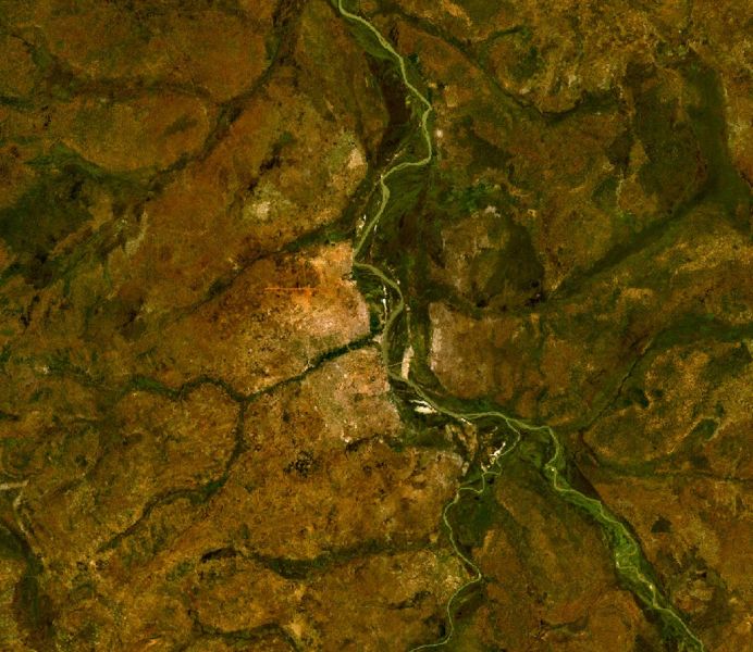
image_caption = Satellite view
flag_size =
image_
seal_size =
image_shield =
shield_size =
image_blank_emblem =
blank_emblem_type =
blank_emblem_size =
mapsize =
map_caption =
mapsize1 =
map_caption1 =
image_dot_
dot_mapsize =
dot_map_caption =
dot_x = |dot_y =
pushpin_
pushpin_label_position =bottom
pushpin_map_caption =Location in Sudan
subdivision_type = Country
subdivision_name =
subdivision_type1 = State
subdivision_name1 =West Bahr al Ghazal
subdivision_type2 =
subdivision_name2 =
subdivision_type3 =
subdivision_name3 =
subdivision_type4 =
subdivision_name4 =
government_footnotes =
government_type =
leader_title =
leader_name =
leader_title1 =
leader_name1 =
leader_title2 =
leader_name2 =
leader_title3 =
leader_name3 =
leader_title4 =
leader_name4 =
established_title =
established_date =
established_title2 =
established_date2 =
established_title3 =
established_date3 =
area_magnitude =
unit_pref =Imperial
area_footnotes =
area_total_km2 =
area_land_km2 =
area_water_km2 =
area_total_sq_mi =
area_land_sq_mi =
area_water_sq_mi =
area_water_percent =
area_urban_km2 =
area_urban_sq_mi =
area_metro_km2 =
area_metro_sq_mi =
area_blank1_title =
area_blank1_km2 =
area_blank1_sq_mi =
population_as_of =2007
population_footnotes =
population_note =
population_total =136,179
population_density_km2 =
population_density_sq_mi =
population_metro =
population_density_metro_km2 =
population_density_metro_sq_mi =
population_urban =
population_density_urban_km2 =
population_density_urban_sq_mi =
population_blank1_title =Ethnicities
population_blank1 =
population_blank2_title =Religions
population_blank2 =
population_density_blank1_km2 =
population_density_blank1_sq_mi =
timezone =
utc_offset =
timezone_DST =
utc_offset_DST =
latd=7|latm=42|lats= |latNS=N
longd=27 |longm=59 |longs= |longEW=E
elevation_footnotes =
elevation_m =438
elevation_ft =1437
postal_code_type =
postal_code =
area_code =
blank_name =
blank_info =
blank1_name =
blank1_info =
website =
footnotes =Wau (Arabic: واو "Wāw"; also Wow or Waw) is a town in southern
Sudan on the western bank of theJur River , and is the capital of theWest Bahr al Ghazal state.Overview
Initially established as a "zariba" (fortified base) by slave-traders in the 19th century, it became an administrative center during the time of Anglo-
Egypt ian condominium rule in Sudan. Wau is a culturally, ethnically, and linguistically mixed town. Its residents include peoples of Fertit, Dinka, Luo, and Arab origin.During the recent civil war it was a government-held garrison town, and was the scene of extensive fighting in the spring of
1998 . Battles erupted again in the town in the spring of2007 , killing several hundred people, mostly of the Fertit tribe.It is the birthplace of NBA players
Luol Deng andDeng Gai and British modelAlek Wek .Burr and Collins (1994, pp. 74) describe Wau in these terms:
:"No one has ever been “at home” in Wau. Situated on the fringe of the Dinka country, it is surrounded by a host of disorganized and diverse peoples . . . It was and remains a town belonging to no single ethnic group, deriving its importance only from its position as a commercial and administrative center . . . Located in the midst of the vast Nilotic plain hundreds of miles from nowhere, it was miserable under the best of circumstances . . . "
Transport
Wau is the terminus of a
narrow gauge branch line of theSudan Railways .Wau airport (code WUU) has a 1506 m (4940 ft) earthen runway.
Demographics
See also
*
Transport in Sudan References
* [http://www.fallingrain.com/world/SU/32/Waw.html FallingRain Map - elevation = 429m (Red dots are railways)]
* Burr, J.M. and Collins, R.O. (1994) Requiem for the Sudan: War, Drought and Disaster Relief on the Nile. Westview Press, Boulder, CO, USA.
* [http://www.hrw.org/reports/1999/sudan/ Human Rights Watch (1999) Famine in Sudan, 1998: The Human Rights Causes. http://www.hrw.org/reports/1999/sudan/]
Wikimedia Foundation. 2010.

