- Pendleton, Greater Manchester
-
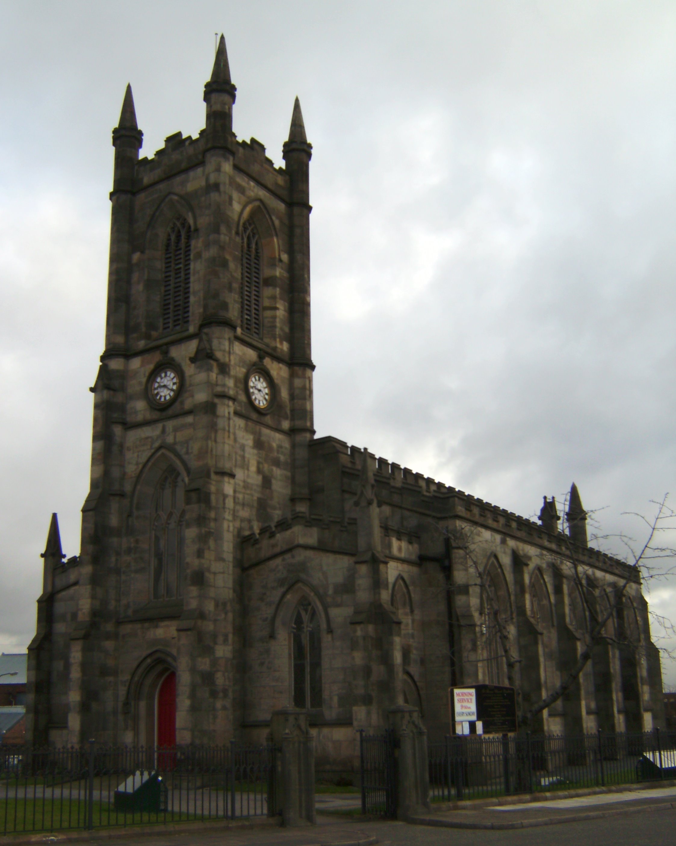
 The parish church of St Thomas, Pendleton
Pendleton is an inner city area of Salford, Greater Manchester, England. It is about 2 miles (3.2 km) from Manchester city centre. The A6 dual carriageway skirts the east of the district.
Historically within Lancashire, Pendleton has two colleges; Pendleton College and a Salford College campus. Pendleton is also where Salford's largest shopping precinct, Salford Shopping City, is located.
The market area of Pendleton has many high rise blocks of flats (tower blocks). These are typically between seventeen and twenty seven floors high and are very close to the new Pendleton Police Station. The high rises are some of the tallest buildings in Salford.
Contents
History
The township has been variously recorded as Penelton in 1199, Pennelton in 1212, Penilton in 1236, Penhulton in 1331, Penulton in 1356 and Pendleton from about 1600.[1]
In the Middle Ages the manor was named Pen-hulton when it was held by the Hultons of Hulton Park.[2]
Until 1780 the village was rural, a group of cottages around a village green with a maypole. The Industrial Revolution brought about rapid expansion in the population and large cotton-mills and premises for dyeing, printing, and bleaching were built providing employment. Collieries were developed from the early 19th century.[2]
Governance
Pendleton emerged as a township and chapelry in the ecclesiastical parish of Eccles in the hundred of Salford in the historic county of Lancashire. After 1837 Pendleton was part of the Salford Poor Law Union which took responsibility for the administration of the Poor Law and provided a workhouse.[3]
Geography
Pendleton is 2½ miles north west of Manchester City Centre by the River Irwell and at the junction roads to Liverpool, Preston, Bolton and Manchester. The Manchester Bolton & Bury Canal, the Liverpool and Manchester and Manchester and Bolton railways pass through the township.[2]
Pendleton sits on the coal measures of the Manchester Coalfield, part of Lancashire Coalfield. In the early days of coal mining in the area the seams lying on or close to the surface were exploited, but as time went on it became necessary to dig progressively deeper; by the beginning of the 20th century Pendleton Colliery had the deepest shafts in Great Britain, at 3,474 feet (1,059 m).[4]
The area gives its name to the geological feature known as the Pendleton Fault, one of four large faults running under Manchester. The faults are geologically active, and cause earthquake tremors that have been recorded for centuries, most recently in August 2007, when Manchester experienced six minor earthquakes.[5]
Transport
Pendleton railway station closed in 1998 after having severely damaged in an arson attack.[6] Salford Crescent railway station now links the district and the adjacent University of Salford, with central Manchester (Piccadilly, Oxford Road and Victoria) and many towns in North West England and Scotland from as far south as Buxton to as far north as Windermere and Glasgow.
Parish church
Pendleton Church or St Thomas's Church is a Commissioners' Church[2] and replaced the original chapel. It was built in 1829–31 to the design of Francis Goodwin and Richard Lane in a Perpendicular revival style with a west tower and three galleries.[7]
Notable people
The 19th-century industrialist and Liberal politician Sir Elkanah Armitage lived at Hope Hall in Pendleton from 1853 until his death in 1876. Albert Finney the actor was born in Pendleton and baptised at St George's Church, Charlestown. James Agate the theatre critic was born in Pendleton.[8]
References
- Notes
- ^ Farrer, William; Brownbill, J, eds. (1907), "Pendleton", A History of the County of Lancaster: Volume 4 (British History Online): pp. 392–396, http://www.british-history.ac.uk/report.aspx?compid=41443, retrieved 2011-02-17
- ^ a b c d Lewis, Samuel (1848), "Pendleton", A Topographical Dictionary of England (British History Online): pp. 545–549, http://www.british-history.ac.uk/report.aspx?compid=51208, retrieved 2011-02-17
- ^ Greater Manchester Gazetteer, Greater Manchester County Record Office, http://www.gmcro.co.uk/Guides/Gazeteer/gazzo2r.htm, retrieved 2011-02-17
- ^ Mullineux 1973, pp. 47–48
- ^ Malvern, Jack (31 August 2007), "The Earth Moves for Manchester", The Times, http://www.timesonline.co.uk/tol/news/uk/article2358111.ece, retrieved 27 February 2010
- ^ Regulator allows closure of Pendleton station, Office of Rail Regulation, 15 December 1998, http://www.rail-reg.gov.uk/server/show/ConWebDoc.5546, retrieved 27 March 2008
- ^ Pevsner, N. (1969) Lancashire, vol. 1. Penguin Books
- ^ Brown, Ivor; Brodie, Marc (rev.) (2004), "Agate, James Evershed (1877–1947)" (subscription required), Oxford Dictionary of National Biography (online ed.), Oxford University Press, http://www.oxforddnb.com/view/article/30346, retrieved 27 February 2010
- Bibliography
- Mullineux, F. (1973), "Coal Mining in Lancashire", in Smith, J. H., The Great Human Exploit: Historic Industries of the North-West, Phillimore & Co, ISBN 0-85033-108-0
Areas and suburbs of Salford Blackfriars · Broughton · Claremont · Greengate · Irlams o' th' Height · Kersal · Langworthy · Ordsall · Pendleton · Seedley · Wallness · WeasteCoordinates: 53°29′31″N 2°16′55″W / 53.49194°N 2.28194°W
Categories:- Districts of Greater Manchester
- Geography of Salford
- Greater Manchester geography stubs
Wikimedia Foundation. 2010.