- Magangué
-
Magangue — Municipality and town — 
Flag
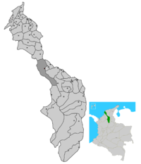
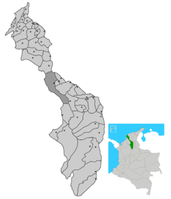
SealLocation of the municipality and town of Magangué in the Bolívar Department of Colombia,Catholic Diocese.People from Maganguė are known as Magangueleños. Country  Colombia
Department Bolívar Department Area – Municipality and town 1.113 km2 (0.4 sq mi) – Water 685 km2 (264.5 sq mi) 70% – Urban 12 km2 (4.6 sq mi) – Metro 31 km2 (12 sq mi) Elevation 25 m (82.2 ft) Population – Municipality and town 214.125 – Density 155/km2 (401.4/sq mi) – Urban 126.123 – Metro 312.255 Time zone Colombia Standard Time (UTC-5)  Location of the municipality and town of Magangué in the Bolivar Department.
Magangué Magangué is a municipality in the Department of Bolivar in Colombia, located on the banks of the Magdalena River in the North Coast. It is the capital of the southern Department, and is the second most important town.
At 41 °C average temperature, is a very warm, suitable for vacation, as it is on the banks of the Magdalena River, the most important river in the country. Is 22 meters and its main economic activities are fisheries, livestock, agriculture and handicrafts. The name Magangué comes from the indigenous voice Maganguey. The more traditional sites of this city are the Cathedral of La Candelaria, which is opposite the bank, The Parque de Las Americas, which is the lung magangueleño, the Calle de Las Flores which is the street of stores and parks, Park Students, a park located at Av Vélez Lequerica, and its different sites fun and entertainment such as clubs, restaurants, shopping centers, clubs, among others.
Magangué is home to great musicians like Chico Cervantes and Martin Wood (Grammy Award) and also a promise of many groups who msicales operate in different genres such as cumbia, vallenato, rock, tropical, pop, reggeton.
Contents
Geography
Magangué is one of the 48 municipalities of Bolívar and is the most important after Cartagena de Indias. Bordered on the north by the municipality of Cordova, on the west by the department of Sucre, south to the town of Achi and east with the municipalities of Cicuco, Talaigua New Mompós and Pinillos.
It is believed that the formation of the department of La Mojana, this would get the title of the departmental capital. Currently this department is in projection.
History
The territory now occupied Magangué in Momposina Depression, stands beside the old branch of Wolf, when the Cauca River in 1860 poured its waters in Boca Tacaloa Magdalena. Today delivery flow to the Rio Grande in Boca Guamal. Magangué close, close to the Retiro, San Jorge River flows. For this reason it follows that the first inhabitants were from Magangué Zenú. Zenúes Indians dominated a vast area divided into three provinces as well: The Sinu River valley Finzenú corresponded to those of the San Jorge river to the Panzenú. The sources ("Zenues" - Museo del Oro Banco de la República), talk about six centuries before the Spanish conquest.
Currently, these domains include the departments of Córdoba, Sucre, Bolívar. Magangué could belong to the Panzenú, without forgetting that Tacasuán (now San Benito Abad), and Tacasaluma Tacaloa are toponyms Zenúes. The last two of these populations are also correct Magangué Township, near the port.
From the seventh century C. begins to produce another population phenomenon in the region. Is the displacement, in part, and the cultural fusion of the other, St. George by Malibu and Chimilas. The territories inhabited Chimilas Tacaloa, Yati, and Guazo Maganguey as Reichel and Dolmatoff (1978) and the chronicler Fray Pedro de Aguado (B. Ramírez del Valle and E. King Sinning - La Monja - IDEMA 50 YEARS, pags. 20 and 21) .3
Foundation
The town was originally an Indian village was renamed as a result of its foundation, the Spanish Diego Carvajal in 1610, with the name of Maganguey of Baracoa. Was subsequently changed the name of Magangué, derived from the indigenous voice Maganguey.
Years later, the Spanish Lieutenant Antonio de la Torre and Miranda moved and reorganized the Indian village ye gave the name of Our Lady of Candelaria of Magangué, on October 28, 1776. The current name and gave rise to trade in the Albarrada. Today, that date should be commemorating the anniversary of this town porteña.4
Symbols
Shield
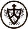
The Coat of Arms Magangué was granted by the governor of the province of Cartagena de Indias, D. Pedro Gual, approved by the Liberator Simón Bolívar, on February 26, 1821. Inverted ogival in shape divided into three barracks on a red field. Has the Holy Cross in its upper part fulgones, arising from the vertices. The barracks on the left shows a gold key as a symbol of entry and exit privileged geographical position occupied by the city. The barracks on the right shows the diligence of the magangueleños by a hive. In the bottom is the region of the former Party of Cauca, to which belonged Magangué in the past. Can see the perimeter of the shield on some weapons as a symbol of recognition of the great deeds and actions Magangué important in the fight for independence from Spain.
Alfonso del Valle Porto Compendium describes it in his monograph of the history of the town of Magangue well "is a shield with three quarters (divisions), two top and bottom, topped by a cross. The upper right quarter holds a hive, the upper left a key symbol of the advantageous geographical position Magangué. The bottom shows the current headquarters of the Cauca River to Magangué and from the point where the arm it is clear Mojana before emptying into the San Jorge, then it to pay tribute to Cauca. "
Don Manuel Atencio Ordóñez referred to "the Coat of Arms Magangué, is inverted ogival shape with headquarters which include coats that distinguish it from other important places." The distinguished historian noted that "the headquarters of the flag shows geographic base, reminiscent of the colonial era. The Party from Bocas de Tacaloa Cauca, to the Shortcut or Boca de La Mojana: that is, the map of the region cross rivers, estuaries and marshes that provide fertility to the land, agricultural resources, entertainment and life. The upper left quarter, instead of representing the lions and castles of the nobles of Spain, is a badge of their very own ways. The Hive caring bees, combs where they lay off a persistent and fruitful work. The upper right quarter holds a key as a flag of its advantageous geographical position. Here you feel the rhythm of the body's arteries river. The key is to open property or closing, for which reason while the square is advantageous commercial position in the military can open its doors, but also can close. The cross is the beacon that lights the world, with flashes of civilization and progress. " 5
Hymn
Oh! Magangué, ciudad cosmopolita de corazón abierto al mundo entero, feliz quien te conoce y quien te habita y quien nutre su vida en tu venero. Feliz quien te conoce y quien te habita y quien nutre su vida en tu venero. Acuciosa ciudad, noble y procera copiada en los cristales de tu río acaricia tu blonda cabellera el pálido esmeralda del plantío. En el paisaje azul de tus esteros se refleja en las tardes de verano la estampa varonil de tus vaqueros sobre el fondo de garzas del pantano. A tu Virgen munífica y morena en suelo de tu encestro y señorío levantaste muy cerca al Magdalena el trono de su gracia y poderío. En la fuerza creadora de tu raza flotan con altivez viejos pendones donde la gloria al pundonor se abraza en un solo latir de corazones. Se admira en tus mujeres su ternura y en tus hombres se admira la entereza y en las promesas que el trabajo augura presagiamos la faz de tu grandeza. No sabemos qué es más en tus plantíos si el cálido vaivén de tus maizales o la voz que a la orilla de tus ríos entonan tus inmensos arrozales. En tu escudo sembraste una colmena el vertical acero de una lanza, el caudal de tu río Magdalena y al frente está la Cruz de la esperanza Y puerto abierto a visitante nave abres tu corazón al meridiano, generosa entregándole la llave y haciendo en cada prójimo un hermano. Este es el simbolismo de tu estirpe, TRABAJO, HONESTIDAD Y FORTALEZA Por que sólo quien te ama bien te sirve y busca tu futuro y tu grandeza
Autor: Antonio Botero Palacio 6
Demography
Currently 62.2% of the total population is urban magangueleña, and 38.8% is rural.
Sportsmen
The most famous sports native of this city is Ricardo Torres, better known as The Owl, who was crowned world boxing champion on November 18, 2006 in Las Vegas, beating Greek split decision over Mike Arnaoutis.
In football, highlighted Governor José Briasco Rosado, who played for Atletico Junior de Barranquilla and was crowned champion twice with this team, reached the semifinals of the Copa Libertadores and then played with Pereira.
Other athletes have the Adolfo Téllez Baldovino, who played for Millonarios of Bogota and Deportes Quindio.
The population had the Magangué Youth football team.
Structure
Magangué currently has a colonial structure, modern and contemporary at once.
In the sports industry, has Magangué Diego de Carvajal Stadium football, where several national teams as the Junior of Barranquilla, Real Cartagena, Cúcuta Deportivo, among others, have played in this, it also has the Magangué Softball Stadium and many stages more.
For the tourism industry, Magangué has several buildings (Building the Alps), shopping (CC Babylon), hotels (Hotel Orense Magangué), parks (Parque de las Americas), restaurants (Restaurant Malibu), clubs (Club Campestre de Magangué ), among others (Calle de las Flores).
For the branch of health care Magangué has several centers as the Divine Mercy Hospital, Clínica Santa Teresa, the future of the Candelaria Hospital and rural health centers.
Most have structures of the twentieth century.
Economy
Its strategic location on the banks of the Magdalena River port becomes a hub where people converge Mompos of depression and the La Mojana.
This is an emporium agribusiness and fisheries. Agriculture, livestock, fisheries exploitation and natural and water resources, quickly turned into a port Magangué of national importance. The rice industry gained strength, which significantly boosted the economy throughout the area making the port in the rice capital of Colombia.
Magangué maintains a close economic relationship with the municipalities of the Depression and Mojana6 Momposina5, because their storage facility for agricultural products, livestock, fisheries and forestry, which are then shipped to the cities of Barranquilla, Cartagena, Medellín, Bucaramanga and Sincelejo. In turn, is a provider of industrial food products, construction materials, fuel, and provider of educational services, health, financial, transport and communication, for municipalities in the south of Bolivar, Sucre, Magdalena, where it exerts its influence . Magangue based economy development in service sector activities, especially commerce sales of goods, raw materials and inputs that are traded through a chain of intermediaries, and education services, health, financial , transportation, communication, professional and government, among others. He is farming, mainly beef cattle and milk, rice, corn, cotton, banana, cassava, pumpkin, fruit and fish. Industrial activity is nascent and is focused on the production of milk, rice mills, bakeries, ice chests, furniture, printing presses, metalworking and clothing.
Magangué industry is characterized by family-owned micro or individual. According to records of the Chamber of Commerce Magangué, 48 manufacturing establishments registered with 4 employees on average per company, its assets ranging between $ 500 billion and $ 290 million pesos, are engaged in a 56.3% to the production of foodstuffs and beverages agro-industrial, 29.2% are tailoring workshops, furniture and lithographs and the remaining 14.6% metalworking shops, cement block factory, toiletries and more.
In Magangué the rice industry is the most traditional. It began in 1925 being his pioneering Lebanese trader based in this city, Alberto Cure Manzur, who traveled to Hamburg and Chicago (world center of cereals) and hired the assembly of a fully automated rice mill and silos, the most modern in South America at that time. This activity gave a boost to the economy Magangué from the early twentieth century until the seventies, is how, in 1962 the city came to have 22 mills which absorbed an annual average of 100,000 tons of paddy rice that came from the Alfred Amin Beet, interview on October 18, 2001.
Mojana, Tiquisio and lower Magdalena. Much of the processed rice surti wholesale markets of the Atlantic Coast, Santanderes and Antioquia. Since the late seventies of the milling business is in decline, so much so that in 2001 there are only 4 rice mills operating in the year received about 20,000 tons of paddy rice for processing. The cause of this decline is that the rice parchment leaves no longer reaches the Mojana Magangué everything but a portion is diverted by the version built in and it gets Mojana Córdoba, Sucre and Antioquia. In the townships there are some small-scale agribusinesses that make such hats, backpacks, rugs, Totumos, mud pots, cheese and biscuits. There is also a chopped cassava plant is not sufficient to process the offer out of the subregion.
Transportation
Access to the city can do by land, river and air.
Land Transport
The main road access routes into the city are the Avenida Colombia to Km 60 of the Savannah Road and Highway Magangué-Mompox.
Has a mutual Magangué transport terminal, where there are destinations mainly in Cartagena, Barranquilla, Sincelejo, Bogotá and Medellin, also in the area are hotels, restaurants, supermarkets, shops and bars.
Water Transport
The main waterway access to the city is the Rio Magdalena.
Has a mutual Magangué transport terminal, where different boats come mainly from Santa Cruz de Mompox, The Bank, Santa Ana and Barrancabermeja. Near the end restaurants are comfortable home for seasonal travel. Its main entrance is through the famous (boat).
Air Transport
The only entrance to the city by air is Magangué Baracoa Airport.
Magangué has an air terminal "Magangue Baracoa Airport" and it can only land type DC-4 aircraft. Formerly at the airport, airline Avianca LANSA and operating in the east, mainly flying to Bogota and Barranquilla.
At ground level, after finishing the water and sewage projects in Magangué and its districts, will start paving the streets in Magangue, the expansion and modernization of the route of the savanna, Colombia Av, Av Yati, Av Esmeralda, Av Pastrana, Albarrada Av, Av Sn. Joseph Center Avenue, etc., and in its districts the main roads and some major streets.
River project is also in the automation and expansion of the Port River area of Magangué building loads, and that since 1980 Magangué has advanced craft.
Air level will enable the airport, will begin the expansion of the runway, construction of taxiways, expansion of the passenger terminal and cargo.
Culture
In Magangue carried out traditional activities such as Fair Livestock and Equine Festival, the festivities of February 2 and holidays from 11 November.
Gastronomy
Magangué Gastronomy is a mix that is governed by cultural influences (Sabanera and riparian zone of the Caribbean Region) and geography to be bordered by the Magdalena River.
Gastronomy Magangueleña has many cultural influences, as the dish of fried fish, catfish head mote, mote of yams, Creole chicken stew, cooked bocachico many dishes.
Policy Division
The urban area is divided into an average of 50 to 70 neighborhoods, and most villages are:
- Yati
- Florida
- Camilo Torres
- Olaya Herrera
- El Sur
- San Pablo
- San Jose
- El Prado
- San Mateo
- Pastrana
The rural area is organized in 43 districts.
The major townships are:
- Cascajal
- Ceibal
- Juan Arias
- Madrid
- La Pascuala
- Henequen
- El Cuatro
- Betania
- Retiro
- Barbosa
- Coyongal
- San Antonio
Categories:- Populated places in Colombia
Wikimedia Foundation. 2010.

