- Seibersdorf
-
Seibersdorf 
 Seibersdorf
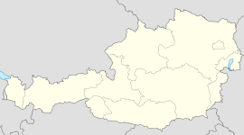
Country Austria State Lower Austria District Baden Mayor Paul Renner Area 20.2 km2 (8 sq mi) Elevation 186 m (610 ft) Population 1,388 (1 January 2011)[1] - Density 69 /km² (178 /sq mi) Time zone CET/CEST (UTC+1/+2) Postal code 2444 Area code 02255 Website www.marktgemeinde-seibersdorf.at Coordinates: 47°56′0″N 16°31′0″E / 47.933333°N 16.516667°E
Seibersdorf is an Austrian market town with 1,283 residents in the District of Baden in Lower Austria.
Contents
Geography
Seibersdorf lies in the industrial belt of Lower Austria. The municipality has an area of 20.2 km², 9.36 percent of which is forested.
Seibersdorf contains the following districts: Deutsch-Brodersdorf, Seibersdorf.
History
In antiquity, the area was part of the Roman province of Pannonia. Located in the Austrian heartland, Lower Austria played a key part in much of Austrian history.
Deutsch Brodersdorf
Business and Infrastructure
Seibersdorf is best known as the home of Austrian Research Centers now changed to Austrian Institute of Technology AIT. The International Atomic Energy Agency also operates laboratories within the same premises.
See also
References
- The information in this article is based on or translated from its German equivalent.
Municipalities in the district of Baden Alland · Altenmarkt an der Triesting · Bad Vöslau · Baden · Berndorf · Blumau-Neurißhof · Ebreichsdorf · Enzesfeld-Lindabrunn · Furth an der Triesting · Günselsdorf · Heiligenkreuz · Hernstein · Hirtenberg · Klausen-Leopoldsdorf · Kottingbrunn · Leobersdorf · Mitterndorf an der Fischa · Oberwaltersdorf · Pfaffstätten · Pottendorf · Pottenstein · Reisenberg · Schönau an der Triesting · Seibersdorf · Sooß · Tattendorf · Teesdorf · Traiskirchen · Trumau · Weissenbach an der Triesting
Categories:- Cities and towns in Lower Austria
- Lower Austria geography stubs

Wikimedia Foundation. 2010.