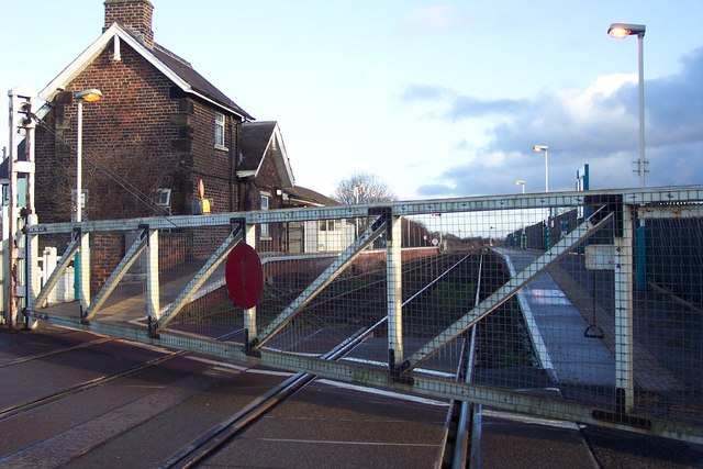
Hammerton railway station
- Hammerton railway station
Infobox UK station
name = Hammerton
code = HMM

manager = Northern Rail
locale = Kirk Hammerton
borough = Harrogate
start =
platforms = 2
lowusage0405 = 21,605
lowusage0506 = 22,888
lowusage0607 = 23,655
Hammerton railway station serves the villages of Kirk Hammerton and Green Hammerton in North Yorkshire, England. It is located on the Harrogate Line 14 km (8¾ miles) west of York and is operated by Northern Rail who provide all passenger train services.
ervices
Generally there is an hourly service from Hammerton to York eastbound and Leeds via Harrogate westbound.
External links
###@@@KEYEND@@@###
Wikimedia Foundation.
2010.
Look at other dictionaries:
Wansford railway station — Wansford station is the headquarters of the Nene Valley Railway. The current station building was opened in 1995 and contains a ticket office, shop, cafe and toilets. The locomotive sheds are located at this station. Also at the station there is… … Wikipedia
Glasgow and South Western Railway — Infobox SG rail railroad name = Glasgow and South Western Railway logo filename = GSWR logo.png logo size = system map caption = map size = marks = image size = image caption = locale = Scotland start year = 1850 end year = 1923 predecessor line … Wikipedia
North British Railway — The North British Railway was a Scottish railway company that was absorbed into the London and North Eastern Railway at the Grouping in 1923. Waverley Station, Edinburgh with the North British Hotel on the left … Wikipedia
HMM — may mean: * Hammerton railway station, England; National Rail station code HMM. * Hidden Markov model, a statistical model. * Heroes of Might and Magic, a series of turn based strategy games by New World Computing. * Marine Medium Helicopter… … Wikipedia
Harrogate Line — 144008 at Headingley, May 2006. Overview Type Heavy rail System National Rail … Wikipedia
River Torrens — Infobox River river name = River Torrens caption = View of Elder Park and Riverside Precinct from Torrens Lake. origin = Mount Pleasant, Mount Lofty Ranges mouth = Gulf Saint Vincent at Henley Beach South basin countries = length = 85 kilometres… … Wikipedia
Portal:London Transport — THE LONDON TRANSPORT PORTAL Wikipedia portals: Culture Geography Health History Mathematics Natural sciences People Philosophy Religion Society Technology … Wikipedia
River Thames — Thames redirects here. For other uses, see Thames (disambiguation). Coordinates: 51°29′56″N 0°36′31″E / 51.4989°N 0.6087°E / 5 … Wikipedia
Connexionsbuses — A Connexionsbuses at the bus station in Wetherby, West Yorkshire Founded 2002 Headquarters 6 St. Thomas s Way, Green Hammerton, York … Wikipedia
Portal:London — Wikipedia portals: Culture Geography Health History Mathematics Natural sciences People Philosophy Religion Society Technology … Wikipedia

