- Oregon Route 130
-
Oregon Route 130
Route information Maintained by ODOT Length: 9.40 mi (15.13 km) Existed: 2002 – present Major junctions West end:  US 101 near Oretown
East end:  OR 22 in Dolph
Highway system Oregon highways
Routes • Highways←  OR 126
OR 131  →
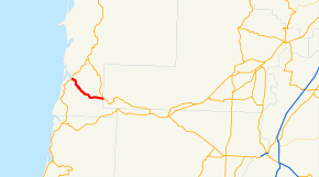
→Oregon Route 130, known as the Little Nestucca Highway No. 130 (see Oregon highways and routes), is an Oregon state highway which runs through the Oregon Coast Range, between Oretown and Dolph. It is 9 miles (14 km) long.
Oregon Route 130 is a post-2002 number, and does not have posted route markers. However, the 2009-2011 official Oregon State Highway Map indicates Route 130.
Route description
The western terminus of Oregon Route 130 is at intersection with U.S. Route 101 in Oretown, near the Nestucca Bay. It then heads southeast from there along the Little Nestucca River, for 9 miles (14 km), until it ends at Oregon Route 22 in Dolph.
Intersections with other highways
- US 101 in Oretown
- OR 22 in Dolph
External links
Categories:- State routes in Oregon
- Transportation in Tillamook County, Oregon


Wikimedia Foundation. 2010.