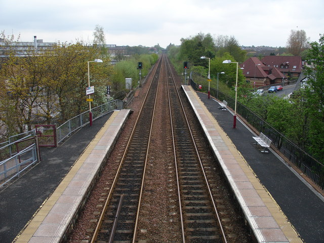
Bishopbriggs railway station
- Bishopbriggs railway station
Infobox UK station
name = Bishopbriggs
code = BBG

caption = Looking east (towards Edinburgh) from the footbridge.
manager = First ScotRail
locale = Bishopbriggs
borough = East Dunbartonshire
latitude =
longitude =
pte = SPT
platforms = 2
usage0405 = 0.503
usage0506 = 0.540
usage0607 = 0.555
original = Edinburgh and Glasgow Railway
pregroup = North British Railway
years =
events =
Bishopbriggs railway station is a railway station serving Bishopbriggs in East Dunbartonshire. It is located on the Glasgow to Edinburgh via Falkirk Line 6 km (3¼ miles) north of Glasgow Queen Street, but is only served by SPT services on the Croy Line.
Train services are provided by First ScotRail.
ervices
2006/07
* Mondays to Saturdays: there was generally a half-hour service southbound to Glasgow Queen Street and northbound to Stirling with alternate services terminating at Stirling and going onwards to Dunblane.
*Sundays: there was an hourly service in each direction.
From May 2008
* Mondays to Saturdays: there is generally a half-hour service southbound to Glasgow Queen Street and northbound to Stirling with alternate services going onwards to Dunblane and Alloa.
*Sundays: there is an hourly service in each direction.
rail line
previous = Glasgow Queen Street
next = Lenzie
route = First ScotRail
Croy Line
col = FF80C0rail line
previous = Cowlairs
next = Lenzie
route = Edinburgh and Glasgow Railway
North British Railway
col = NBR colour
###@@@KEYEND@@@###
ources
*
*
Wikimedia Foundation.
2010.
Look at other dictionaries:
Croy railway station — Croy Looking south east at the Glasgow bound platform Location Place Croy Local authority … Wikipedia
Springburn railway station — Infobox UK station name = Springburn other name = code = SPR caption = manager = First ScotRail locale = Springburn borough = Glasgow platforms = 4 pte = SPT lowusage0203 = 142,566 lowusage0405 = 203,452 lowusage0506 = 231,293 lowusage0607 =… … Wikipedia
Glasgow Queen Street railway station — Infobox UK station name = Glasgow Queen Street other name = Sràid na Banrighinn caption = Glasgow Queen Street high level platforms code = GLQ manager = First ScotRail locale = Glasgow borough = Glasgow pte = SPT latitude = 55.8622 longitude =… … Wikipedia
Bishopbriggs — infobox UK place country = Scotland official name= Bishopbriggs gaelic name=Coille Dobhair scots name= Bishops Riggs os grid reference= NS615705 latitude=55.908141419438444 longitude= 4.215062882679799 population= 23,500 unitary scotland= East… … Wikipedia
Edinburgh and Glasgow Railway — [v · d · … Wikipedia
Forth to Firth Canal Pathway — Infobox Hiking trail Name=Forth to Firth Canal Pathway Photo=FofF13.jpg Caption=Along the canal pathway Location=Scotland Designation= Length=Convert|106|km|mi|0 Start/End Points=Bowling, west of Glasgow Lochrin, Edinburgh Use=Hiking, cycling… … Wikipedia
Croy Line — Overview Type Heavy rail System National Rail Status Operational Locale Glasgow East Dunbartonshire … Wikipedia
Milngavie — Coordinates: 55°56′32″N 4°18′49″W / 55.9421°N 4.3137°W / 55.9421; 4.3137 … Wikipedia
Kirkintilloch — Coordinates: 55°56′08″N 4°09′17″W / 55.93568°N 4.15469°W / 55.93568; 4.15469 … Wikipedia
Galashiels — infobox UK place country = Scotland official name= Galashiels gaelic name=An Geal Àth scots name= Gala, Galashiels population = 12,367 os grid reference= NT495365 map type=Scotland latitude=55.61945 longitude= 2.80339 unitary scotland= Scottish… … Wikipedia

