Conistone

Conistone

Conistone is a small village (population 117 in the 2001 census) in North Yorkshire, England. It lies 3 miles north of Grassington, beside the River Wharfe, in Upper Wharfedale.

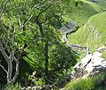
The village is set in characteristic limestone scenery, including Mossdale Caverns, the dry gorge of Conistone Dib and the limestone outcrop of Conistone Pie. Above the Dib a Dalesway path connects Kettlewell, to its north, and Grassington, to its south, providing distant views over the Wharfedale. From the B6160 road, the Wharfe is crossed at Conistone by a stone-arch bridge, which is within easy walking distance of Kilnsey, with its Crag.

See also

External links

Coordinates: 54°06′N 2°02′W / 54.1°N 2.033°W / 54.1; -2.033


Wikimedia Foundation. 2010.

Игры ⚽ Поможем написать реферат

Look at other dictionaries:

  • Conistone with Kilnsey — The dry gorge of Conistone Dib Conistone with Kilnsey is a civil parish in North Yorkshire, England. It contains the villages of Kilnsey and Conistone. Coordinates …   Wikipedia

  • St Mary's Church, Conistone — St Mary s Church, Conistone, from the southeast …   Wikipedia

  • Grass Wood, Wharfedale — Grass Wood is an 88 hectare woodland in Wharfedale, Yorkshire, England.The area was notified as a Site of Special Scientific Interest in 1955. The site is also listed in the Nature Conservation Review (under the Conistone Old Pasture and Bastow… …   Wikipedia

  • Scargill House — is a Christian Conference Centre [cite web|url=http://www.scargillhouse.co.uk/indexflash.html|title=Welcome to Scargill|work=Scargill House website|year=2007|accessdate=2007 06 22] located in Wharfedale, in the county of North Yorkshire, England …   Wikipedia

  • North Yorkshire — For other uses, see Yorkshire North. North Yorkshire Geography Status Ceremonial ( …   Wikipedia

  • River Wharfe — Infobox River | river name = River Wharfe caption = Linton Falls, on the upper Wharfe near Grassington origin = Beckermonds, Langstrothdale Chase mouth = River Ouse at Wharfe s Mouth, near Cawood basin countries = England length = 97 km (60 mi)… …   Wikipedia

  • Wharfedale — is one of the Yorkshire Dales in England. It is the valley of the River Wharfe. Towns and villages in Wharfedale (in order, travelling downstream, from west to east) include Buckden, Kettlewell, Conistone, Hebden, Grassington, Ilkley, Burley in… …   Wikipedia

  • Filipendula ulmaria — Meadowsweet redirects here. For other uses, see Meadowsweet (disambiguation). Meadowsweet Scientific classification Kingdom: Plantae …   Wikipedia

  • St. Mary's Church — Contents 1 Albania 2 Azerbaijan 3 Belarus 4 Bosnia and …   Wikipedia

  • Kettlewell — infobox UK place country = England static static image caption = Kettlewell latitude = 54.147 longitude = 2.047 official name = Kettlewell population = shire district = Craven shire county = North Yorkshire region = Yorkshire and the Humber… …   Wikipedia

Share the article and excerpts

Direct link
Do a right-click on the link above
and select “Copy Link”