- Malakula
-
Malakula 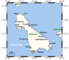
Map of Malakula
Geography Location Pacific Ocean Coordinates 16°18′S 167°30′E / 16.30°S 167.50°ECoordinates: 16°18′S 167°30′E / 16.30°S 167.50°E Archipelago New Hebrides Area 2,041 km2 (788 sq mi) Highest elevation 879 m (2,884 ft) Highest point unnamed Country Province Malampa Largest city Lakatoro Demographics Population 30,000 (as of 2000) Density 14.7 /km2 (38.1 /sq mi) Malakula Island (coordinates 16°18′S 167°30′E / 16.30°S 167.50°E), also spelled Malekula, is the second-largest island in the nation of Vanuatu, in the Pacific Ocean region of Melanesia. Its name, coined by James Cook, is apparently derived from the French mal au cul (literally, 'pain in the arse') and was inspired by the presence of cannibals, volcanic activity and other unpleasant features of the island at the time of its discovery.
Contents
Location
It is separated from the islands of Espiritu Santo and Malo by the Bougainville Strait. Lakatoro, capital of Malampa Province, is situated on its eastern shore and is the largest settlement in the island.On the northeastern side of the island there is a group of islands called Small Islands, amongst them (from N to S) Vao, Atchin, Wala (island), Rano, Norsup, Uripiv and Uri (island).
It has a maximum elevation of 879 m. It is called as Mt. Liambele.[1] In 1768, Bougainville gave his name to the straits which separate Malakula from Santo.
History
During 1914 and 1915 the British anthropologist John Layard lived on the island taking anthropological notes as well as phononographic and photographic records during his fieldwork. On his return to Britain he donated copies of the more than 400 photographs on plates to the Museum of Archaeology and Anthropology, University of Cambridge.
Demographics
According to the latest census information, from 2000, Malakula has a population of over 30,000 inhabitants.
There are nearly thirty different languages spoken on the island[2]. The two tribes living are Big Nambas in the North and the Small Nambas in the central part of the southern area, whose names stem from the size of the penis sheath they wear, made out of banana or pandanus leaves.[3]
Economy
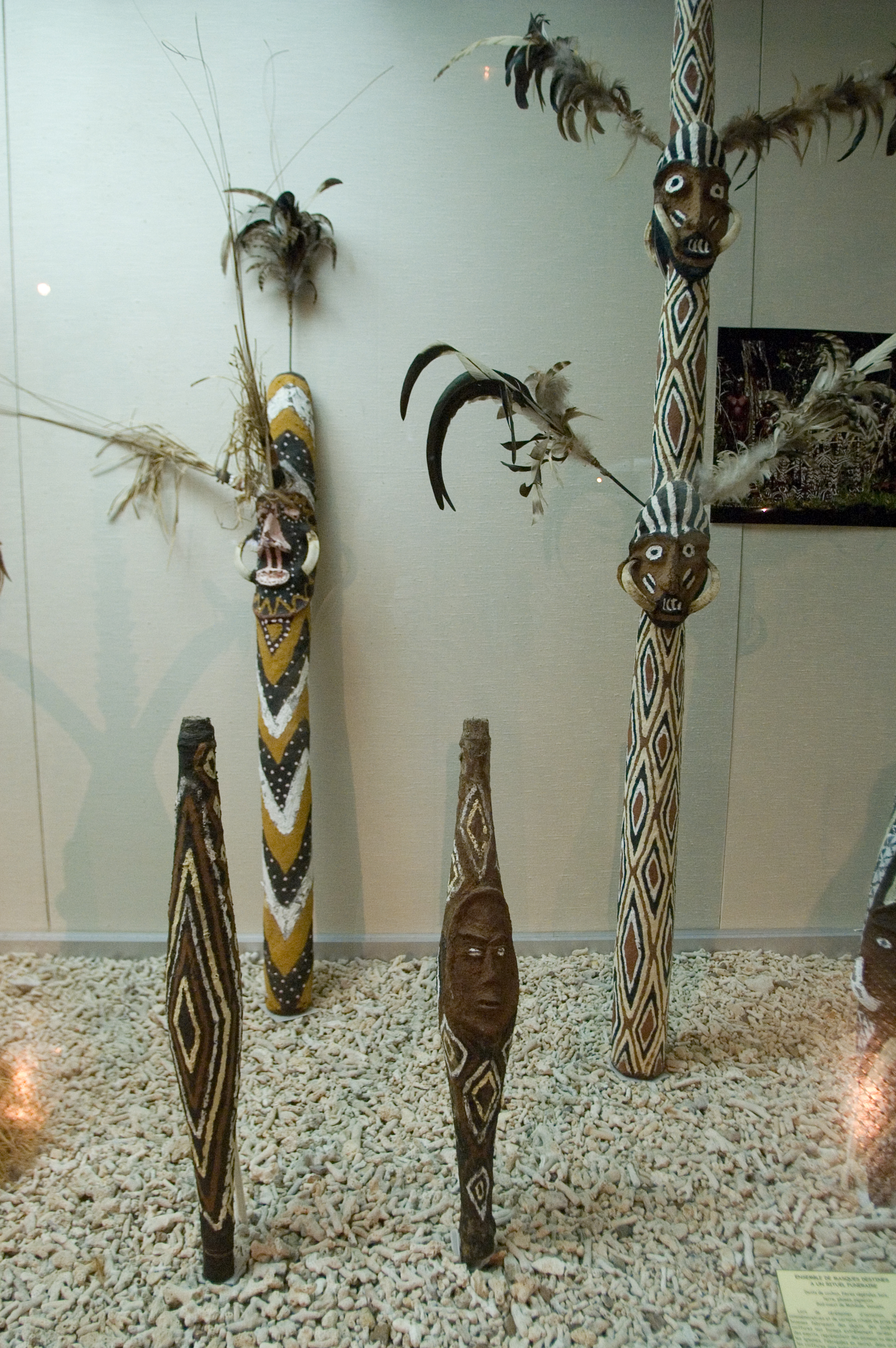
 Malakula funeral masks
Malakula's economy is largely based on agriculture with extensive copra plantations on the eastern coastal plains around Norsup and Lakatoro. In 1939, a copra cooperative was set up at Matanvat in northern Malakula. In no time, it took on some of the cargo cult traits, up until 1950, after which it returned to its original purpose, copra production. Today, the largest copra-producing plantation in Vanuatu is located at Norsup.
Infrastructure
Lakatoro has more stores, a market house, a National Bank of Vanuatu branch, an Air Vanuatu office, the main wharf and it is the administrative centre for MALAMPA province (Malekula, Ambrym, Paama). Norsup has the provincial hospital. Both Norsup and Lakatoro have telephones and 24 hour electricity.
Tourism
The interior of Malekula is mountainous, rugged and forest-covered with good walking and bird watching. There are old cannibal sites hidden in the bush on north Malekula, but at many the bones and skulls have been removed or buried. The Maskelynes and the small offshore islands along the east coast of Malekula have sand beaches and coral reefs with good snorkelling and diving.
Transport
Air Transport
There are airports on Malekula at Norsup, Lamap and Southwest Bay. Norsup has a tarmac surface. Air Vanuatu flies to Malekula on every day of the week.
Road Transport
Lakatoro is Malekula's road transport hub. The best place to find trucks is at the Lakatoro Trading Centre. There are several trucks along the northeast coast as far as Vao.
Literature
- Haidy Geismar and Anita Herle: Moving images. John Layard, fieldwork and photography on Malakula since 1914, Crawford House Publishing Australia, Aelaide, South Australia, 2009 ISBN 978-1-86333-3-191
- in Bislama language
- John Layard long Malakula 1914 - 1915, Vanuatu Cultural Centre
References
External links
 Islands of Vanuatu by provinceCategories:


Wikimedia Foundation. 2010.