- Jupiter Inlet Light
Infobox Lighthouse
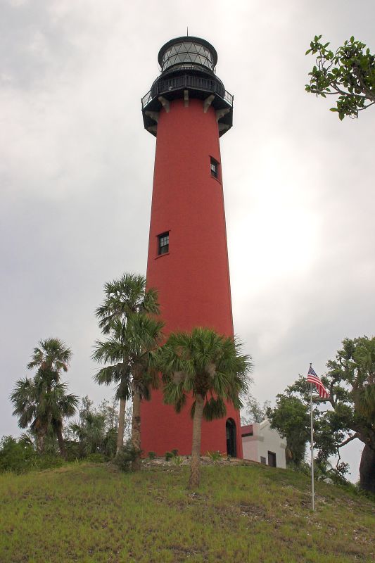
caption = The Jupiter Inlet lighthouse
location = north side of theJupiter Inlet inJupiter, Florida
coordinates = coord|26|56|55|N|80|04|55|W|region:US_type:landmark
yearlit = 1860
automated = 1928
yeardeactivated =
foundation =oyster shells
construction = brick
shape = conical tower
height = 108 feet (tower) 146 feet (above water)
lens = first orderFresnel lens
range = 25 nm
characteristic = Fixed white varied by a white flash every 90 secondsThe Jupiter Inlet Light is located inJupiter, Florida , on the north side of theJupiter Inlet . The site for the lighthouse was chosen in 1853. It is located betweenCape Canaveral Light andHillsboro Inlet Light . The lighthouse was designed by then Lieutenant George G. Meade of the Bureau of Topographical Engineers. The Jupiter Inlet silted shut in 1854, forcing all building supplies to be shipped in light boats down the Indian River. Work was interrupted from 1856 to 1858 by the Third Seminole War. The lighthouse was completed in 1860 at a cost of more than $60,000.00.The lighthouse was built on an Indian shell mound (
midden ). The top of the 105 foot tower is 146 feet above sea level. The light can be seen 25 miles at sea. The walls are 31 inches thick at the base and taper to 18 inches near the top. The tower was left unpainted for the first fifty years, but had grown so discolored that it was painted red around 1910.During the Civil War
blockade runner s brought supplies to the Confederacy through the Jupiter Inlet, while the Union Navy tried to stop them. Fearing that the lighthouse was an aide to the Union ships, a group of Confederate sympathizers disabled the light and removed the machinery from the lighthouse. A Union agent found the machinery where it had been hidden, and took it by boat toKey West, Florida for safekeeping.The lighthouse was put back into service after the war. The lighthouse was very isolated. Supplies were delivered once a year by boat. The year's supply of flour would go bad with weevils and worms. The lighthouse keepers had to fish and hunt to provide food. They would also buy
venison from theSeminole s for ten cents a pound.In 1928 the mineral oil lamps and the weights that turned the lamp were replaced with electrical equipment, and a diesel generator was installed for emergency backup. The Okeechobee Hurricane the same year cut the electric power and damaged the diesel generator, so the keeper reinstalled the oil lamps, and his 16-year old son turned the lamp by hand through the storm. The top of the lighthouse swayed 17 inches during the hurricane.
Jupiter Inlet Light was placed on the Federal Register of Historic Places in 1973.
References
*McCarthy, Kevin M. 1990. Jupiter Inlet Lighthouse. "Florida Lighthouses". (pp.33-36). University of Florida Press. [http://www.uscg.mil/history/weblighthouses/LHFL.asp U.S. Coast Guard List of Historic Light Stations] - accessed
June 29 ,2008 External links
* [http://users.erols.com/lthouse/jilt.htm Florida Lighthouse Page - Jupiter inlet Lighthouse]
* [http://www.joe4speed.com/jupiterlighthouse.htm Jupiter Lighthouse Pictures]
* [http://www.jupiterlighthouse.org/ Official Jupiter Lighthouse Site]
Wikimedia Foundation. 2010.