- Texas State Highway 165
Infobox TX State Highway
type=State
route=165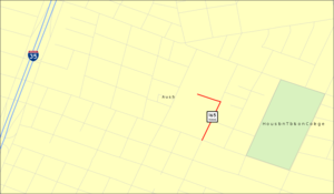
length_mi=0.9
length_ref=TxDOT|SH|165|accessdate=2008-03-15]
length_round=1
formed=1932
dir1=South
dir2=North
from=7th Street in Austin
to=Texas State Cemetery in Austin
previous_type=State
previous_route=164
next_type=State
next_route=166State Highway 165, or SH 165, is a
state highway in the state ofTexas in theUnited States . At convert|0.90|mi|2, it is the second shortest state highway in Texas (after SH 168 in Galveston), and perhaps the only one partially locked at night. It is also isolated from all other Texas highway system roads.History
In 1932, Texas
historian Louis Kemp brought the neglected Texas State Cemetery to the attention of officials at the Texas Highway Department. At the time, the convert|22|acre|adj=on State Cemetery, located just east of current downtown Austin, had no roads. The Highway Department established a highway to and created and paved roads through the cemetery. The highway to the State Cemetery was also previously known informally as the "Lou Kemp Highway".At various times, SH 165 originated from US 290 and SH 20 (probably the same route redesignated) in downtown Austin, and at Loop 343. In 1965, SH 165 was truncated to Comal Street from 7th Street to the entrance of the State Cemetery as well as the roads within the cemetery. At that time, Loop 343 ran along 7th Street (which borders the State Cemetery). In 1977, the eastern section of Loop 343, including the routing along 7th Street, was deleted from the Texas highway system, leaving SH 165 officially isolated from other highways in the Texas highway system. However, the Texas State Cemetery — and SH 165 — are located just six blocks east of Interstate 35.
This route has only been designated as SH 165 or, on an informal basis, as "Lou Kemp Highway".
Route description
Officially, SH 165 runs north along Comal Street from 7th Street into and within the
Texas State Cemetery in Austin. As of December 2005, it is signed only within the State Cemetery while the Comal Street portion is unsigned. The posted speed limit for the highway is convert|10|mph.References

Wikimedia Foundation. 2010.