- Devonport, New Zealand
-
Devonport 
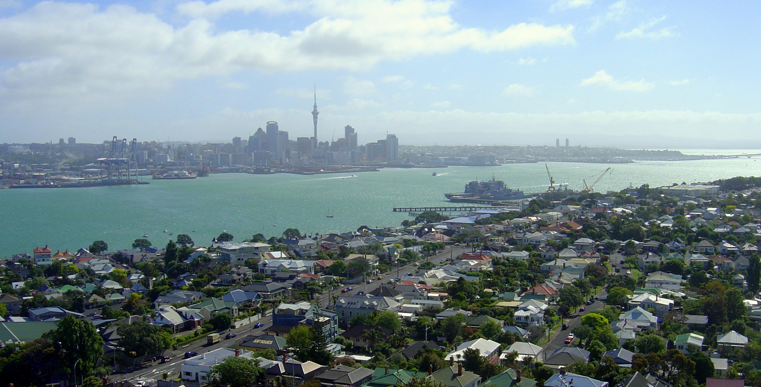
Devonport and the Waitemata Harbour from atop Mount Victoria. Auckland CBD in the distance.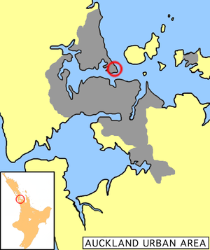
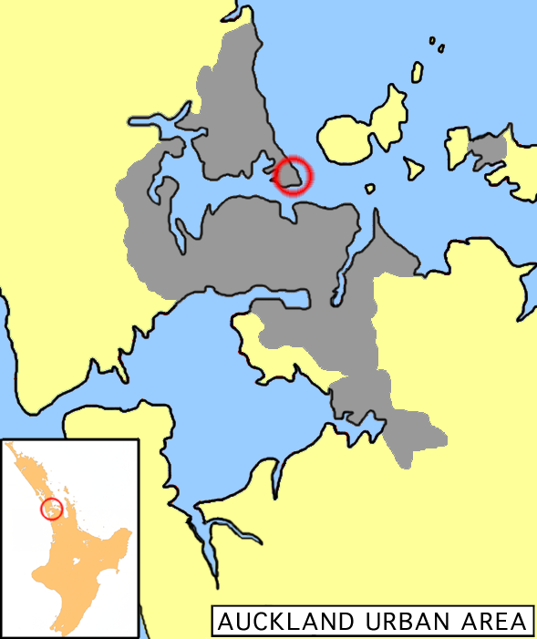
Location of Devonport in Auckland.Basic information Local authority Auckland Council Electoral ward North Shore Local board Devonport-Takapuna Date established 1840s Population 5,337 (2006 census) Postcode(s) 0624 Facilities Ferry terminal(s) Devonport Wharf Hospitals(s) Navy Hospital Surrounds North Vauxhall Northeast Cheltenham East (North Head) Southeast (Waitemata Harbour) South (Waitemata Harbour) Southwest (Waitemata Harbour) West Stanley Bay Northwest (Duders Point) Devonport is a harbourside suburb of Auckland, New Zealand. It is located on the North Shore, at the southern end of a peninsula that runs southeast from near Lake Pupuke in Takapuna, forming the northern side of the Waitemata Harbour. East of Devonport lies North Head, the northern promontory guarding the mouth of the harbour.
The population of Devonport and the adjoining suburb of Cheltenham was 5,337 in the 2006 Census, an increase of 126 since 2001.[1] With the additional suburbs of Stanley Bay, Vauxhall and Narrow Neck, the 2006 population was 11,142.[2]
The suburb hosts the Devonport Naval Base of the Royal New Zealand Navy, the main facility for the country's naval vessels, but is best known for its harbourside dining and drinking establishments and its heritage charm. In its scenery and setting, Devonport has been compared to Sausalito, California.[3]
In 2011 the Devonport community, led by parents and local publication the Devonport Flagstaff, launched a grassroots movement protesting the sale of the synthetic cannabis Kronic in local dairies. The battle was a success, and Kronic was banned from the area. [4]
Contents
Character
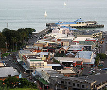
The Devonport shops contain a fair array of antiques, gift & book shops as well a number of good cafes and restaurants making it a popular destination for tourists and Aucklanders. People often travel over from Auckland on the ferry for dinner, the starry sky and glittering lights of Auckland on the return trip being very beautiful.
Day trips combining a meal in Devonport with a trip up Mt Victoria or an exploration of the military emplacements on nearby North Head are also very popular. Devonport is also noted for the popular annual event, the Devonport Food & Wine Festival,[5] as well as for the Devonport Museum located near Mt. Cambria.
The navy base at Devonport features strongly in the local character, with the North Shore City Council having signed a Memorandum of Understanding with the Navy which recognises the developing partnership between them.[6]
History
Overview
Around 40,000 years ago Devonport consisted of three islands of volcanic origin, Mount Victoria, North Head and between them Mount Cambria (now largely quarried away).[7]
The earliest evidence for (Māori) settlement dates from the mid-14th century (roughly during the same time as the supposed landing of the Tainui waka which is commemorated by a stone memorial on the foreshore).[8] The last remaining significant Māori settlement in the area, on North Head, was wiped out by rival tribes in the 1790s.[9]
Jules Dumont d'Urville, a French explorer, is thought to have gone ashore in the area in 1827, possibly as the first European.[8] The first permanent European inhabitant was a pilot and harbour master stationed on North Head in 1836.[9] The suburb of Devonport itself was first settled in 1840 and is one of the oldest in Auckland and the first on the North Shore. It was initially called Flagstaff because of the flagstaff raised on nearby Mount Victoria (Takarunga). For the first half century or so of its existence Devonport was geographically isolated from the rest of the North Shore, and was sometimes called "the island" by the local inhabitants.[10] Only a thin strip of land beside the beach at Narrow Neck connected Devonport to Belmont and the rest of the North Shore peninsula. In the late 19th century the mangrove swamp that stretched from Narrow Neck to Ngataringa Bay was filled in to form a racecourse, now a golf course.[10] A new road was built along the western edge of the racecourse allowing more direct travel to the north.
On the southern shore, to the west of the centre of Devonport, a nearby deep water anchorage suitable for Royal Navy vessels, the Devonport Naval Base was established. William Hobson, then the Governor of New Zealand, considered the sandspit-protected area a better choice for a naval installation than the shallower Tamaki waters on the southern side of the harbour.[8] While some facilities have expanded and shifted in location over time, the area is still the primary base for the Royal New Zealand Navy. The Calliope Dock at Stanley Bay, part of the base, was opened on 16 February 1888 and at the time was the largest dock in the Southern hemisphere. The suburb also had one of the oldest New Zealand shipyards, now part of the Devonport Yacht Club area.[8]
The main centre of the suburb slowly shifted west from Church Street and the original wharf at Torpedo Bay, to its current location around the ferry wharf.[8] The settlement itself was renamed Devonport by 1859 after the English naval town of Devonport.[11] Devonport achieved Borough status in 1886 and was incorporated into North Shore City in 1989.
Ferries
The first ferry services to Auckland city began in the 1840s These were open sailing cutters operated by local seamen running passengers to the foot of Queen Street Auckland's main road. In 1860 the first paddlesteamer ferries began operation.[7][10]
These were in turn replaced by double-ended, screw-driven ferries in 1904.[10] Both passenger and vehicle ferries operated on the Devonport run until the opening of the Auckland Harbour Bridge in 1959. Immediately after the opening of the bridge passenger ferry services to other North Shore destinations (such as Northcote and Birkenhead) were cancelled as were all vehicular ferries. The Devonport passenger ferry was retained on a much reduced timetable. The majority of the ferries were scrapped, only a handful being retained until being replaced by more modern vessels. The last of the old-style double-ended ferries, the diesel-engined Kestrel (built in 1905), was retired from the commuter run in 1988 and was then operated for cruises and sightseeing. In 2002 the Kestrel was moved to Tauranga to serve as a floating restaurant. The Kestrel has since changed hands again and moved back to Auckland, currently residing at the Auckland City ferry terminal.[12]
Today, ferry services, subsidised by the Auckland Regional Transport Authority, are more numerous again. A crossing between the Auckland CBD and Devonport takes about 12 minutes, usually on the 'Seabus Kea', a newer double-ended ferry.[10]
The Devonport Wharf / Ferry Terminal received a variety of maintenance and repairs during 2011 in advance of the Rugby World Cup. Further structural works are to be carried out in 2012.[13]
Notable locations
 Devonport as seen from Mt Victoria. Victoria Road on left, Devonport Wharf at the rear.
Between the wharf and Mt Victoria is located the Devonport shops, the most prominent landmarks of which are:
- The Devonport Wharf; rebuilt in the 1990s and about to be redeveloped.
- The Esplanade Hotel; This is an elegant example of an 1890s seaside hotel, reminiscent of many an English seaside resort of the period. Recently restored.
- King Edward Parade Reserve; here are located the 1970s Public Library, the War Memorial [a bronze soldier figure] and under the Morton Bay Fig trees a charming 1950s styled bandstand.
- The Victoria Cinema; Built in 1912 and remodelled in the 1930s internally and externally in the fashionable Art Deco Style, this is apparently the oldest cinema in the Southern hemisphere in continuous use. Victoria Cinema has since opened after renovations, having recently (2006) been purchased by the North Shore City Council on behalf of the city.[14]
Recently, in July 2007, Devonport was given permission to be excluded from a list of local Auckland growth node centres. The Auckland Regional Council accepted that while it was encouraging intensified growth (such as higher-density housing) around transport nodes such as Devonport, the character and historical nature of the Devonport Wharf area would make such a designation inappropriate in this case.[15]
Notable people
- Dove-Myer Robinson, a former Auckland Mayor, attended Devonport Primary School.[16]
- Isabel Maude Peacocke, teacher, novelist, broadcaster, born in Devonport in 1881.[17]
- Tom Ashley, Boardsailing Olypic Gold medallist
- Sir Peter Blake, attended Bayswater Primary School,[18] Takapuna Grammar School[19]
Education
 Morning mist over Devonport.
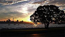 Devonport waterfront with a large Pohutukawa tree.
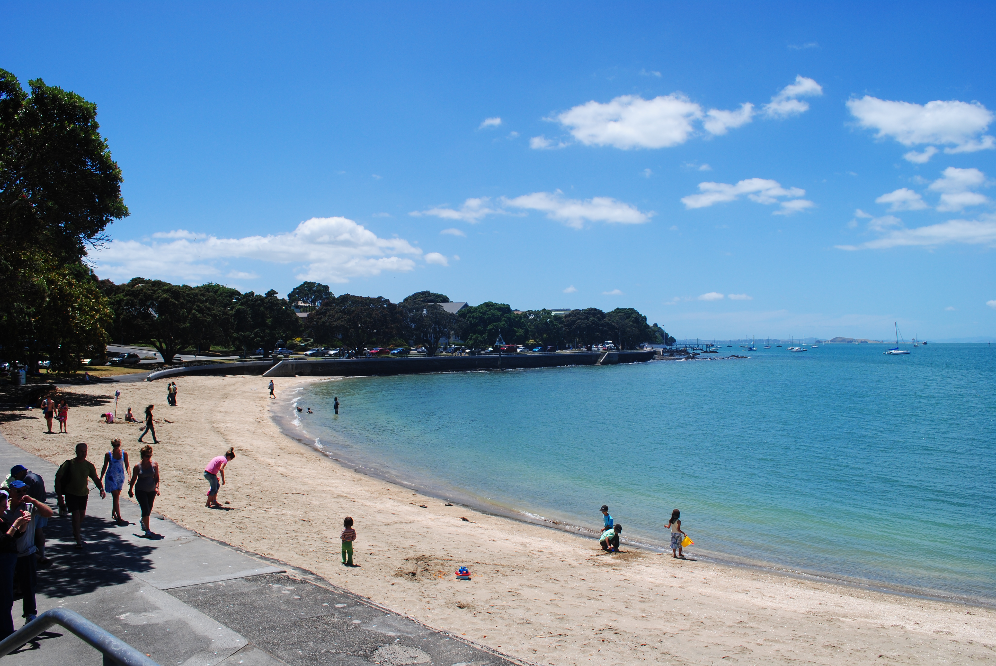
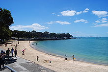 The shoreline of Devonport Beach.
Devonport School, St Leo's School and AppleTree Education Centre are coeducational primary schools with rolls of 312,[20] 124[21] and 22[22] respectively. Devonport School and St Leo's School have decile ratings of 10 and provide education for years 1-6. St Leo's is a state integrated Catholic school.[23] AppleTree Education Centre is an independent school established with a curriculum focusing on the development of multiple human intelligences[24] for students in years 1-8. It moved to its current premises in 2004.[25]
See also
- William C Daldy, a historical steam tug currently berthed in Devonport
References
- ^ The statistical area used by the Census is called Mt Victoria. Quickstats about Mt Victoria
- ^ "The North Shore". Te Ara Encyclopedia of New Zealand. http://www.teara.govt.nz/Places/Auckland/AucklandPlaces/5/en. Retrieved 2008-06-16.
- ^ In Auckland, Life Is Alfresco - The New York Times, 5 October 1997
- ^ http://tvnz.co.nz/national-news/grassroots-battle-against-kronic-proves-success-4271298
- ^ Devonport Food & Wine Festival (official festival website)
- ^ Navy and North Shore City Council Join Forces (from the Royal New Zealand Navy website. Accessed 2008-05-11.)
- ^ a b About Devonport 1 (from the devonpporttours.co.nz website)
- ^ a b c d e Set sail for adventure on dry land - The New Zealand Herald, Travel: NZ Special Issue, Tuesday 06 November 2007, Page D7
- ^ a b About Devonport 2 (from the devonpporttours.co.nz website)
- ^ a b c d e Destination History - Devonport (from the Fullers Ferries website. Retrieved 2007-09-14.)
- ^ Wises New Zealand Guide, 7th Edition, 1979. Page 83
- ^ "The Kestrel Plans A Return To Devonport". The Devonport Speculator. 24 August 2010. http://www.speculator.co.nz/2010/the-kestrel-plans-a-return-to-devonport. Retrieved 9 September 2011.
- ^ "Devonport Wharf's makeover completed". Media release from Auckland Transport. 9 September 2011. http://www.aucklandtransport.govt.nz/about-us/News/LatestNews/Pages/Auckland-Transport-gives-Devonport-Wharf-a-makeover.aspx. Retrieved 9 September 2011.
- ^ "Victoria Theatre - FAQ's". http://www.northshorecity.govt.nz/?src=/your_council/news_releases/releases-2006/july/deal-sealed-on-victoria-theatre-faqs.htm. Retrieved 2007-06-14.
- ^ Development gets thumbs down - The New Zealand Herald, Tuesday 17 July 2007, Page A9
- ^ Robinson, Dove-Myer (entry in the Dictionary of New Zealand Biography)
- ^ Peacocke, Isabel Maude (entry in the Dictionary of New Zealand Biography)
- ^ "Sir Peter Blake Memorial Hall opened at Bayswater". North Shore and Waitakere City Libraries. http://www.localhistoryonline.org.nz/cgi-bin/PUI?e=0off-supercol--2-------0---4------110-20--00-1-1-0-0-0-01&a=d&c=supercol&cl=CL3.2000s.2002&d=nsnw-NNI-AAD-6007.
- ^ "Message from the Principal" (PDF). Ex-Pupils Newsletter for Takapuna Grammar School. Takapuna Grammar School. May 2006. http://www.takapuna.school.nz/uploaded/expupilsnewslettermay06.pdf.
- ^ Te Kete Ipurangi schools database: Devonport School
- ^ Te Kete Ipurangi schools database: St Leos School
- ^ Te Kete Ipurangi schools database: AppleTree Education Centre
- ^ "Confirmed Accountability Review Report: St Leos School". Education Review Office. 25 August 1999. http://www.ero.govt.nz/ero\reppub.nsf/Institution/0D9B51E9C46432AC4C2568460033C3A5/$File/1500.htm.
- ^ "Confirmed Accountability Review Report: Apple Tree Education Centre". Education Review Office. 15 October 2001. http://www.ero.govt.nz/ero\reppub.nsf/Institution/6C70723285582C46CC256AF400165E7B/$File/1637.htm.
- ^ "Private School Review Report: Apple Tree Education Centre". Education Review Office. 24 August 2004. http://www.ero.govt.nz/ero\reppub.nsf/Institution/57178494B3A0891CCC256F07007C01D8/$File/1637.htm.
External links
Coordinates: 36°49′54″S 174°47′47″E / 36.831667°S 174.796278°E
Categories:


Wikimedia Foundation. 2010.