- Magoula, Attica
-
Magoula
ΜαγούλαLocation 
 Magoula
Coordinates 38°5′N 23°31′E / 38.083°N 23.517°ECoordinates: 38°5′N 23°31′E / 38.083°N 23.517°E Location within the regional unit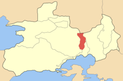
Government Country: Greece Region: Attica Regional unit: West Attica Municipality: Elefsina Population statistics (as of 2001) Municipal unit - Population: 4,005 - Area: 18.134 km2 (7 sq mi) - Density: 221 /km2 (572 /sq mi) Other Time zone: EET/EEST (UTC+2/3) Elevation (center): 35 m (115 ft) Postal: 190 18 Telephone: 210 Auto: Z Magoula (Greek: Μαγούλα) is a town (pop. 3,728 in 2001) and former community (pop. 4,005) of West Attica, Greece. Since the 2011 local government reform it is part of the municipality Elefsina, of which it is a municipal unit.[1]
Magoula is linked by road with Elefsina and Agios Thomas in Boeotia, and to Mandra in the west. Magoula is located about 22 km northwest of Athens, north of Elefsina, ENE of Corinth and southeast of SSE of Thiva. The municipal unit of Magoúla also includes the village of Néos Póntos (pop. 277).
Businesses and agriculture are the most popular industry in Magoula and its surrounding area. The prior to the late-20th century were entirely rural. Housing developments arrived in the 1980s and the 1990s.
Contents
Historical population
Year Town population Community population 1981 1,915 - 1991 2,663 - 2001 3,728 4,005 Gallery
-

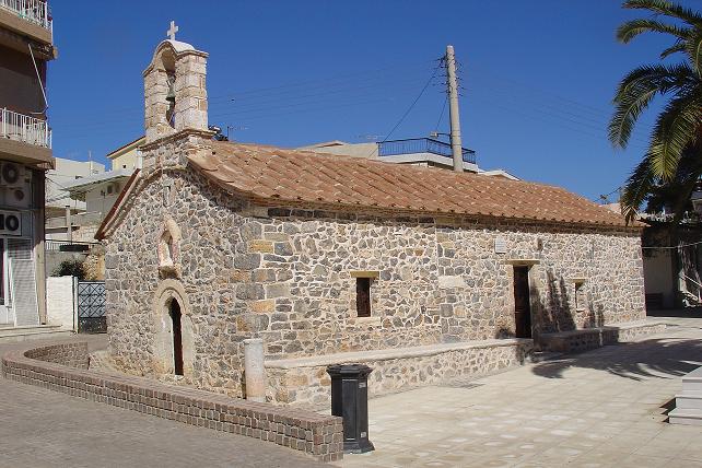
Agios Dimitrios orthodox church in Magoula
-
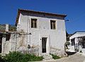
Traditional house in Magoula
References
- ^ Kallikratis law Greece Ministry of Interior (Greek)
External links
- GTP Travel Pages (Municipality) (in English and Greek)

Dervenochoria Mandra 
Aspropyrgos  Magoula

Elefsina Elefsina Municipal units Elefsina · MagoulaCategories:- Populated places in West Attica
-


Wikimedia Foundation. 2010.