- Tōhoku Expressway
Infobox_road
highway_name = Tōhoku Expressway (東北自動車道)
marker_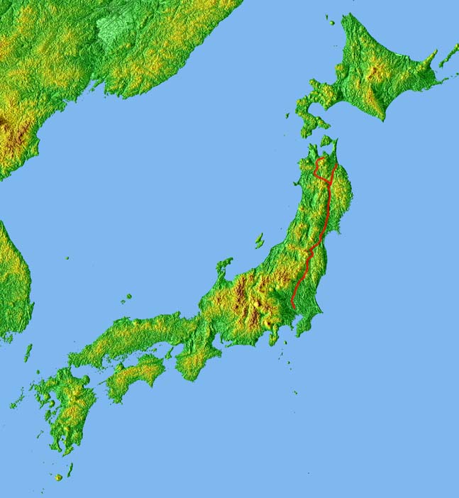
length = 679.5 km
established = 1972 [cite web| url= http://www2.tokai.or.jp/stt/road/expwyopn.html | title= Expressway Opening Dates | accessdate= 2008-04-16 ]
first_open =
starting_terminus =Kawaguchi Junction inKawaguchi, Saitama
cities = Saitama, Tatebayashi, Utsunomiya, Kōriyama, Fukushima,Sendai , Morioka, Kazuno, Hirosaki
ending_terminus =Aomori Interchange inAomori, Aomori
The nihongo|Tōhoku Expressway|東北自動車道|Tōhoku Jidōsha-dō is a national expressway inJapan . It is owned byJapan Expressway Holding and Debt Repayment Agency and operated byEast Nippon Expressway Company .Naming
Tōhoku refers to the
Tōhoku region , the northernmost region on the island ofHonshū .Officially the expressway is designated as the Tōhoku Jūkan Expressway Hirosaki Route. It is also concurrent with the Tōhoku Jūkan Expressway Hachinohe Route until
Ashiro Junction , where it diverges from the Tōhoku Expressway to become theHachinohe Expressway . [cite web| url= http://www.mlit.go.jp/road/ir/ir-yosan/h20/s07.pdf | title= High Standard Trunk Road Map |author= Ministry of Land, Infrastructure and Transport | accessdate= 2008-04-13 | format=pdf]Overview
The expressway links the Tōhoku region with the
Kantō region and the greaterTokyo urban area. It is also the longest expressway among all expressways operated by East Nippon Expressway Company.cite web| url= http://www.e-nexco.co.jp/more_expressway/data/ | title= E-NEXCO Expressway Data | accessdate= 2008-04-13 ]Starting at a junction with the
Tokyo Gaikan Expressway to the north of Tokyo, the expressway follows a northerly course through the plains ofSaitama Prefecture andTochigi Prefecture before entering the mountainous interior of the Tōhoku region. Passing through centralFukushima Prefecture , the expressway then entersMiyagi Prefecture and passes to the west ofSendai , the largest city in the Tōhoku region. The expressway continues north intoIwate Prefecture , passing the prefectural capital Morioka. In the northern part of Iwate, the expressway veers to the northwest, while the Hachinohe Expressway branches off to the northeast. The Tōhoku Expressway continues into centralAomori Prefecture before terminating in the city of Aomori, the prefectural capital.The route parallels the
Tōhoku Shinkansen andTōhoku Main Line ofEast Japan Railway Company as well as National Route 4 from the origin to the city of Morioka. North of Morioka the route diverges and parallels theŌu Main Line and National Route 7 to the terminus in Aomori.The expressway is 6 lanes from
Kawaguchi Junction toUtsunomiya Interchange , and 4 lanes from Utsunomiya to the terminus in Aomori.List of interchanges and features
* IC - interchange, SIC -
smart interchange , JCT - junction, SA -service area , PA -parking area , BS -bus stop , TN -tunnel , BR -bridge , TB -toll gate , CB -snow chains Kawaguchi JCT - Sendai-Miyagi IC
*Iwafune JCT - Tochigi-Tsuga JCT is concurrent with the
Kita-Kantō Expressway Sendai-Miyagi IC - Aomori IC
References
External links
*ja icon [http://www.e-nexco.co.jp/ East Nippon Expressway Company]
Wikimedia Foundation. 2010.