- Blackwood River
Infobox River
river_name = Blackwood River
image_size =
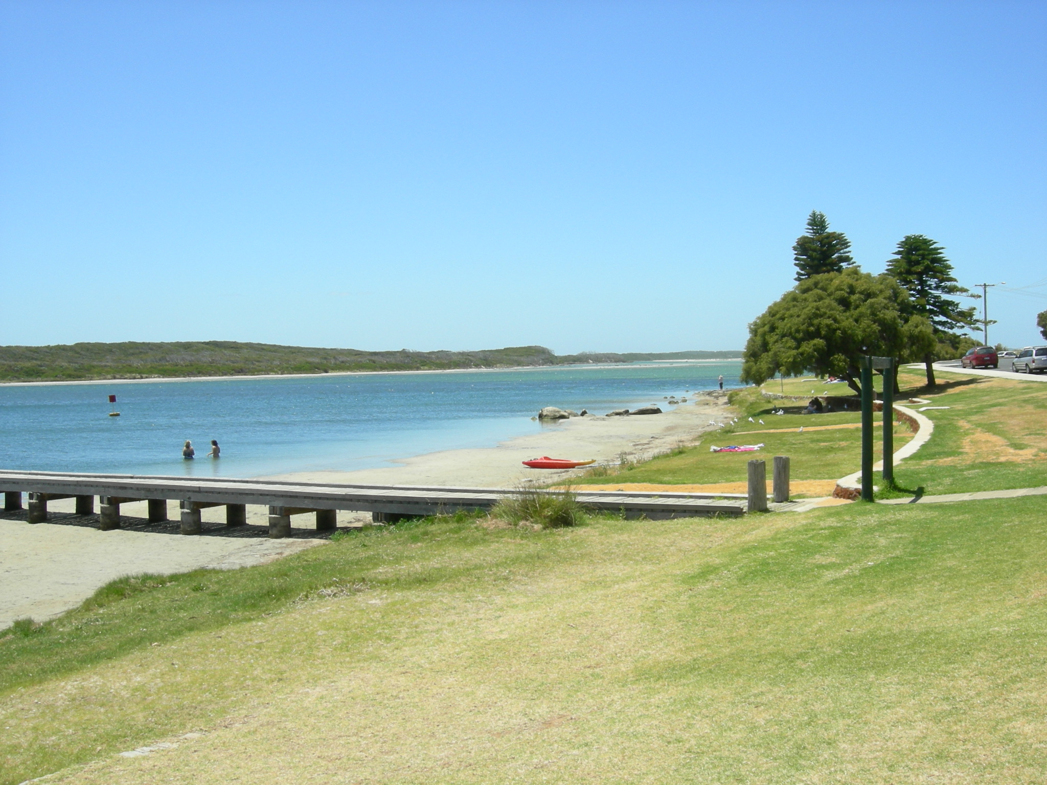
caption = Colour Patch area at mouth of Blackwood river and start of eastern section of estuary
origin = Junction of Arthur River and Balgarup River
mouth = Hardy Inlet, Augusta
basin_countries = Australia
length = 300km [LandInfo WA|r|B|2008-08-04]
elevation =
mouth_elevation = sea level
discharge = 29.8 m³/s [cite web|url=http://www.epa.wa.gov.au/docs/swy/ERMP_SWYarragadee_App27.pdf|title=Water Corporation - Ecological water requirementa of Blackwood Riverand tributaries|year=2007|accessdate=2007-07-26]
watershed = 28,100 km² [cite web|url=http://www.wrc.wa.gov.au/ribbons/blackwood_region.html|title=Waters and Rivers Commission - Ribbons of Blue - Blackwood Region|year=2004|accessdate=2007-07-26]The Blackwood River is a major river and catchment in the South West of
Western Australia .The upper or larger catchment area of the river is in agricultural areas, while the middle catchment area passes through forest areas, and the lower portion of the river passes into mixed forest, agricultural and residential lands. The river emerges into
Flinders Bay at Augusta.It was first discovered by a European in 1827 by Captain (later Admiral Sir) James Stirling and named in honour of
Henry Blackwood , under whom Stirling had served as a youth from April 1808 to April 1810.Historically it was of considerable importance in the early days of the
Swan River Colony , and more recently of importance in the ecology of the Augusta-Margaret River region due to conflicts in land use policy.Hardy Inlet has a number of islands - namely Molloy Island and Thomas Island.
The mouth of the river has attracted interest in its various points of opening and closing over the last 100 years, Duke Head at the west side being a benchmark location for the shifting mouth.
References
Further reading
* Brearley, Anne, "Ernest Hodgkin's Swanland : estuaries and coastal lagoons of South-western Australia" Crawley, W.A. : University of Western Australia Press for the Ernest Hodgkin Trust for Estuary Education and Research and National Trust of Australia (WA), 2005. ISBN 1-920694-38-2
* Muirden, Peter: Pen, Luke and Marnie Leybourne (2003) "Stream and catchment hydrology in South West Western Australia" Perth, W.A. Dept. of Environment. Department of Environment river restoration, 1442-6919 ; report no. RR19 ISBN 1920849246
* Pen, Luke J.(1999) "Managing our rivers : a guide to the nature and management of the streams of south-west Western Australia" (editor, June Hutchison) East Perth, W.A. : Water and Rivers Commission. ISBN 0730974502
Wikimedia Foundation. 2010.