- Boundary Ranges
Geobox | Range
name=Boundary Ranges
other_name=Alaska Boundary Range
image_size=275
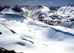
image_caption=View of theJuneau Icefield .
country=Canada
country1=United States
region=British Columbia
region1=Alaska
parent=Coast Mountains
geology=
geology1=
geology2=
orogeny=
highest=Mount Ratz
highest_elevation=3090
highest_lat_d=57|highest_lat_m=23|highest_lat_s=35.2|highest_lat_NS=N
highest_long_d=132|highest_long_m=18|highest_long_s=11.2|highest_long_EW=W
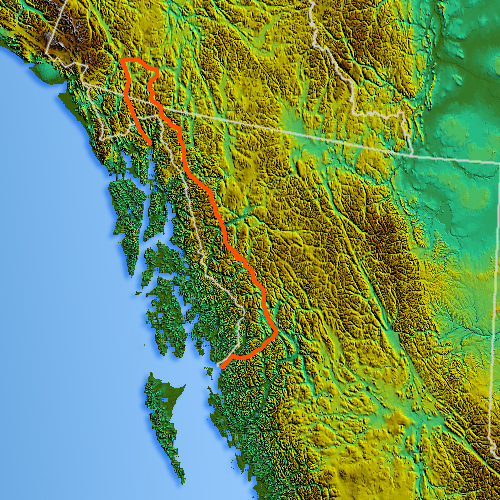
map_caption=Location map of Boundary Ranges; marine shoreline-boundary not shown
map_size=275The Boundary Ranges, also known in the singular and as the Alaska Boundary Range, are the largest and most northerly subrange of the
Coast Mountains . They begin at theNass River , near the southern end of theAlaska Panhandle in theCanadian province ofBritish Columbia and run to theKelsall River , near theChilkoot Pass . Beyond them to the west are theAlsek Ranges of theSaint Elias Mountains , while to their east are theSkeena Mountains ,Stikine Plateau andCassiar Mountains of theInterior Mountains complex that lies northwest of theInterior Plateau . To their northeast are theTagish Highland and theTahltan Highland .The Boundary Ranges include several large icefields, including the
Juneau Icefield , between theAlaska city of the same name andAtlin Lake in B.C.; and theStikine Icecap , which lies between the lowerStikine River and theWhiting River . Some of the highest mountains in the Boundary Ranges are:Mount Ratz , 3090 m (10138 ft),Chutine Peak , 2910 m (9547 ft), andDevils Thumb , 2766 m (9077 ft), all in theStikine Icecap region; andDevils Paw , 2593 m (8507 ft), in theJuneau Icefield . (There are other peaks in theStikine Icecap higher than 2600 m but they have relatively lowtopographic prominence .)Despite the height of
Mount Ratz and its neighbours, most of the Boundary Ranges are considerably lower than thePacific Ranges of the southernCoast Mountains . The larger icefields of the Boundary Ranges are at a much lower elevation than their southern counterparts in thePacific Ranges because of the difference in latitude.Physiographically, they are a section of the larger Pacific Border province, which in turn are part of the larger Pacific Mountain System physiographic division.
The granitic
intrusion s that form the Boundary Ranges are remnants of aLate Cretaceous volcanic arc system called theCoast Range Arc .ub-ranges
*
Cheja Range
*Chechidla Range
*Chutine Icefield
*Adam Mountains
*Ashington Range
*Burniston Range
*Dezadeash Range
*Florence Range
*Halleck Range
*Juneau Icefield
*Kahpo Mountains
*Kakuhan Range
*Lincoln Mountains
*Longview Range
*Peabody Mountains
*Rousseau Range
*Seward Mountains
*Snowslide Range
*Spectrum Range
*Stikine Icecap External links
* [http://www.bivouac.com/ArxPg.asp?ArxId=1641 Boundary Ranges] of the Canadian Mountain Encyclopedia
References
*S. Holland, "Landforms of British Columbia", Province of British Columbia, 1976
Wikimedia Foundation. 2010.