- Hrčava
Infobox City
official_name = Hrčava
native_name =
nickname =
motto =
settlement_type = Village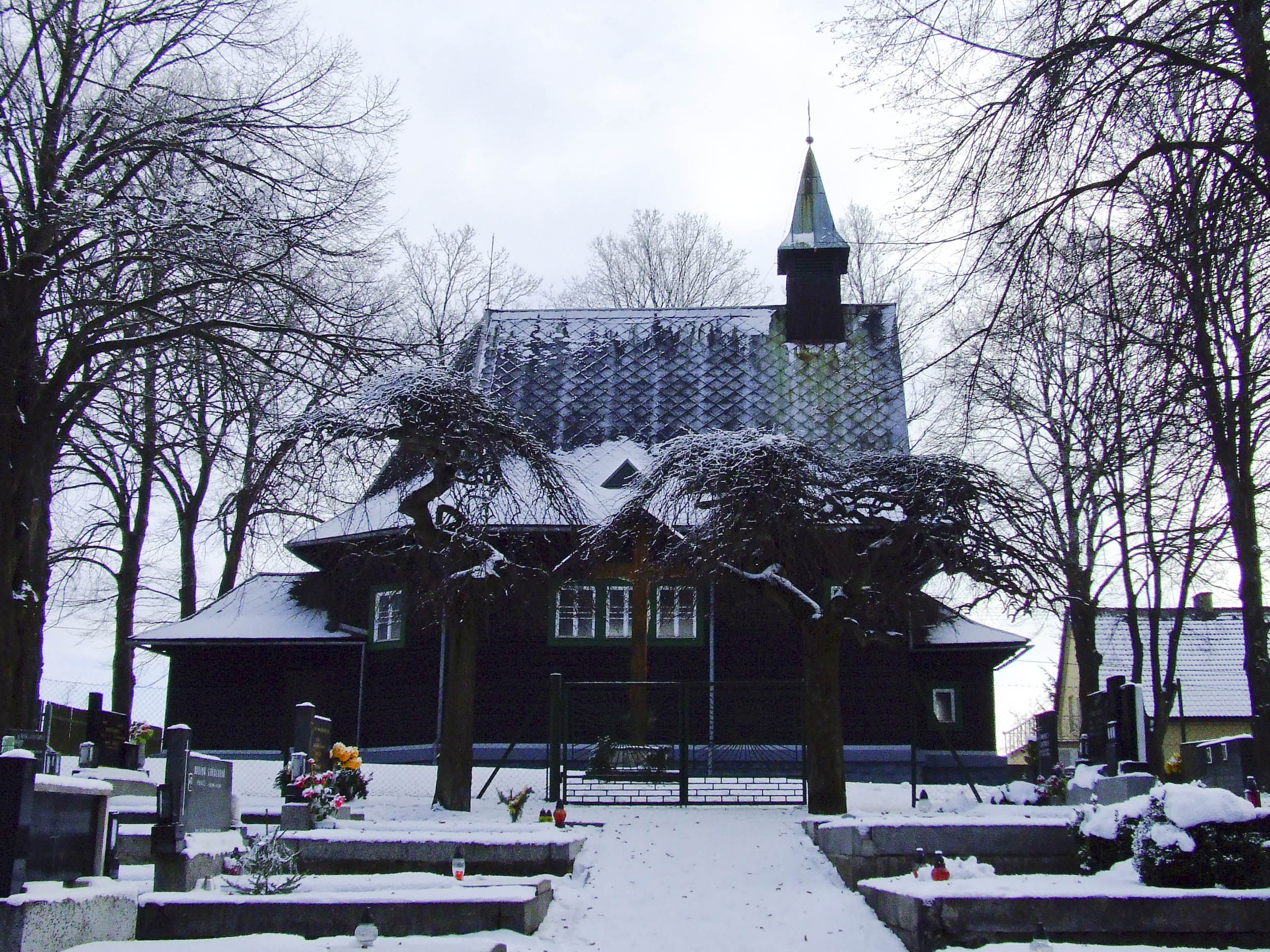
imagesize =
image_caption = Saints Cyril and Methodius Church
image_shield = Herczawa herb.png
pushpin_label_position = none
pushpin_map_caption = Location in the Czech Republic
subdivision_type = Country
subdivision_name =Czech Republic
subdivision_type1 = Region
subdivision_name1 = Moravian-Silesian
subdivision_type2 = District
subdivision_name2 = Frýdek-Místek
leader_title =Mayor
leader_name = Josef Szkandera
established_title = Established
established_date = 1920
area_magnitude = 1 E8
area_total_km2 = 2.87
population_as_of = 2006
population_note =
population_total = 255
population_density_km2 = auto
latd = 49
latm = 31
lats = 30
latNS = N
longd = 18
longm = 50
longs = 4
longEW = E
elevation_m = 594
postal_code_type = Postal code
postal_code = 739 98
website = [http://www.volny.cz/obec.hrcava/ http://www.volny.cz/obec.hrcava/]
footnotes =Audio|Hrcava.ogg|Hrčava (Polish: Audio-nohelp|Herczawa.ogg|"Herczawa", _de. Hertschawa) is a
village inFrýdek-Místek District ,Moravian-Silesian Region ,Czech Republic . It has 255 inhabitants (2006). It is the second easternmost village of the country (after Bukovec), lying near the borders withPoland andSlovakia . In 2001 census six people (2% of the inhabitants) declared Polish nationality and 96.7% declared Roman Catholic faith. [cite web |url= http://www.czso.cz/sldb/sldb2001.nsf/obce/598232?OpenDocument |title= 2001 census data |accessdate= |author= |date= |work= |publisher=Czech Statistical Office ]It is situated on the foothills of the
Silesian Beskids mountain range, in the historical region ofCieszyn Silesia .Footnotes
See also
*
Zaolzie External links
* [http://www.volny.cz/obec.hrcava/ Official website]
* [http://portal.gov.cz/wps/portal/_s.155/696?kam=obec&kod=598232 Short official information about the village]


Wikimedia Foundation. 2010.