- Khartoum North
-
Khartoum North
al-Khartum Bahri— City — Industrial area of Khartoum North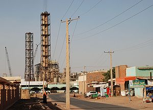
Nickname(s): Bahri Country  Sudan
SudanPopulation 900,000+ Khartoum North (al-Khartūm Bahrī) is a city close to, but distinct from, Khartoum in central Sudan. The city is close to the confluence of the White and Blue Nile on the eastern bank of the Blue Nile. The city, which had in 1993 a rapidly growing population of 900,000, is connected by bridges to Khartoum and Omdurman. It is known also as " Bahrī بحري meaning North in Egyptian Arabic(South is Qibli قبلي ).
Contents
Demographics
 Location of Khartoum North
Year Population[1] 1956 39.100 1973 150.989 1983 341.155 1993 700.887 2007 Estimate 1.725.570 Economy and industry
The industrial centre of the region and the country, the city contains dockyards, marine and rail workshops, and sawmills. Khartoum North trades in cotton, grains, fruit, and livestock; industries include tanning, brewing, brickmaking, textile weaving, and food processing. Since the year 2000, chemical plants supplying household products to the rest of the country have been built in the city.
A wealthy suburb is growing towards the eastern part of the city, along the Blue Nile.
Neighbourhoods
Khartoum North has many neighbourhoods, some of which are:
- alamlaak
- Cooper City
- Kafouri
- Bahri Industrial Area
- St. Joseph
- Al Sababi
- Al Dnagla north
- Al Dnagla south
- Hilat Hamad
- Hilat Khojali
- Hilat Koko
- Greaf Sharq
- Alshabia north
- Alshabia south
- Almazad
- Almulazmien
- Almerghania
- Alsafia
- shambat
Infrastructure
Bridges
The following bridges cross the Blue Nile and connect Khartoum North to Khartoum:
- Mac Nimir Bridge
- Blue Nile Road and Railway Bridge
- Cooper Bridge
- Al Mansheiya Bridge
References
Coordinates: 15°38′N 32°38′E / 15.633°N 32.633°E
Categories:- Populated places in Sudan
- Khartoum
- Communities on the Nile River
- Sudan geography stubs


Wikimedia Foundation. 2010.