- Flåm Line
Infobox rail line
name = Flåm Line
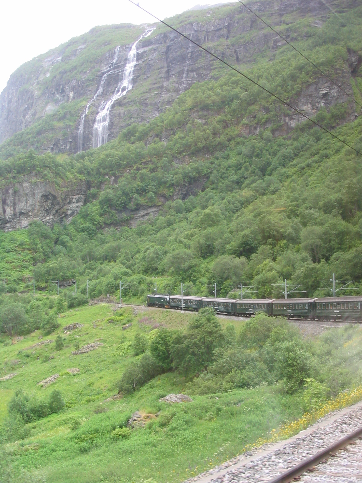
caption = A train on the Flåm railway
type =Railway
system = Norwegian railway
status =
start = Myrdal
end =Flåm
stations = 11
open = 1940
close =
owner =Norwegian National Rail Administration
operator =Norges Statsbaner
character = Tourist line
stock = El 17
linelength = convert|20|km|mi
tracklength =
notrack = Single
gauge = RailGauge|sg
el = 15 kV AC
speed =
elevation = 866 m asl
Flåmsbana map
map_state = show|The Flåm Line ( _no. Flåmsbana) is a
branch line of theBergen Line which runs between Myrdal andFlåm inAurland ,Norway . Because of the line's steep incline and scenery, it is a major tourist attraction.History
The Flåm Line was built in order to provide a line of communication between
Sognefjorden and the main railway. The resolution to make such a line was passed inStortinget in 1908 and the route was decided in 1916. The route chosen was a difficult one. Construction on the line started in 1923 but the construction was not complete before 1947, although trains started operating on it a few years earlier. Eighteen of the twenty tunnels were dug out manually.The line was opened in 1940, but passenger traffic did not start until 1941. The line was electrified in 1944. Since the line was completed during
World War II , the line was not "officially" opened then, and the official opening was in fact not till 1980. The operation of the line was privatized in 1998, though the line itself is still owned by the state throughNorwegian National Rail Administration .Line description
The single track line is 20.2 km long. The top station Myrdal is 865 metres above sea level, while Flåm is by the fjord at sea level. In order to manage the climb up the mountainside, the line twists and turns and has twenty tunnels to gain altitude; even so, the steepest incline of the railway is 1:18, the third steepest adhesion railway in the World. The line has one
horseshoe curve (a full 180 degree turn) in Vatnahalsen tunnel as well as one horseshoe curve in open air at Reinunga to gain altitude. [Flåm line museum web site [http://www.flamsbana-museet.no/visartikkel.asp?art=296] ] [Norwegian National Rail Administration [http://www.jernbaneverket.no/template/virtuell_togreise/flamsbana/jbv_flamsbana.pdf] ] [Flåm line web site [http://www.flaamsbana.no/eng/reisebeskr-fr_e.htm] ] There is a crossing (passing) loop at Berekvam station to allow trains going up and down at the same time. Like most of the other operational railway lines in Norway, Flåmsbana is astandard gauge (1435 mm) railway and electrified.tations
*Myrdal (866 metres above sea level)
*Vatnahalsen (811 metres above sea level)
*Reinunga (768 metres above sea level)
*Kjosfoss (669 metres above sea level) Trains stop at this station during the summer to let passengers get off the train to admire the Kjosfosswaterfall . There is no access to the station apart from the train itself.
*Kårdal (556 metres above sea level)
*Blomheller (450 metres above sea level)
*Berekvam (345 metres above sea level), crossing loop.
*Dalsbotn (200 metres above sea level)
*Håreina (48 metres above sea level)
*Lunden (16 metres above sea level)
*Flåm (2 metres above sea level)Operations
Flåmsbana trains are operated by
Norges Statsbaner , but management, ticket sales, risk and marketing is managed byFlåm Utvikling , which is owned by the local tourist industry and the local authorities. The rolling stock, with a dark green livery, consists of El17 locomotives which operatepush-pull trains of old B3 carriages from the 1960s with rebuilt interiors to give a higher passenger density.Service is provided throughout the year, but much more frequently in the summer months. During high season, there are typically two trainsets in operation allowing hourly departures from upper and lower end stations. Freight traffic on the line is virtually non-existent, but passenger numbers are at over 500,000 per year, and the figure for 2007 was 582,000 passengers, a new record for the line. [Sogn avis [http://www.sognavis.no/lokale_nyhende/article3643342.ece] ] Flåm Line is currently (2008) the third most visited tourist attraction in Norway. [Asker og Bærum budstikke [http://www.budstikka.no/sec_forbruker/sec_reiser/article181337.ece] ]
There are still passenger boat connections on the Sognefjorden, mostly for tourist purposes. In 1992 the
Gudvanga Tunnel (11 km) opened and in 2000 theLærdal Tunnel (24 km, longest road tunnel in the world) opened. Since then there is no need for car ferries or passenger boats except for tourists.References
External links
* [http://www.flaamsbana.no/eng/Index.html Flåmsbana AS official website]
Wikimedia Foundation. 2010.
