Kohimarama

Kohimarama

Infobox New Zealand suburbs
name = Kohimarama


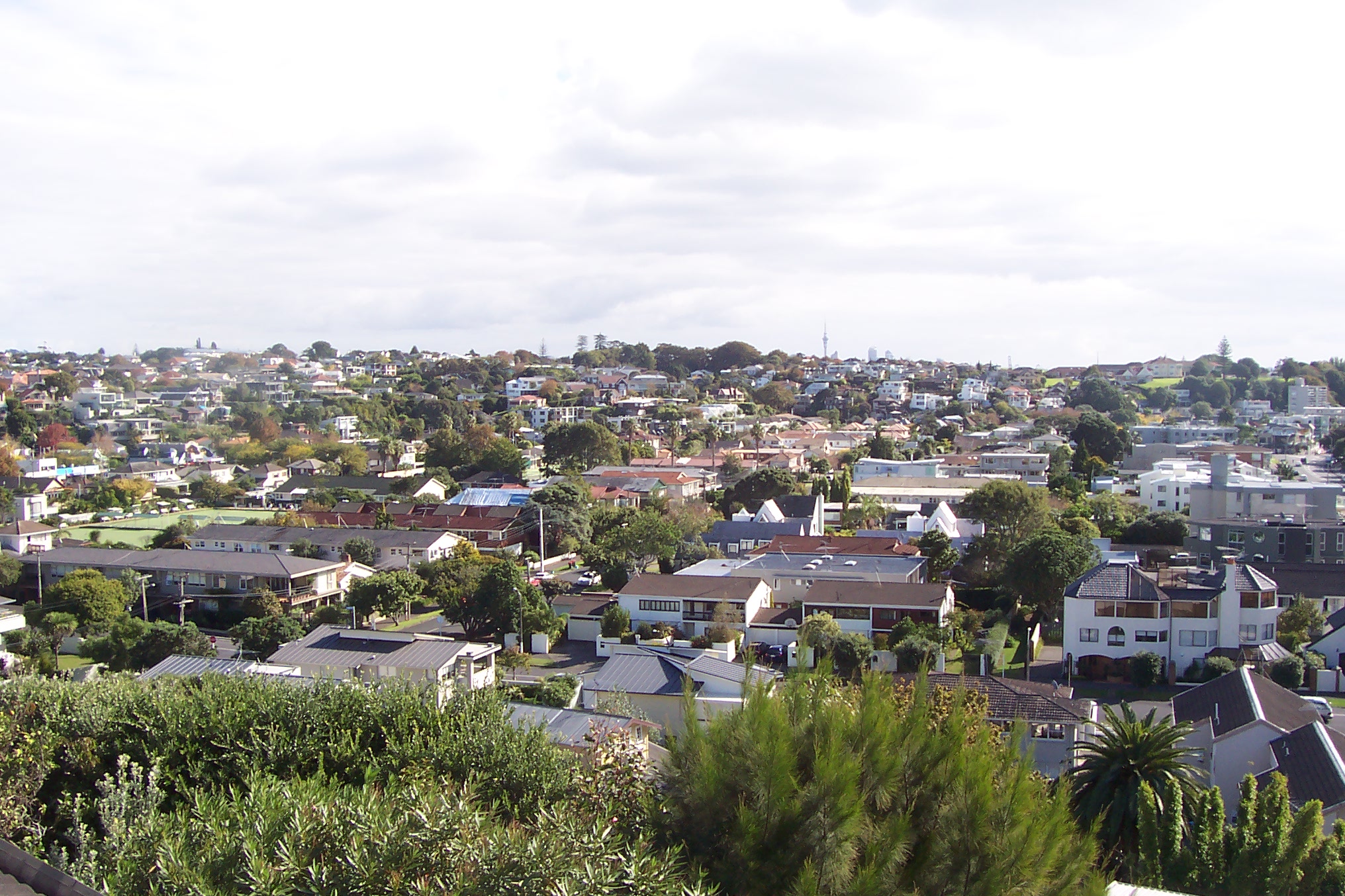
caption1 = Part of the suburb from the eastern headland.
city1 = Auckland City
city2 =
ward =
established =
area =
population = 6,339
popdate =
trainstations =
ferryterminals =
airports =
hospitals =
north = (Hauraki Gulf)
northeast = (Hauraki Gulf)
east = St Heliers
southeast = Glen Innes, Glendowie
south = St Johns
southwest = Meadowbank
west = Mission Bay
northwest = Mission Bay


caption2 =

Kohimarama is a coastal residential Auckland City suburb, located to the east of the city.

Situated in Eastern Auckland and has a reputation as being relatively wealthy, with many of the homes having some of the best views over Auckland Harbour. According to the 2001 census, Kohimarama has a population of 6,339. Kohimarama is home to two primary and one secondary school: St Thomas' School, Kohimarama School, and Selwyn College, which has a student population of over 1,000. Conveniently located Catholic schools include St Peter's College and Baradene College of the Sacred Heart.

History of Kohimarama

The name is Māori for 'gathering-in-of-light'. It was originally known as Mission Bay, a name now given to a neighbouring suburb.Fact|date=July 2008

Gallery

References

* "The Lively Capital", Auckland 1840-1865, Una Platts. Avon Fine Prints Limited New Zealand 1971.


Wikimedia Foundation. 2010.

Игры ⚽ Поможем написать курсовую

Look at other dictionaries:

  • Mission Bay, New Zealand — Mission Bay Mission buildings at Selwyn Reserve. Basic information Local authority Auckland City Population 5,235 …   Wikipedia

  • Retro Hit Radio — Infobox Radio station name = Retro Hit Radio airdate = February 6, 2004 format = Retro, Old School eirp = 500 mW owner = private webcast = [http://www.retrohitradio.co.nz retrohitradio.co.nz] website = [http://www.retrohitradio.co.nz… …   Wikipedia

  • Orakei — View of Hobson Bay looking northwards with Orakei visible in the far right distance, under Rangitoto Island. Basic information Local authority Auckland City …   Wikipedia

  • Saint Johns, New Zealand — Suburb:Saint JohnsCity:Auckland CityIsland:North IslandSurrounded by to the north to the north east to the east to the south east to the south to the south west to the west to the north west Kohimarama (2.0 km) Saint Heliers (3.0 km) Glen Innes… …   Wikipedia

  • Selwyn College, Auckland — Infobox NZ school name = Selwyn College badge = motto = type = State, Co educational, Secondary established = 1956 address =Kohimarama Road, Kohimarama, Auckland, New Zealand coordinates = coord| 36.8625|174.8381|format=dms|display=inline,title… …   Wikipedia

  • Waitemata Harbour — Die Auckland Harbour Bridge über den Hafen Lage des …   Deutsch Wikipedia

  • George Bolt — George Bruce Bolt OBE (born 24 May, 1893 in Dunedin, died 27 July, 1963 in Auckland) [http://www.dnzb.govt.nz/dnzb/Find Quick.asp?PersonEssay=4B44 Dictionary of New Zealand Biography: George Bruce Bolt] ] was a pioneering New Zealand aviator.He… …   Wikipedia

  • Split Enz — Infobox musical artist 2 Name = Split Enz Img capt = Split Enz (1977) ...with costumes and hair...like nothing else, wild, colourful and inventive. Background = group or band Origin = Auckland, New Zealand Genre = Pop, New Wave, Rock Prog Rock,… …   Wikipedia

  • List of New Zealand place names and their meanings — Placenames in New Zealand derive largely from British and Māori origins. An overview of naming practices can be found at New Zealand place names. * Akaroa Kāi Tahu Māori for Long Harbour . * Albert Town named after Prince Albert of Saxe Coburg… …   Wikipedia

  • Auckland City — This article is about the former local government area. For the football team, see Auckland City FC. For the greater metropolitan area, see Auckland. Auckland City   Territorial authority of New Zealand   …   Wikipedia

Share the article and excerpts

Direct link
Do a right-click on the link above
and select “Copy Link”