- Mawsley
-
Coordinates: 52°23′35″N 0°43′23″W / 52.39312°N 0.72292°W
Mawsley
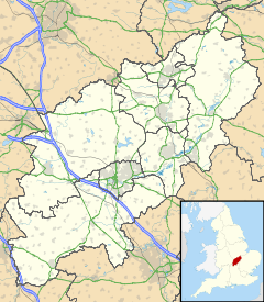
 Mawsley shown within Northamptonshire
OS grid reference SP8778 District Kettering Shire county Northamptonshire Region East Midlands Country England Sovereign state United Kingdom EU Parliament East Midlands List of places: UK • England • Northamptonshire Mawsley is a newly built village and civil parish in the Kettering borough of Northamptonshire, England, a few miles west of Kettering. Until 1 April 2004, Mawsley was part of the nearby parish of Cransley.
Mawsley was first planned in 1993 by Northamptonshire County Council, and construction began in 2001. The village is very nearly complete, with a school, doctors surgery and village hall all provided by the developers. Further research has revealed that Mawsley was built on the site of on older village called Mawsley, which vanished around the time of the Black Death[citation needed] A Roman villa was found nearby, as well as other archeological evidence. When the village was planned, a site was set aside for the building of a Public House. The site has recently (as of July 2006) been sold to a company to build and run the pub.
The village is always windy, as it sits at the same level as the local landscape - other well established villages in the area are built in dips, which protect them from the strong local winds.
Local access to the village is via an unclassified road (known locally as the C31), which is now approved for gritting in the winter along its entire length by the local council.
A local One Stop Shop was officially opened on Saturday 8 March 2008, which is situated in Barnwell Court. A hairdresser and nursery is also in the court. With office spaces, restaurant and take away spaces still available for rent. A bistro/cafe/coffee shop called Coffee @ no. 9 is also in barnwell court.
The speed limit in the village is a ridiculously low 5 mph.
External links
Categories:- Villages in Northamptonshire
- Northamptonshire geography stubs
Wikimedia Foundation. 2010.

