- Poipet
Infobox Settlement
official_name =Pagename
other_name =
native_name =
nickname =
settlement_type =
motto =
imagesize = 250px
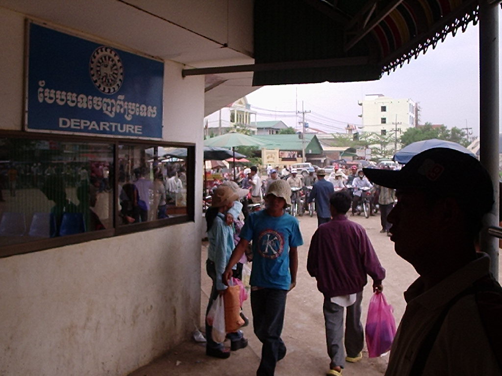
image_caption =Cambodian passport control at Poipet, looking into the Cambodian side
flag_size =
image_
seal_size =
image_shield =
shield_size =
city_logo =citylogo_size =
mapsize =
map_caption = Location of PAGENAME, Cambodia
mapsize1 =
map_caption1 =
image_dot_
dot_mapsize =
dot_map_caption =
dot_x = |dot_y =
pushpin_
pushpin_label_position =
pushpin_map_caption =
pushpin_mapsize =
subdivision_type = Country
subdivision_name = CAM
subdivision_type1 = Province
subdivision_name1 =Preah Vihear Province
subdivision_type2 = District
subdivision_name2 =Ou Chrov District
subdivision_type3 =
subdivision_name3 =
subdivision_type4 =
subdivision_name4 =
government_footnotes =
government_type =City
leader_title =
leader_name =
leader_title1 =
leader_name1 =
leader_title2 =
leader_name2 =
leader_title3 =
leader_name3 =
leader_title4 =
leader_name4 =
established_title =
established_date =
established_title2 =
established_date2 =
established_title3 =
established_date3 =
area_magnitude =
unit_pref =
area_footnotes =
area_total_km2 =
area_land_km2 =
area_water_km2 =
area_total_sq_mi =
area_land_sq_mi =
area_water_sq_mi =
area_water_percent =
area_urban_km2 =
area_urban_sq_mi =
area_metro_km2 =
area_metro_sq_mi =
population_as_of = 2006
population_footnotes =
population_note =
population_total =
population_density_km2 =
population_density_sq_mi =
population_metro =
population_density_metro_km2 =
population_density_metro_sq_mi =
population_urban =
population_density_urban_km2 =
population_density_urban_sq_mi =
population_blank1_title =
population_blank1 =
population_density_blank1_km2 =
population_density_blank1_sq_mi =
timezone =
utc_offset =
timezone_DST =
utc_offset_DST =
latd=13 |latm=39 |lats= |latNS=N
longd=102 |longm=34 |longs= |longEW=E
elevation_footnotes =
elevation_m =
elevation_ft =
postal_code_type =
postal_code =
area_code =
blank_name =
blank_info =
blank1_name =
blank1_info =
website =
footnotes =Poipet is a Cambodian town on the
Cambodia /Thailand border , inOu Chrov district,Banteay Meanchey Province. It is a key crossing point between the two countries, and also extremely popular as agambling destination as gambling is popular, but illegal in Thailand. There is a strip ofcasino s and hotels between the Cambodian and Thai passport control counters, enabling Thais to gamble in Cambodia without needing to go through Cambodian immigration.Poipet is adjacent to the town of
Aranya Pratet on the Thai side of the border.Transport
The Poipet border is the terminus of the Thai railway system, though in 2006 it is proposed that there will be a building of a link between the Cambodian Railways at
Sisophon to this town.ee also
Poipet on wikitravel.
Wikimedia Foundation. 2010.

