- Cholpon-Ata
-
Cholpon-Ata
ЧолпонатаLocation in Kyrgyzstan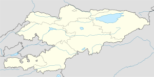
 Cholpon-Ata
Coordinates: 42°39′N 77°05′E / 42.65°N 77.083°E Country  Kyrgyzstan
Province Issyk Kul Province Population - Total 12,000  A boulder-strewn slope at Cholpon-Ata has numerous examples of petroglyphs, some showing people hunting animals which are now extinct or scarce in the area
Cholpon-Ata (Kyrgyz: Чолпон-ата, pronounced [tʃolponɑtɑ́], literally "Venus-father", the name of a mythological protecting spirit) is a resort town on the northern shore of Lake Issyk-Kul in Kyrgyzstan with a year-round population of about 12,000. It is the administrative center of the Issyk Kul District of Issyk Kul Province; this district occupies most of the lake's north shore. To the west west along highway A363 is Tamchy and to the east, Bosteri.
The town contains numerous large and small sanatoria, hotels and guesthouses to accommodate the many visitors who descend upon the lake in summer. During the Soviet era it was much frequented by vacationers brought here in organized mass tours from other parts of the USSR. Holidaymakers now usually visit on their own or in small groups and originate mainly from Kyrgyzstan, Kazakhstan and Uzbekistan. Attracting more demanding foreign tourists will require substantial upgrading of the existing facilities, but the location is certainly attractive. The view of the imposing alpine ranges of the Tian Shan across the lake is impressive. There is a good local museum and an open-air site with about 2000 petroglyphs dating from 800 BC to 1200AD[1].
References
- ^ Luc Hermann, Les pétroglyphes de Tcholpon-Ata, Paris, 2010 http://www.bod.fr/index.php?id=1786&objk_id=429117
External links
Coordinates: 42°39′N 77°05′E / 42.65°N 77.083°E
Categories:- Populated places in Issyk Kul Province
- Rock art in Asia
- Issyk Kul geography stubs


Wikimedia Foundation. 2010.