- Gisborne, New Zealand
:"For other uses of Gisborne see
Gisborne (disambiguation) ."Infobox Settlement
name=Gisborne
native_name=Tūranga-nui-a-Kiwa (Maori)
total_type=Terretorial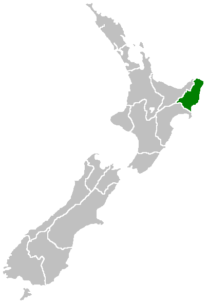
mapsize=180px
subdivision_type=Country
subdivision_name=NZL
subdivision_type1=Region
subdivision_name1=Gisborne
subdivision_type2=Territorial authority
subdivision_name2=Gisborne District
leader_name=Meng Foon
leader_title=Mayor
area_total_km2=8355
population_as_of=2006 census
population_urban=32700
population_total=44500
population_density_km2=auto
area_code=06
website=http://www.gdc.govt.nzGisborne ( _mi. Tūranga-nui-a-Kiwa) is the name of a unitary authority in
New Zealand , being both a region and a district. Gisborne is also the name of the largest settlement within the Gisborne Region.Gisborne is named for an early Colonial Secretary
William Gisborne . The council is located in the town of Gisborne (locally referred to as the City of Gisborne). State Highway 2 passes through Gisborne and Gisborne is the northern terminus of thePalmerston North - Gisborne Line railway , which opened in 1942. Passenger services were provided until 1988, when the Endeavour express was cancelled north of Napier. Today, the railway carries solely freight.Gisborne or East Coast region
The region is located in the northeastern corner of the
North Island and is also referred to as theEast Cape or East Coast or Eastland region. It is a sparsely inhabited and isolated region, with small settlements mainly clinging to small bays along the eastern shore includingTokomaru Bay andTolaga Bay . The population of the region is about 45,000, with almost three quarters of those living in the city of Gisborne. No other settlement has a population of over 1000. The largest other settlements are the towns of Tolaga Bay andRuatoria , each with populations of over 800 in 2001.Inland, the land is rough, predominantly forested, hill country.
Te Urewera National Park is located in the west of the region, and theKaingaroa Forest is located further west of that. A spine of rough ridges dominates the centre of the region, culminating in the impressive bulk of the 1620 metreMount Hikurangi in the region's northeast. This mountain is the fifth highest mountain in the North Island, and the highest that is not a volcano. Regarded as sacred by theMāori , there is some justification to the claims that this is the first mountain to see the sun in summer (see note below under "Gisborne City").The region's population has higher than the national average proportion of Māori - over 50% in some areas - and still maintains strong ties to both Māori tradition and the
iwi andmarae structure. The predominant iwi in the region areNgāti Porou , Rongowhakaata, Ngai Tamanuhiri, Te Aitanga a Mahaki.City of Gisborne
The city of Gisborne is located at the north end of
Poverty Bay . The white cliff headland ofYoung Nick's Head at the other end of the bay is visible from the city. The cliffs can be seen in the left hand side of the sat photo. The Māori name for the cliffs is Te Kuri o Kiwa,Fact|date=July 2008 meaning The Dog of Kiwa, as this was what it was originally said to look like.This prominence was the first part of New Zealand sighted by the crew of Captain
James Cook 's ship "Endeavour", and was named for the crew member who first saw it. A memorial to Cook stands on the foreshore, marking the point where he first stepped ashore in New Zealand onOctober 8 ,1769 .On the right hand side of the sat photo at the other end of the bay, known as Poverty Bay, is
Kaiti Hill . This hill overlooks the town and magnificent views can be obtained by driving or walking to the summit.The city maintains a rural charm and is a popular holiday spot. Local industries include
agriculture ,horticulture ,farming andforestry .Wine production is also valuable to the local economy.It is sometimes known as the City of Rivers as the centre of town is the convergence of three different rivers.Gisborne City has four main high (secondary) schools: Gisborne Boys' High, Gisborne Girls' High, Lytton High and Campion College. Campion College is a Catholic co-educational school.
The harbour was host to many ships in the past. A meat works was sited beside the harbour and meat and wool was shipped from here. Now the harbour is the home of many smaller fishing boats as well as ships loading logs for export.
Gisborne boasts being the first city in the world to greet the sun each day. Technically, however, this is only true for part of the year. Both
Suva ,Fiji , and NukuOkinaalofa,Tonga , are closer to theInternational Date Line and therefore would seem more likely candidates for this title. Due to the earth's tilt on its axis, however, Gisborne does overtake their claim as New Zealand summer days grow longer. In the longest days of summer, though, it again loses the title to the hillier suburbs ofDunedin in theSouth Island .The city has the benefit of being very close to the white sand beaches of Waikanae and Midway. A short distance from the city is the surf beach of Wainui.
Two major annual events are the Dawn Raid
Beach Day Out , which is an outdoor concert featuring many of the Dawn RaidHip-hop stars held in January, and theRhythm & Vines concert held everyNew Years' Eve which features a huge concert featuring well-knownNew Zealand bands performing in avineyard .Gisborne had three sister cities in the Sister Cities International Program, two are in the
United Kingdom (one inWales andScotland ), the third beingPalm Desert, California in the US. The town of Gisborne 50 kilometes north-west ofMelbourne ,Australia is now also twinned with it.2007 Earthquake
At 8.55pm (NZDT) on
20 December 2007 , the Gisborne region was hit by an earthquake of Richter Magnitude 6.8, centred in the Hikurangi Trench, 50Km southeast of Gisborne at a depth of 40km. [ [http://www.geonet.org.nz/earthquake/quakes/2839343g.html GeoNet – New Zealand Earthquake Report - Dec 20 2007 at 8:55 pm (NZDT) ] ] Intensities of 7 - 8 were experienced, with three buildings substantially collapsed in the CBD and others experiencing some structural damage. One death was reported (a heart attack of an elderly woman, sustained during the quake) plus minor injuries. [ [http://www.nzherald.co.nz/section/1/story.cfm?c_id=1&objectid=10483683 Quake damage extensive as massive clean-up begins - 21 Dec 2007 - NZ Herald: New Zealand National news ] ]uburbs in Gisborne
Gardens in and around Gisborne
Gisborne has its own
botanical garden :Gisborne Botanical Gardens In the surroundings are two important arboreta:
*Eastwoodhill Arboretum at Ngatapa
*Hackfalls Arboretum atTiniroto External links
* [http://www.gdc.govt.nz/ Gisborne District Council Website]
* [http://www.gisbornenz.com/ Tourism Eastland Website]References
ee also
*
2006 Tonga earthquake
*List of Marae in the Gisborne Region
*List of people from Gisborne
*List of Schools in the Gisborne Region
Wikimedia Foundation. 2010.