- Mount Lycabettus
-
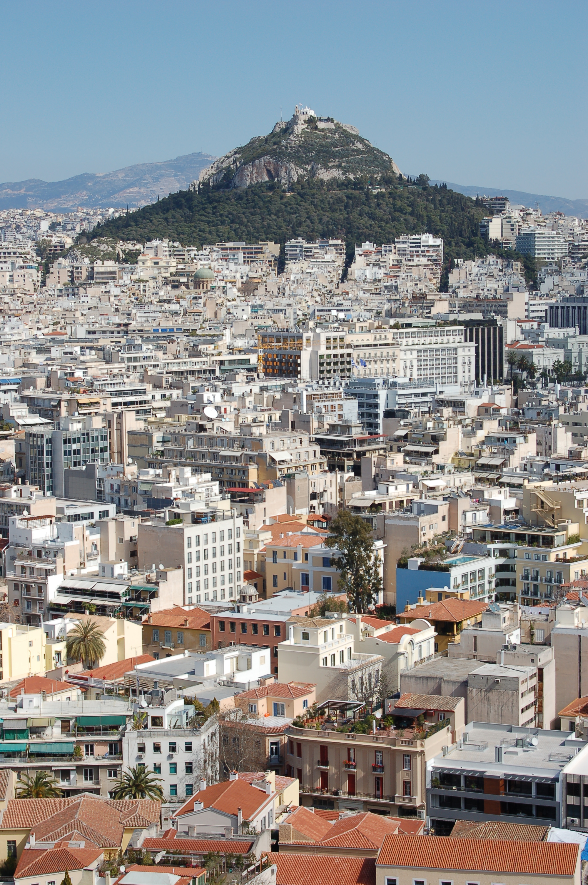
 Mount Lycabettus rising from Athens.
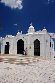
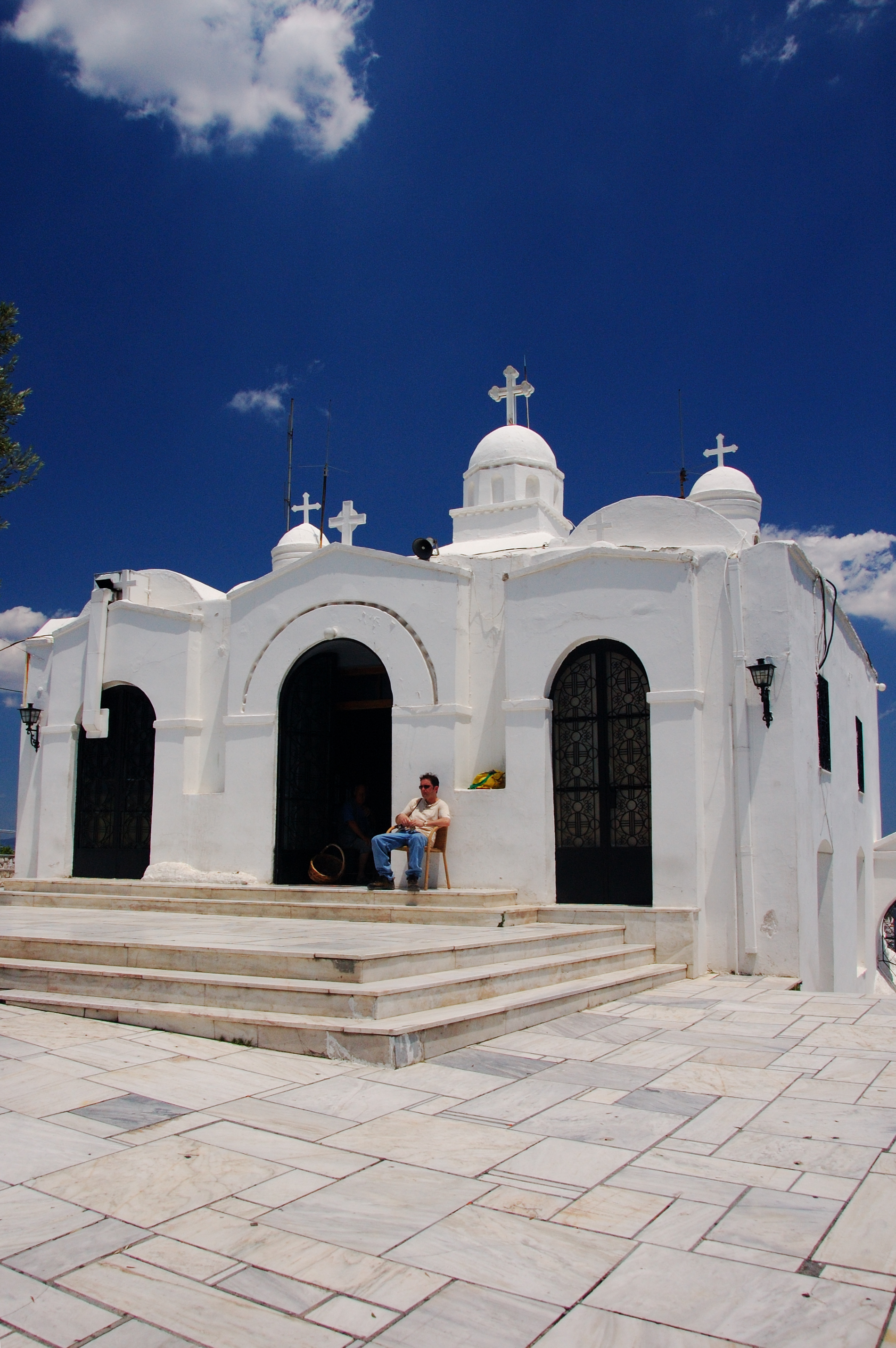
Mount Lycabettus, also known as Lycabettos, Lykabettos or Lykavittos (Greek: Λυκαβηττός, pronounced [likaviˈtos]), is a Cretaceous limestone hill in Athens, Greece. At 277 meters (908 feet) above sea level, the hill is the highest point in the city that surrounds it. Pine trees cover its base, and at its peak are the 19th century Chapel of St. George, a theatre, and a restaurant.
The hill is a popular tourist destination and can be ascended by the Lycabettus Funicular, a funicular railway which climbs the hill from a lower terminus at Kolonaki (The railway station can be found at Aristippou street). Lycabettus appears in various legends. Popular stories suggest it was once the refuge of wolves, possibly the origin of its name (which means "the one (the hill) that is walked by wolves"). Mythologically, Lycabettus is credited to Athena, who created it when she dropped a mountain she had been carrying from Pallene for the construction of the Acropolis after the box holding Erichthonius was opened.
The hill also has a large open-air theater at the top, which has housed many Greek and international concerts.
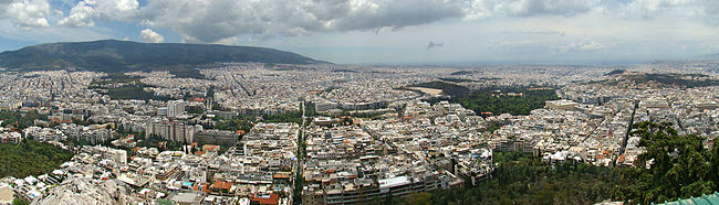 Panorama from Mount Lycabettus, with a view of the Panathinaiko Stadium, the Temple of Olympian Zeus, the Hellenic Parliament, and the Acropolis of Athens.
References
- Boguslawski, Alexander (2000). "Lykavittos Hill." Retrieved August 30, 2005.
Major landmarks of Athens Academy · Acropolis · Acropolis Museum · Ancient Agora · Arch of Hadrian · Areopagus · Monument of Lysicrates · Hellenic Parliament · Kerameikos · Mount Lycabettus · Monastiraki · Kapodistrian University of Athens · National Archaeological Museum · National Gardens · National Library of Greece · National Theatre · Odeon of Herodes Atticus · Old Parliament House · Olympic Sports Complex · Panathinaiko Stadium · Pedion tou Areos · Philopappos Hill / Monument · Plaka · Pnyx · Presidential Palace · Stoa of Attalos · Temple of Hephaestus · Temple of Olympian Zeus · Theatre of Dionysus · Tower of the Winds · Tsisdarakis Mosque · Zappeion
Neighbourhoods of Athens Akadimia · Akadimia Platonos · Acropolis · Ambelokipi · Anafiotika · Ano Patissia · Ano Petralona · Assyrmatos · Asteroskopeio · Attiki · Dafni · Ellinoroson · Exarcheia · Gazi · Gizi · Goudi · Gouva · Ilissia · Kallimarmaro · Kato Patissia · Kato Petralona · Keramikos · Kolokynthou · Kolonaki · Kolonos · Koukaki · Kypseli · Lykavittos · Makrygianni · Metaxourgeio · Mets · Monastiraki · Nea Filothei · Neapoli · Neos Kosmos · Omonoia · Pangrati · Patissia · Pedion tou Areos · Petralona · Plaka · Polygono · Profitis Daniil · Profitis Ilias · Psiri · Rizoupoli · Rouf · Sepolia · Treis Gefyres · Thiseio · Votanikos
Coordinates: 37°58′55″N 23°44′35″E / 37.98194°N 23.74306°E
Categories:- Geography of Athens
- Hills of Greece
- Outdoor theatres
- Visitor attractions in Greece
- Greece geography stubs

Wikimedia Foundation. 2010.